On Saturday, Sept. 21, TRMM captured rainfall data on Typhoon Usagi as it passed between the northern Philippines and southern Taiwan. TRMM found rain falling at a rate of over 134 mm/hr (~5.2 inches) in USAGI's eye wall.   Credit: SSAI/NAS…
Typhoon Usagi approaching China
On Sept. 21, Typhoon Usagi was moving between the northern Philippines and Taiwan when NASA's Aqua satellite passed overhead. NASA's AIRS instrument that flies aboard the Aqua satellite captured this near-infrared image on Sept. 21 at 505 U…
Near-Infrared Image of Typhoon Usagi Between Taiwan and the Philippines
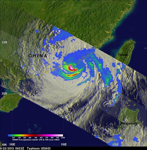
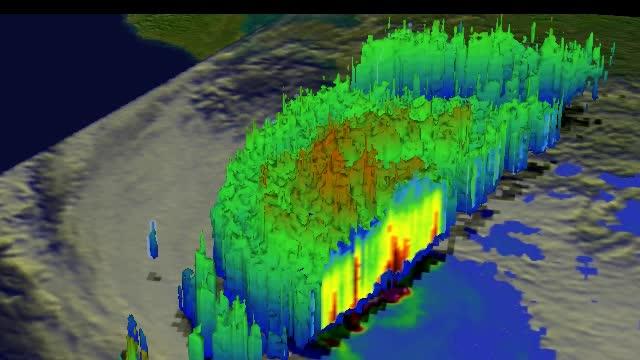
On Sept. 22 at 0923 UTC/5:23 a.m. EDT,  just south of Usagi's eye where rain was falling at a rate of over 169mm/~6.7 inches per hour along China's coast.  TRMM radar sliced through Usagi and found that heights of some thunderstorms were re…
Typhoon Usagi approaching China
This simulated 3-D flyby animation over Typhoon Usagi on Sept. 22 at 0923 UT showed heavy rain south of the center a rate of over 169mm/~6.7 inches per hour along China's coast. Cloud heights of some thunderstorms were reaching only about 1…
Typhoon Usagi approaching China
The Moderate Resolution Imaging Spectroradiometer or MODIS instrument that flies aboard NASA's Terra satellite captured this image of Typhoon Usagi on Sept. 22 at 02:45 UTC/Sept. 21 at 10:45 p.m. EDT on its approach to a landfall in China.…
Typhoon Usagi approaching China
No more images