
This image from NASA Terra spacecraft shows a perspective view, looking toward the Aso volcanic caldera, which indicates the epicenter with a red star.

The Channeled Scablands in Washington were formed about 19,000 years ago when glacial Lake Missoula in Montana burst through its ice dam, and a 320 m deep lake emptied in a catastrophic flood that reached the Pacific Ocean. The basaltic ter…

These images from NASA Terra satellite include eastern Vermont, New Hampshire, and western Maine, as well as the southeastern corner of Quebec province between August and October, 2000.
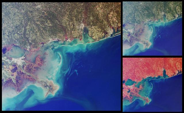
This set of images from NASA Terra satellit highlights coastal areas of four states along the Gulf of Mexico: Louisiana, Mississippi, Alabama and part of the Florida panhandle. The images were acquired on October 15, 2001 Terra orbit 9718.
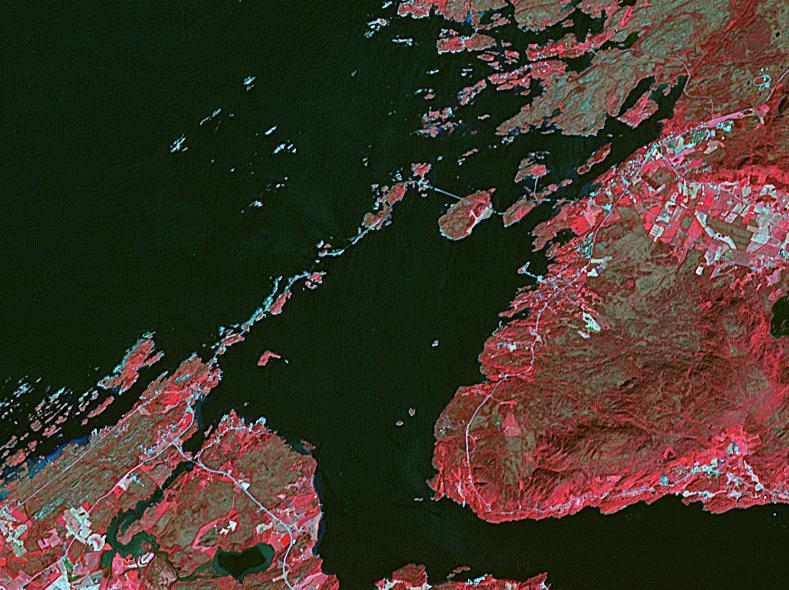
The Atlantic Ocean Road is an 8.3 kilometer road that runs through an archipelago in Eide and Averoy in More of Romsdal, Norway. It consists of eight bridges and four resting places and viewpoints. The road was originally proposed as a rail…

Acquired by NASA Terra spacecraft, this image shows Hamelin Pool Marine Nature Reserve, located in the Shark Bay World Heritage Site in Western Australia.

This perspective view from the Advanced Spaceborne Thermal Emission and Reflection Radiometer instrument aboard NASA Terra spacecraft shows the magnificent natural landscape of Salzkammergut, Austria.

Large lightning-induced fires were active in Alaska and the Yukon Territory from mid-June to mid-July, 2004 as seen by NASA Terra spacecraft.
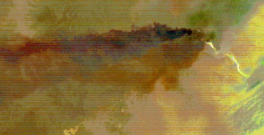
Sangay Volcano, Ecuador, erupted in early June, sending lava flows and pyroclastic flows down its southeastern flank. A large ash plume rose above 7 km, and was blown westward by the prevailing winds. Ashfall was reported in several cities…
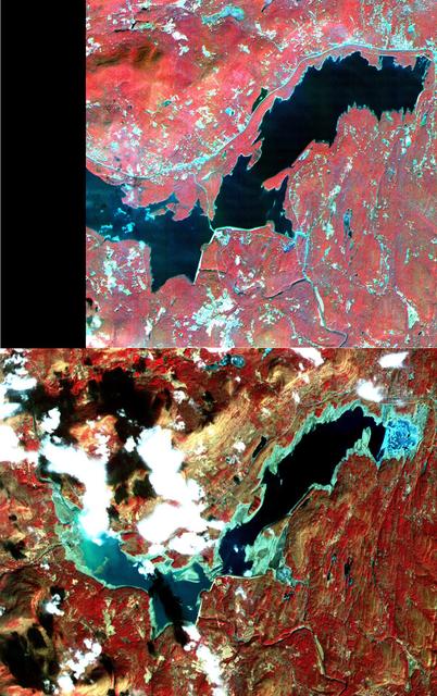
On March 26, New York Mayor Michael Bloomberg declared a drought emergency for the city and four upstate counties in response to the worst drought to hit the eastern United States in nearly 70 years. Restrictions on water use will affect mo…
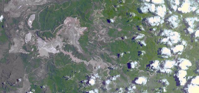
On Nov. 5, 2015, a dam at an iron-ore mine in southeastern Brazil burst, sending a wall of water, clay-red mud and debris downstream, overwhelming several villages in the path as seen by NASA Terra spacecraft. The Germano mine is near the t…
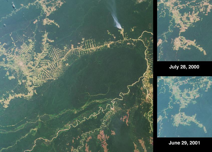
Rio Brancois the capital of the Brazilian state of Acre and is situated near the border with northeastern Bolivia. This image from NASA Terra satellite was acquired on July 28, 2000.
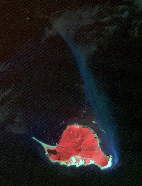
Twelve km off Taiwan's NE coast lies Turtle Island, a forest-covered volcanic island. The bluish patch of water on the island's eastern side (nicknamed the Milky Sea) marks the site of dozens of hydrothermal vents, spewing out hot, acidic w…
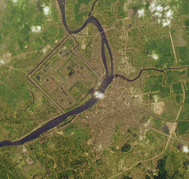
This image from NASA Terra satellite is of Hue, Vietnam. The Perfume River flows through the Capital City, the Imperial City, the Forbidden Purple City and the inner city.

Lake Mead, the largest reservoir in the US, has fallen to its lowest level ever. The water is a major source for such cities as Los Angeles and Las Vegas. With the predicted drought through this summer, the lake's water supply is expected t…
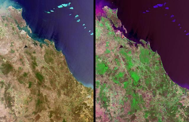
Queensland, Australia. This image, acquired on November 19, 2001 from NASA Terra satellite, is MISR Mystery Image Quiz #11.
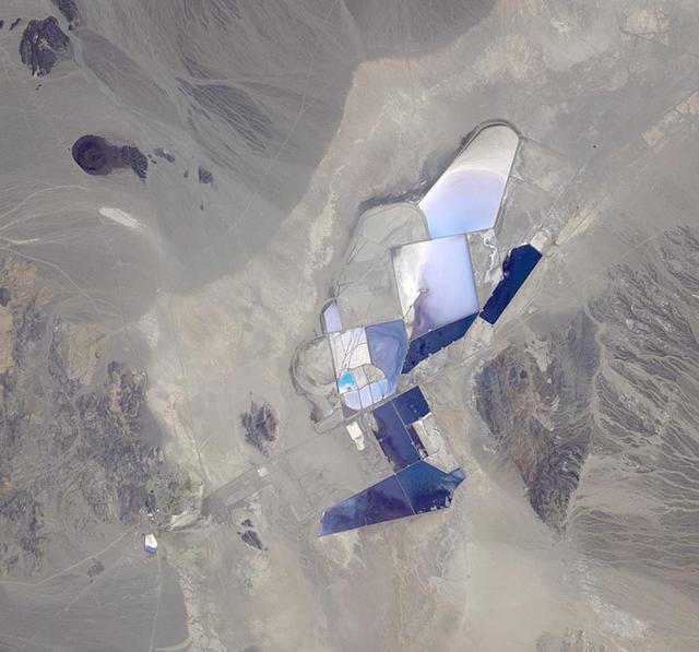
This image from NASA Terra spacecraft shows the once-abandoned mining town of Silver Peak, Nevada, which began to thrive again when Foote Mineral Company began extracting lithium from brine below the floor of Clayton Valley in 1966.

Along the western flank of the Andes, 400 km SE of Lima Peru, erosion has carved the mountain slopes into long, narrow serpentine ridges. NASA Terra satellite captured this image on September 28, 2004.

On Feb. 13, 2014, violent eruption of Kelud stratovolcano in Java, Indonesia sent volcanic ash covering an area of 70,000 square miles, prompting the evacuation of tens of thousands of people. This image is from NASA Terra spacecraft.

Sheveluch Volcano in Kamchatka, Siberia, is one of the frequently active volcanoes located in eastern Siberia. In this image from NASA Terra spacecraft, brownish ash covers the southern part of the mountain, under an ash-laden vertical erup…

Jamestown, located on Jamestown Island in the Virginia Colony, was founded on May 14, 1607. NASA Terra spacecraft acquired this image on September 4, 2007.

This image acquired by NASA Terra spacecraft, shows the oldest material on Earth which has yet been dated by man is a zircon mineral of 4.4 billion years old from a sedimentary gneiss in the Jack Hills of the Narre Gneiss Terrane of Austral…
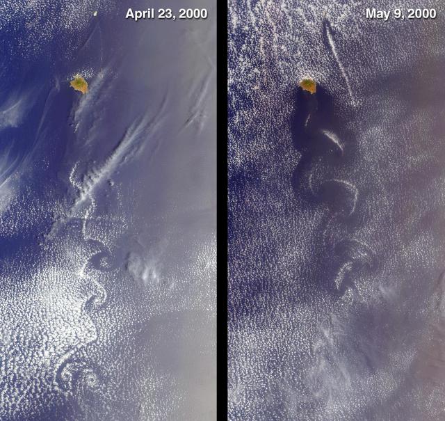
Socorro, Mexico was captured by NASA Terra satellite in 2000 showing cloud swirls, like delicate lace, forming patterns known as von Karman vortex streets.
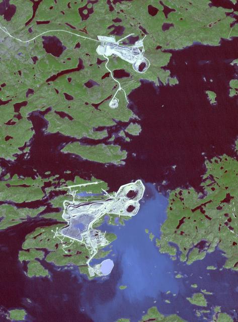
This image from NASA Terra spacecraft shows the Diavik Mine in northern Canada.The largest diamond found in North America came from the Diavik Mine. The Foxfire diamond weighs an impressive 187 carats, and was discovered in August 2015; it…

Frisco, Texas is a city in the Dallas-Fort Worth metroplex, located about 40 km (24.9 mi) northeast of the Dallas/Fort Worth International Airport. Founded in 1860 along the Shawnee Trail, the town has become a bedroom community for workers…

This image, acquired by NASA Terra spacecraft, shows the epicenter of a magnitude 7.7 earthquake which struck south-central Pakistan on Sept. 24, 2013, in Pakistan Makran fold belt.
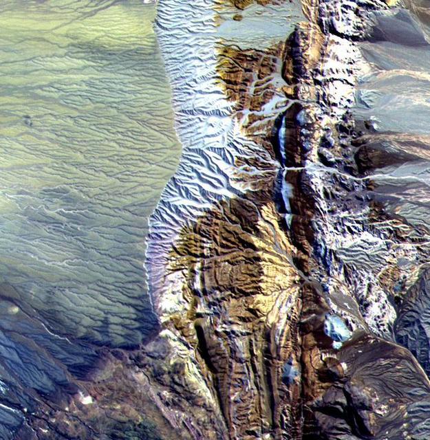
This 10.5 by 11 km sub-area in northern Chile was acquired by ASTER on April 7, 2000. Dramatically displayed is a geological angular unconformity: a contact between layers of rock at different angles. On the right side of the image, Cretace…

Folds in the lower reaches of valley glaciers can be caused by powerful surges of tributary ice streams. This phenomenon is spectacularly displayed by the Sustina Glacier in the Alaska Range as seen by NASA Terra spacecraft.

In many parts of the world, wetlands are being converted to shrimp ponds in order to farm these crustaceans for food and sale. One example is on the west coast of Ecuador, south of Guayaquil. This image was acquired by NASA Terra spacecraft…
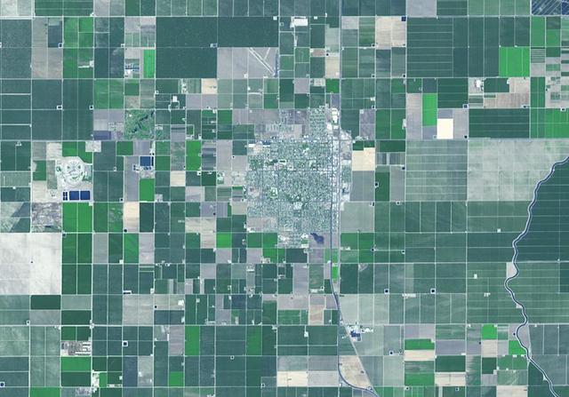
Wasco, California advertises itself as the Rose Capital of the World; over 8000 acres are devoted to cultivation of existing and new varieties of roses, shipped to every state in the U.S. and all over the world.

The October 2007 wildfires, including the Witch Wildland fire, plagued southern California and were some of the worst on record. Image from NASA Terra satellite.
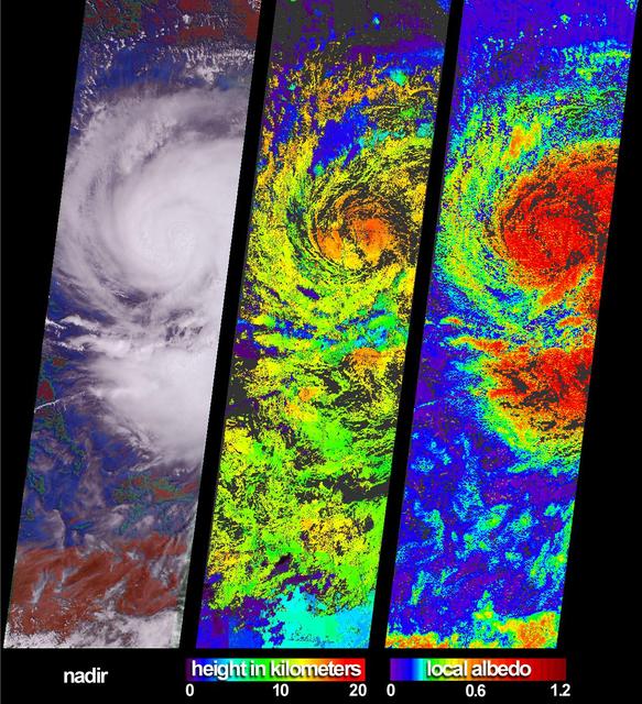
These views of Hurricane Isidore were acquired by NASA Terra satellite on September 20, 2002 as it flooded western Cuba and swept westward to Mexico Yucatan Peninsula.
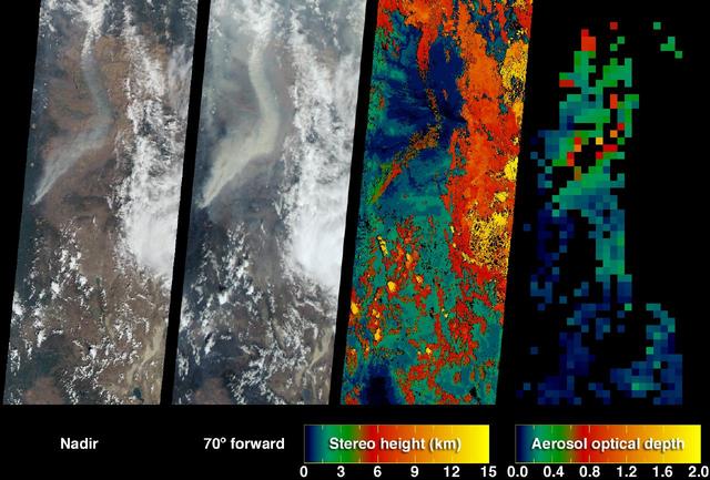
The extent, height, and amount of smoke originating from the B&B Complex Fires in central Oregon are captured in these September 4, 2003 views from NASA Terra spacecraft.
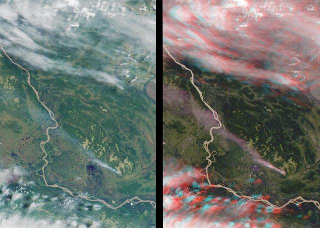
This stereo view of western Alaska was acquired by NASA Terra satellite on June 25, 2000. 3D glasses are necessary to view this image.

These images show dramatic change in the water at Dongting Lake in Hunan province, China. A flood crest surged down the Yangtze River in late August of this year, but the embankments made by residents there held. The left image was acquired…
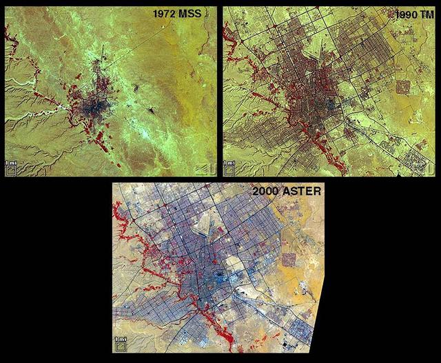
Riyadh, the national capital of Saudi Arabia, is shown in 1972, 1990 and 2000. Its population grew in these years from about a half million to more than two million. Saudi Arabia experienced urbanization later than many other countries; in…
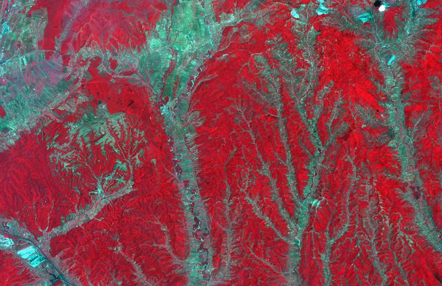
In southwest Romania, the rivers draining the Transylvanian Alps have incised the rough topography of the foothills. Only the river channels can be utilized for agriculture; the inter-stream land is rugged and forested. Agricultural fields…
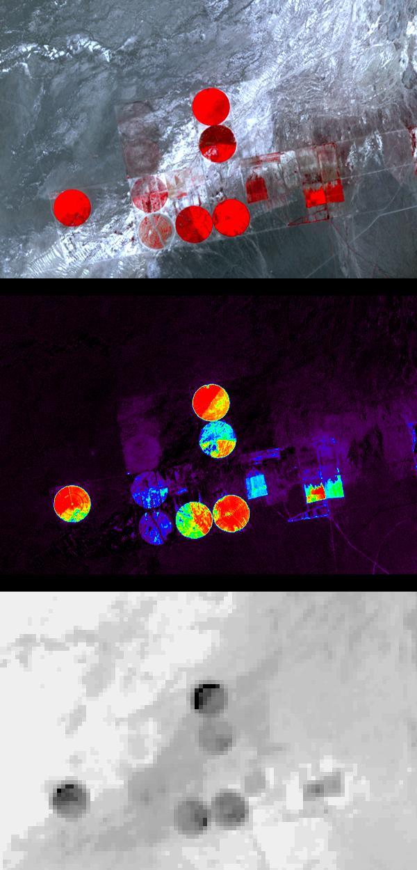
Information from images of Railroad Valley, Nevada captured on August 17, 2001 by the Advanced Spaceborne Thermal Emission and Reflection Radiometer (ASTER) may provide a powerful tool for monitoring crop health and maintenance procedures.…

Phoenix is the capital and most populous city in Arizona. It is also the fifth largest city in the US. It was settled in the 1880s as an agricultural community. Between 1980 and 2017, the metropolitan area grew from 1.5 million residents to…

The Blackhawk landslide, Lucerne Valley, California, is a lobe of marble breccia, 10 to 30 m thick, 3 km wide, and nearly 8 km long. Geologic evidence shows that the rockslide came down the gently inclined slope as a nearly monolithic sheet…
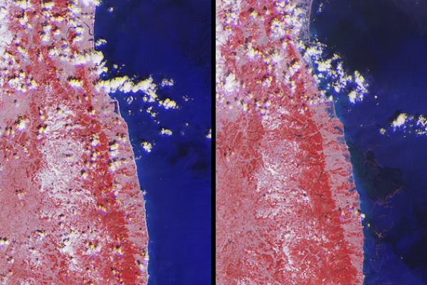
The extent of inundation from the destructive and deadly tsunami triggered by the March 11, 2011, magnitude 8.9 earthquake centered off Japan northeastern coast east of the city of Sendai is revealed in this image pair from NASA Terra space…
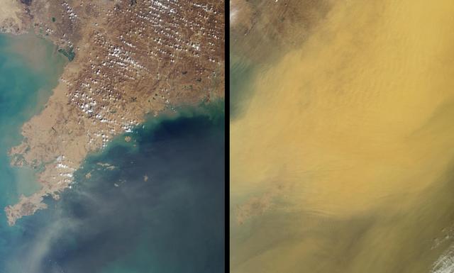
This pair of images, acquired 16 days apart by NASA Terra satellite in 2002 and 2007, covers the Liaoning region of China and parts of northern and western Korea, comparing a relatively clear day and an extremely dusty day.

NASA Terra spacecraft shows vast alluvial fan blossoms across the desolate landscape between two mountain ranges that form the southern border of the Taklimakan Desert in China XinJiang Province.
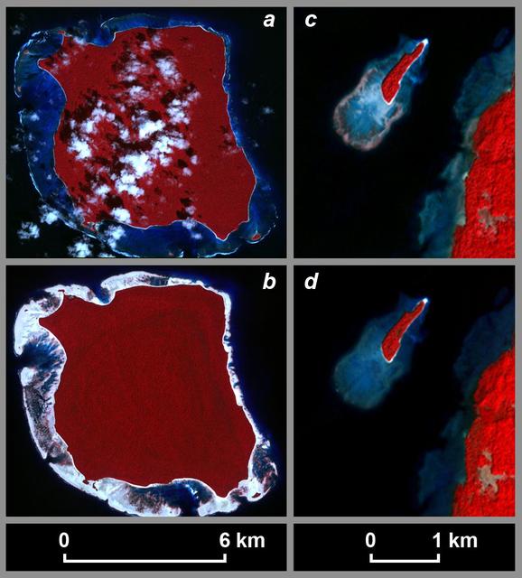
The magnitude 9.2 Indian Ocean earthquake of December 26, 2004, produced broad regions of uplift and subsidence. In order to define the lateral extent and the downdip limit of rupture. This image is from NASA Terra spacecraft.
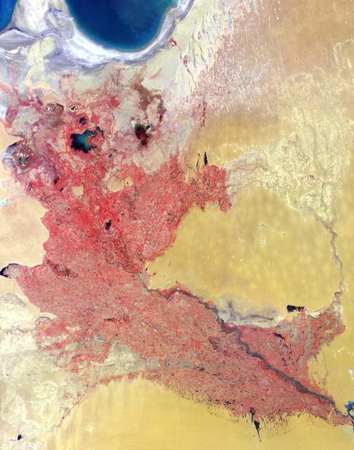
Acquired by the Multi-angle Imaging SpectroRadiometer instrument aboard NASA Terra spacecraft, this image is from the MISR Where on Earth...? Mystery Quiz #13. The location is Western Uzbekistan and Northeastern Turkmenistan.

The Maldives nation, in the Indian Ocean, faces an environmental threat from sea level rise, as 80% of its islands are less than 1 m above seal level. To counter this threat, the country is creating a new artificial island, Hulhumale. The c…

Karst topography is a geological formation shaped by the dissolution of layers of soluble rock such as limestone. A good example is found in Guangxi Province in southeast China, as seen by NASA Terra spacecraft.

These images from NASA Terra satellite images of Oklahoma and north Texas were acquired on March 12, 2000 during Terra orbit 1243.