On August 9 at 03:00 UTC (Aug. 8 at 11 p.m. EDT) the MODIS instrument aboard NASA's Terra satellite passed over the remnant clouds of Typhoon Soudelor when it was over eastern China.    By 22:35 UTC (6:35 p.m. EDT) on August 8, 2015, Typhoo…
NASA Sees Typhoon Soudelor's Remnants Over Eastern China
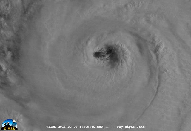
On August 6, 2015, NASA-NOAA's Suomi NPP satellite passed over powerful Typhoon Soudelor when it was headed toward Taiwan.  The Visible Infrared Imaging Radiometer Suite (VIIRS) instrument aboard NASA-NOAA's Suomi satellite captured this ni…
Typhoon Soudelor's Eye Close-Up from NASA-NOAA's Suomi NPP
NASA's Aqua satellite and RapidScat instrument analyzed Super typhoon Soudelor's extent and winds as it reached Category Five typhoon status on the Saffir-Simpson Wind Scale.  On Aug. 4, 2015, at 4:10 UTC (12:10 a.m. EDT) the MODIS instrume…
NASA Sees Soudelor Reach Category 5 Typhoon Status
In this MODIS image from NASA's Aqua satellite, the eye of Typhoon Soudelor is seen over northwestern Taiwan on August 8, 2015 at 05:25 UTC (1:25 a.m. EDT). At that time, Soudelor had maximum sustained winds near 90 knots. It was less than…
Typhoon Soudelor's Eye over Northwestern Taiwan
On August 6, 2015, NASA-NOAA's Suomi NPP satellite passed over powerful Typhoon Soudelor when it was headed toward Taiwan.  The Visible Infrared Imaging Radiometer Suite (VIIRS) instrument aboard NASA-NOAA's Suomi satellite captured this ni…
Typhoon Soudelor's Eye Close-Up from NASA-NOAA's Suomi NPP
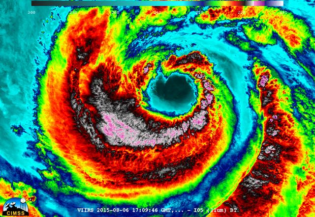
On August 6, 2015, NASA-NOAA's Suomi NPP satellite passed over powerful Typhoon Soudelor when it was headed toward Taiwan.  The Visible Infrared Imaging Radiometer Suite (VIIRS) instrument aboard NASA-NOAA's Suomi satellite captured an infr…
NASA-NOAA's Suomi NPP Gets an Infrared look at Typhoon Soudelor
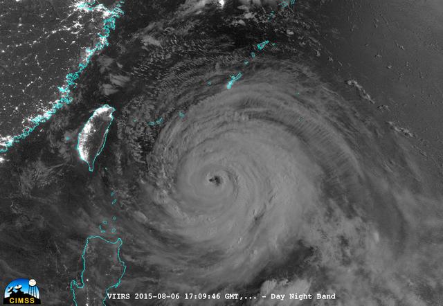
On August 6, 2015, NASA-NOAA's Suomi NPP satellite passed over powerful Typhoon Soudelor at night when it was headed toward Taiwan. The Visible Infrared Imaging Radiometer Suite (VIIRS) instrument aboard NASA-NOAA's Suomi satellite captured…
A Night-time Look at Typhoon Soudelor from NASA-NOAA's Suomi NPP Satellite
The MODIS instrument aboard NASA's Aqua satellite flew over Typhoon Soudelor on Aug. 7, 2015, at 4:40 UTC (12:40 a.m. EDT) as it was approaching Taiwan.  Credits: NASA Goddard's MODIS Rapid Response Team  Clouds in Typhoon Soudelor's wester…
NASA Sees a Wider-Eyed Typhoon Soudelor Near Taiwan
No more images