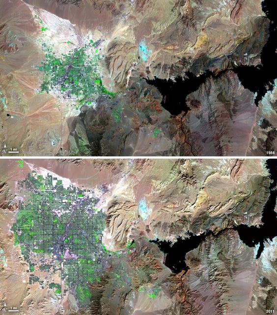
Over the years of the Landsat program, the desert city of Las Vegas has gone through a massive growth spurt. The outward expansion of the city over the last quarter of a century is shown here with two false-color Landsat 5 images (August 3,…

NASA image acquired March 26, 2012 This nearly cloud-free view of Great Britain and Ireland was acquired by the Moderate Resolution Imaging Spectroradiometer (MODIS) aboard NASA’s Terra satellite on March 26, 2012. Just a few days into spr…
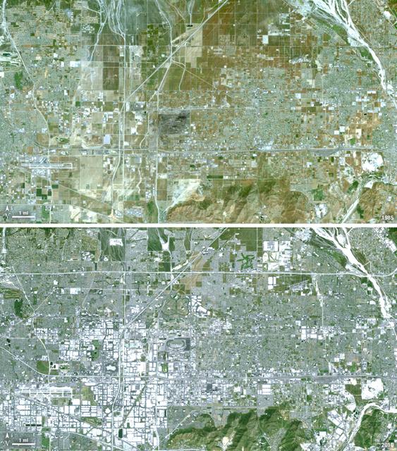
Thirty-five miles due east of downtown Los Angeles lies the city of Ontario, California. In 1881 two Canadian brothers established the town, naming it after their native city. By 1891 Ontario, Calif., was incorporated as a city. The farming…
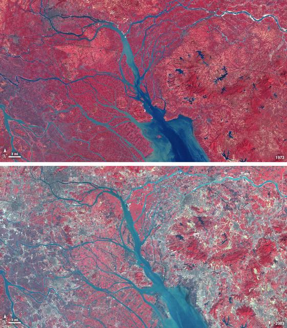
In 1979, China established two special economic zones around the Pearl River Delta, north of Hong Kong. This image, taken by Landsat 3 on October 19, 1973, shows that the region was rural when the zone was established. Plant-covered land, w…
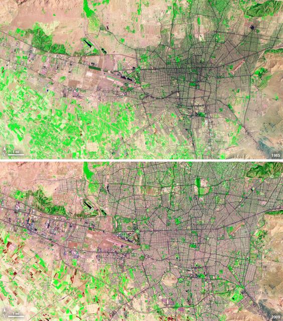
Between 1985 and 2009, the population of Tehran, Iran, grew from six million to just over seven million. The city's growth was spurred largely by migration from other parts of the country. In addition to being the hub of government and asso…
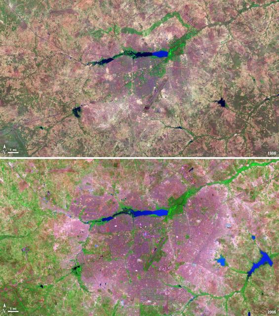
The landlocked western African nation of Burkina Faso experienced a 200 percent increase in urban population between 1975 and 2000. As a result, the area of the capital city Ouagadougou grew 14-fold during this period. These Landsat image…

Over the last 25 years, Chandler, Arizona has traded its grid of fields for a grid of streets. Founded in 1912 on cotton, grains, alfalfa, and ostrich farms, brown and green irrigated fields still dominate the region southeast of Phoenix in…
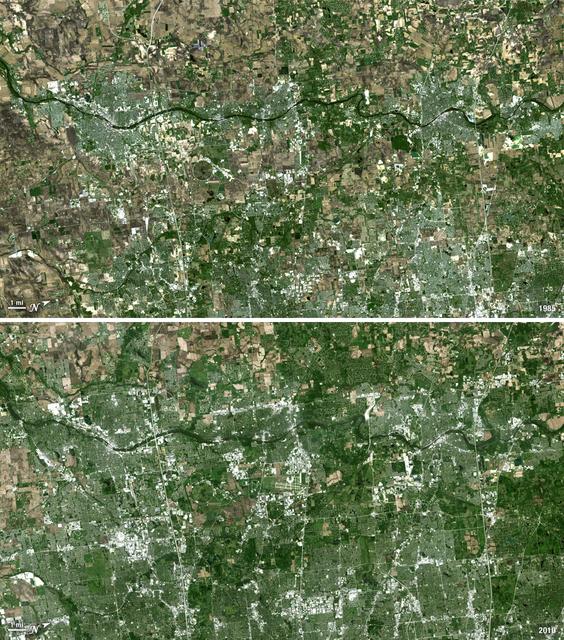
Forty miles west of downtown Chicago, the Fox River meanders its way through what has become the westernmost reaches of metropolitan Chicago, where the sprawling metropolis meets the hinterlands. While Chicago itself has seen a seven percen…

NASA GOES 13 satellite image showing earth on May 28, 2010 11:45 UTC. <b><a href="http://goes.gsfc.nasa.gov/" rel="nofollow">Credit: NOAA/NASA GOES Project</a><b> <b><a href="http://www.nasa.gov/centers/goddard/home/index.html" rel="nofol…
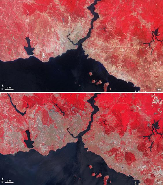
Istanbul has been a bustling trade city for thousands of years. In this 1975 image, taken by Landsat, the city centers on the Golden Horn the estuary that flows into the Bosporus Straight at the center of the scene. Shown in false color, ve…
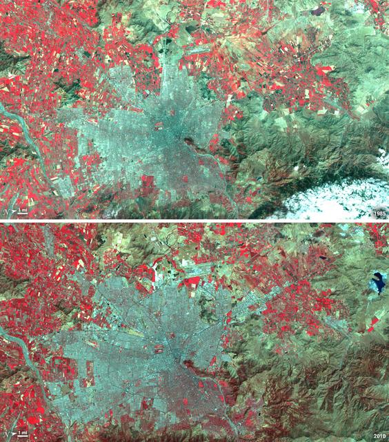
Santiago, Chile, ranks among the world's fastest growing cities. Chile is South America's fifth largest economy with strong export and tourism markets. More than a third of Chile's population lives in Santiago as of 2009. Taken on January 9…
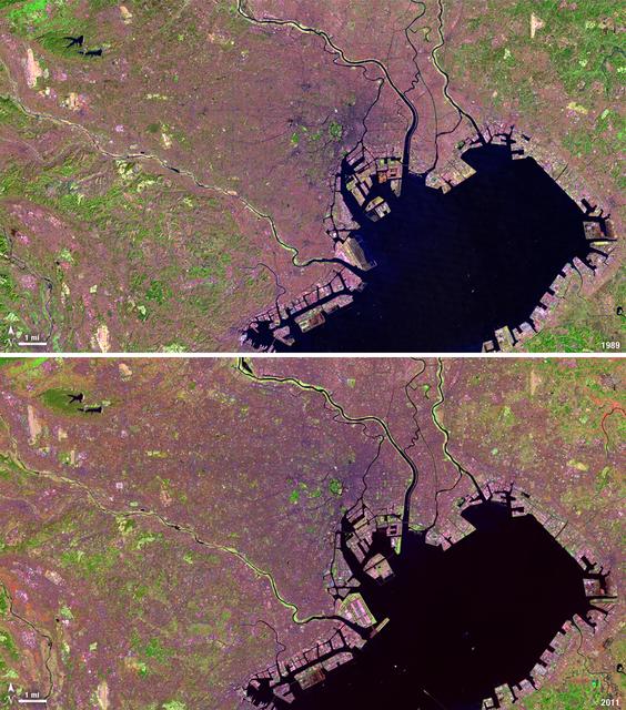
Tokyo is the world’s largest metropolitan region, home to nearly 37 million people. During the past two decades, Tokyo’s population has grown by more than 7 million. The city’s growth has continued despite Japan’s overall stagnating populat…

On August 25, 2013, the Moderate Resolution Imaging Spectroradiometer (MODIS) on NASA’s Terra satellite acquired this image of the drought-fueled Rim fire burning in central California, near Yosemite National Park. Red outlines indicate ho…