Aug 30, 2011  USGS has released a new mosaic of the Chesapeake Bay. Using six Landsat 5 images collected in July 2009 and 2011 a beautiful, seamless mosaic of the Chesapeake Bay region was created by the USGS Landsat team. The Washington D.…
Beautiful New Landsat Mosaic of Chesapeake Bay
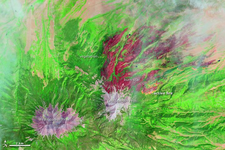
On June 22, 2013, the Operational Land Imager (OLI) on Landsat 8 captured this false-color image of the East Peak fire burning in southern Colorado near Trinidad. Burned areas appear dark red, while actively burning areas look orange. Dark…
East Peak Fire Burn Scar, Colorado [annotated]
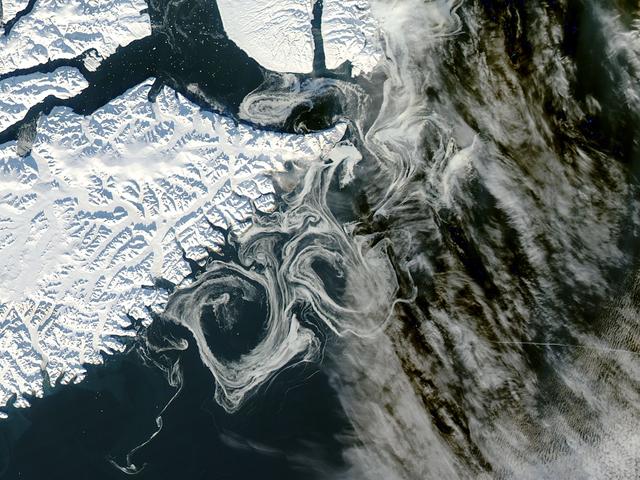
NASA image acquired October 16, 2012  The MODIS instrument on NASA's Aqua satellite captured this visible image of Sea Ice off eastern Greenland on October 16, 2012.    NASA/GSFC/Jeff Schmaltz/MODIS Land Rapid Response Team  <b><a href="htt…
Sea Ice off eastern Greenland
On August 23, 2013, the Moderate Resolution Imaging Spectroradiometer (MODIS) on NASA’s Aqua satellite acquired this image of the drought-fueled Rim fire burning in central California, near Yosemite National Park.  Red outlines indicate hot…
Rim Fire, California
NASA satellite image acquired May 2, 2010  To view a detail of this image go to: <a href="http://www.flickr.com/photos/gsfc/4584266734/">www.flickr.com/photos/gsfc/4584266734/</a>  Ash and steam continued billowing from Eyjafjallajökull Vol…
Eruption of Eyjafjallajökull Volcano, Iceland May 2nd View
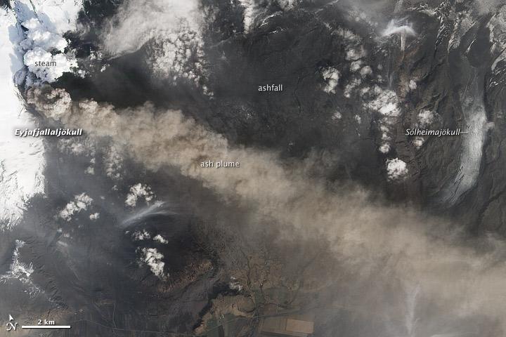
NASA satellite image acquired May 2, 2010  To see the full view of this image go to:  <a href="http://www.flickr.com/photos/gsfc/4584266582/">www.flickr.com/photos/gsfc/4584266582/</a>  Ash and steam continued billowing from Eyjafjallajökul…
Eruption of Eyjafjallajökull Volcano, Iceland May 2nd View [Detail]
On June 22, 2013, the Operational Land Imager (OLI) on Landsat 8 captured this false-color image of the East Peak fire burning in southern Colorado near Trinidad. Burned areas appear dark red, while actively burning areas look orange. Dark…
East Peak Fire Burn Scar, Colorado [high res]
No more images