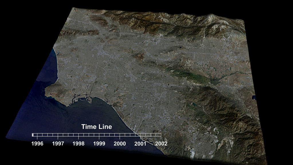
This frame from an animation depicts variations in surface elevation resulting from the discharge and recharge of groundwater basins in Southern California.
Southern California INSAR Time Series
Several Goddard technologists are involved in a new CubeSat technology-demonstration mission called SNoOPI, which employs a novel remote-sensing technique for measuring soil-moisture levels. From left to right: Jeffrey Piepmeier, Chase Kiel…
SNoOPI: A Flying Ace for Soil Moisture and Snow Measurements
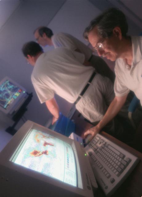
Marshall researchers conduct extensive analysis of weather patterns by using remote sensing on lightning and thunderstorms from outer space for the Mission to Planet Earth program.
Earth Science
Ground crew members make final preparations on NASA Armstrong Flight Research Center’s ER-2 aircraft at Edwards, California, on Thursday, Aug. 21, 2025, ahead of a high-altitude mission for the Geological Earth Mapping Experiment (GEMx). Th…
NASA ER-2 Flies Geological Mapping Mission
Suited up and ready, ER-2 pilot Kirt Stallings waits inside the transport vehicle at Edwards, California, on Thursday, Aug. 21, 2025, moments before boarding NASA’s Armstrong Flight Research Center’s ER-2 aircraft for a high-altitude missio…
NASA ER-2 Flies Geological Mapping Mission
Ground crew members make final preparations on NASA Armstrong Flight Research Center’s ER-2 aircraft at Edwards, California, on Thursday, Aug. 21, 2025, ahead of a high-altitude mission for the Geological Earth Mapping Experiment (GEMx). Th…
NASA ER-2 Flies Geological Mapping Mission
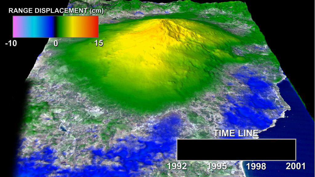
This animation depicts a time-series of ground deformation at Mount Etna Volcano between 1992 and 2001. The deformation results from changes in the volume of a shallow chamber centered approximately 5 km 3 miles below sea level.
Mount Etna InSAR Time Series Animation
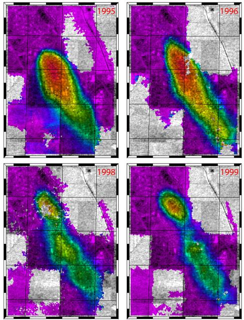
This figure shows a comparison of interferograms from four different years mapping the rapid ground subsidence over the Lost Hills oil field in California.
Lost Hills, California Interferogram
Jason Jones, left, and Lauren Childs are pictured with their presentation during the poster session at the American Geophysical Union Fall Meeting in San Francisco, Calif., Dec. 10-14, 2007.
Students with NASA's Stennis Space Center attend national conference
A crew member handles liquid nitrogen servicing for NASA’s Armstrong Flight Research Center’s ER-2 aircraft at Edwards, California, on Thursday, Aug. 21, 2025. Liquid nitrogen is used to support key science instruments for extended flight d…
NASA ER-2 Flies Geological Mapping Mission
NASA Armstrong Flight Research Center’s ER-2 aircraft lifts off from Edwards, California, on Tuesday, Sept. 23, 2025, in support of the Geological Earth Mapping Experiment (GEMx). The high-altitude science aircraft operates between 20,000 a…
NASA ER-2 Flies Geological Mapping Mission
Crew members reattach the nose cone of NASA’s Armstrong Flight Research Center’s ER-2 aircraft at Edwards, California, on Thursday, Aug. 21, 2025, ahead of a mission for the Geological Earth Mapping Experiment (GEMx). The aircraft’s nose ho…
NASA ER-2 Flies Geological Mapping Mission
This image of California Hayward fault is an interferogram created using a pair of images taken by ESA ERS-1 and ERS-2 in June 1992 and September 1997 over the central San Francisco Bay in California.
Hayward Fault, California Interferogram
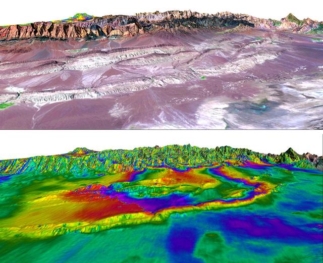
A magnitude 6.6 earthquake struck a sparsely inhabited area of southeast Iran on March 14, 1998, at 11:10 p.m. local time.
Shahdad, Southeast Iran, Radar Interferometry -- Silent Earthquake, Perspective View
Crew members prepare NASA Armstrong Flight Research Center’s ER-2 aircraft for flight at Edwards, California, on Tuesday, Sept. 23, 2025, in support of the Geological Earth Mapping Experiment (GEMx). The high-altitude science aircraft opera…
NASA ER-2 Flies Geological Mapping Mission
Crew members prepare NASA Armstrong Flight Research Center’s ER-2 aircraft for flight at Edwards, California, on Tuesday, Sept. 23, 2025, in support of the Geological Earth Mapping Experiment (GEMx). The high-altitude science aircraft opera…
NASA ER-2 Flies Geological Mapping Mission
From the window of the ER-2 chase car, a crew member gives a thumbs up to the pilot as NASA Armstrong Flight Research Center’s ER-2 aircraft taxis at Edwards, California, on Thursday, Aug. 21, 2025. The gesture signals a final check before…
NASA ER-2 Flies Geological Mapping Mission
NASA Armstrong Flight Research Center’s ER-2 aircraft taxis at Edwards, California, on Thursday, Aug. 21, 2025, ahead of a high-altitude mission supporting the Geological Earth Mapping Experiment (GEMx), which requires flights of up to eigh…
NASA ER-2 Flies Geological Mapping Mission
No more images