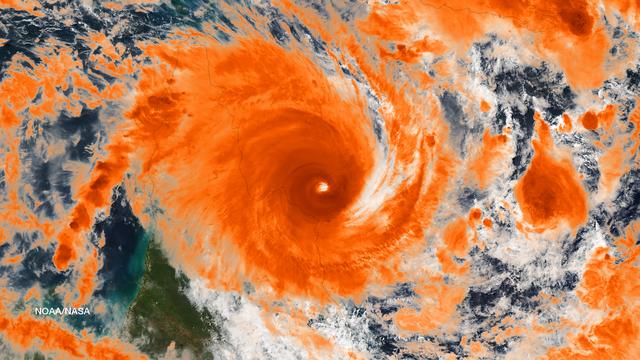
NASA's Aqua satellite passed over Tropical Cyclone Ita as it began making landfall on the Eastern Cape York Peninsula of Queensland, Australia, today, April 11, 2014. Ita officially made landfall at Cape Flattery about 9:00 p.m. local AEST…
Powerful Tropical Cyclone Ita Making Landfall in Queensland, Australia
NASA image acquired March 18, 2010.  Tropical Cyclone Ului persisted south of the Solomon Islands on March 18, 2010. A bulletin from the U.S. Navy’s Joint Typhoon Warning Center (JTWC) issued the same day reported that the cyclone had maxim…
NASA Satellite Image of Tropical Cyclone Ului
NASA image acquired January 30, 2011 at 23:20 UTC.  Satellite: Terra  <b> Click here to see the most recent image captured Feb. 1: <a href="http://www.flickr.com/photos/gsfc/5407540724/">www.flickr.com/photos/gsfc/5407540724/</a></b>  Tropi…
NASA Sees Large Tropical Cyclone Yasi Headed Toward Queensland, Australia
Residents of the northeast coast of Queensland, Australia are facing high winds, dangerous tides and very heavy rain between Cape Melville and Cooktown. These hazards will migrate southward for the next few days as the center of the storm r…
Tropical Cyclone Ita Off-Shore Queensland, Australia
Tropical Cyclone Debbie made landfall in Queensland bringing heavy rainfall, hurricane-force winds, rough seas, and flooding. NASA-NOAA's Suomi NPP satellite provided a visible look at the storm from space while NASA's Aqua satellite analyz…
NASA Sees Tropical Cyclone Debbie Make Landfall in Queensland
No more images