
This nearly cloud-free image of Iceland was captured by the MODIS instrument on board the Terra spacecraft on 04/15/2015 at 13:00 UTC.
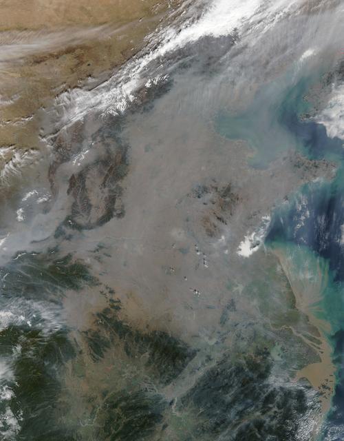
On October 17, 2015, the Moderate Resolution Imaging Spectroradiometer (MODIS) aboard NASA’s Terra satellite captured this true-color image of a thick haze hanging over eastern China. In the north, the large city of Beijing is completely ob…

On Oct. 18 at 17:35 UTC (1:35 p.m EDT) the MODIS instrument aboard NASA's Aqua satellite saw Hurricane Gonzalo approaching Newfoundland. ..Credit: NASA Goddard MODIS Rapid Response Team..<b><a href="http://www.nasa.gov/audience/formedia/fe…

March 24, 2010 - Dust over Japan This image of gray/brown dust being blown over Japan was captured on March 21, 2010 by the MODIS on the Terra satellite. On the left is the Korean peninsula. Japan stretches diagonally across the image, up…

NASA image acquired March 18, 2010. Tropical Cyclone Ului persisted south of the Solomon Islands on March 18, 2010. A bulletin from the U.S. Navy’s Joint Typhoon Warning Center (JTWC) issued the same day reported that the cyclone had maxim…

Decades of satellite observations and astronaut photographs show that clouds dominate space-based views of Earth. One study based on nearly a decade of satellite data estimated that about 67 percent of Earth’s surface is typically covered b…

The Moderate Resolution Imaging Spectroradiometer (MODIS) instrument aboard NASA's Aqua satellite captured this image of the Yucatán Peninsula on Feb. 3, 2022. At the center is Belize, a country whose Caribbean coast is home to the Belize B…
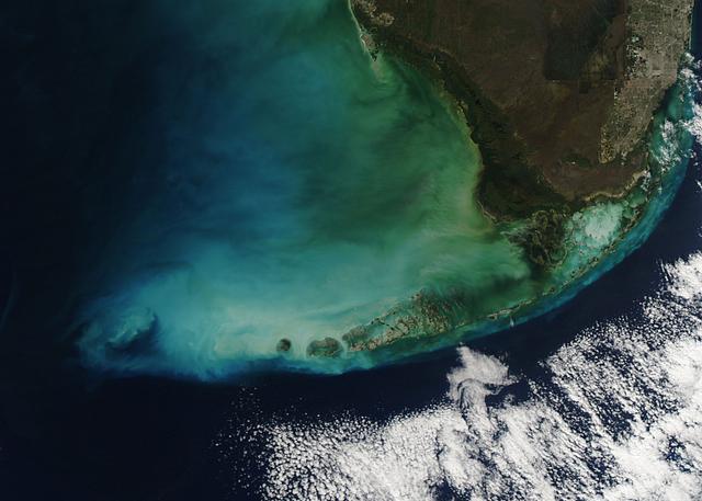
NASA image acquired January 4, 2012 The Florida Keys many colors were captured when the Moderate Resolution Imaging Spectroradiometer (MODIS) aboard the Aqua satellite captured this true-color image. NASA/GSFC/Jeff Schmaltz/MODIS Land Ra…

Ship tracks above the northern Pacific Ocean. NASA image captured July 3, 2010. Satellite: Aqua NASA/GSFC/Jeff Schmaltz/MODIS Land Rapid Response Team To learn more about MODIS go to: <a href="http://rapidfire.sci.gsfc.nasa.gov/gallery/…

Image acquired February 19, 2010: Tropical Cyclone Gelane had sustained winds of 125 knots (230 kilometers per hour) and gusts up to 150 knots (275 kilometers per hour), according to a report from the U.S. Navy’s Joint Typhoon Warning Cent…

2010/107 - 04/17 at 21 :05 UTC. Open-cell and closed-cell clouds off Peru, Pacific Ocean Resembling a frosted window on a cold winter's day, this lacy pattern of marine clouds was captured off the coast of Peru in the Pacific Ocean by the…

NASA image March 29, 2010 Tropical Cyclone Paul spanned the ocean waters between Australia and New Guinea on March 29, 2010. The MODIS on NASA’s Terra satellite captured this natural-color image the same day. The center of the cyclone is a…

A data visualization shows the average concentration of PM2.5 particulate pollution in the Los Angeles region from 2000 to 2018, along with the locations of nearly 11,000 warehouses over the same time period. Particles measuring 2.5 m…

In a paper published in November 2022 in Frontiers in Remote Sensing, researchers at NASA's Jet Propulsion Laboratory, with colleagues in Belize, used data from the Moderate Resolution Imaging Spectroradiometer (MODIS) instrument aboard NAS…

NASA image acquired August 10, 2010 Tropical Storm Dianmu blew over the East China Sea in early August 2010, traveling slowly toward the Korean Peninsula. On August 10, 2010, the U.S. Navy’s Joint Typhoon Warning Center (JTWC) reported tha…

NASA image acquired March 24, 2010. Tropical Cyclone Imani swirled over the Southern Indian Ocean on March 24, 2010. The same day, the U.S. Navy’s Joint Typhoon Warning Center (JTWC) reported that the storm had maximum sustained winds of 5…
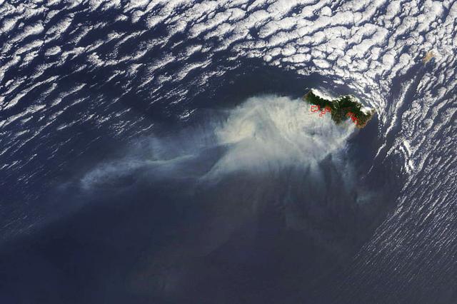
Smoke from several large fires burning on Portugal's Madeira Island were seen blowing over the Atlantic Ocean on Aug. 10 when NASA's Terra satellite passed overhead. Madeira is an archipelago of four islands located off the northwest coast…