On Nov. 22, 2015 at 19:15 UTC the MODIS instrument aboard NASA's Aqua satellite captured this image of Snow across the Midwest.  Credit: NASA Goddard MODIS Rapid Response Team  NASA image use policy.  NASA Goddard Space Flight Center enable…
Snow across the Midwest
The GOES-East satellite captured a Midwestern wintertime "White Out" at 2015 UTC/3:15 p.m. EST on January 6, 2014. Blowing snow and intensely cold air created dangerous white-out conditions over the Midwest, particularly around th…
Satellite Sees a Midwest White Out
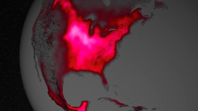
Amazing the things you can 'see' from space, if you just know how to look ... Satellite data show that during the Northern Hemisphere's growing season, the U.S. Midwest boasts more photosynthetic activity than any other spot on Earth.  The…
Photosynthetic Activity in US Midwest
A strong late-winter cyclone brought significant snows and blizzard conditions to the upper Great Lakes/northern Plains on 21 February 2014. In the warm sector of the storm, there were numerous reports of tornadoes, large hail, and damaging…
Suomi NPP View of a Strong Midwest Cyclone
An autumn storm brought the first snow of the season to the Upper Mississippi River Valley and the Midwestern United States in early November, 2013. The Moderate Resolution Imaging Spectroradiometer (MODIS) aboard NASA’s Terra satellite cap…
Autumn snow across the Midwest
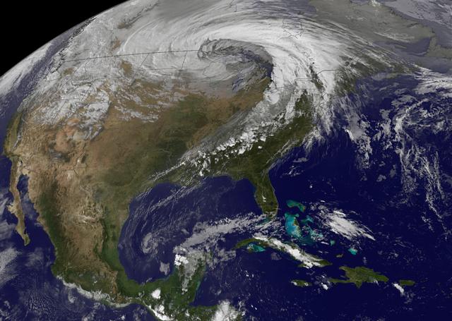
NASA image acquired October 26, 2010  The storm that swept across the center of the United States on October 26 and October 27, 2010, was memorable to those who experienced it because of its strong winds, rain, hail, and widespread tornadoe…
Strong Extratropical Cyclone Over the US Midwest
No more images