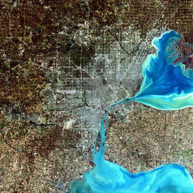
Detroit, Michigan, USA Sensor: L7 ETM+ Acquisition Date: December 11, 2001 Path/Row: 20/30 Lat/Long: 42.330/-83.046  Detroit, Michigan, is commonly referred to as Motor City because of the many automobile manufacturing plants located in the…
Detroit, Michigan, USA
SL3-83-0152 (July-September 1973) --- A near vertical view of the metropolitan Detroit, Michigan area is seen in this Skylab 3 Earth Resources Experiments Package S190-B (five-inch Earth terrain camera) photograph taken from the Skylab spac…
Detroit, Michigan metropolitan area photographed from Skylab
NASA image acquired December 17, 2010  In mid-December 2010, suspended sediments transformed the southern end of Lake Michigan. Ranging in color from brown to green, the sediment filled the surface waters along the southern coastline and fo…
Sediment Transforms Lake Michigan
In this late winter scene of Chicago, Illinois, USA (41.5N, 87.0W) the light dusting of snow has actually enhanced the determination of the cities street pattern, parks and other cultural features. Sited at the south end of Lake Michigan, C…
Chicago, Illinois, USA
STS040-77-045 (6 June 1991) --- This image, photographed on June 6, 1991, is an oblique view looking north-northeast and shows most of the Great Lakes region.  Part of Columbia's cargo bay and the Spacelab Life Sciences (SLS-1) module are i…
Great Lakes Region, State of Michigan, USA
STS059-S-027 (10 April 1994) --- This image is a false-color composite of Raco, Michigan, centered at 46.39 degrees north latitude, 84.88 degrees east longitude.  This image was acquired by the Spaceborne Imaging Radar-C and X-Band Syntheti…
False-color composite image of Raco, Michigan
No more images