S65-28653 (August 1965) --- Rendezvous Evaluation Pod (REP) in orbit is approached by Gemini spacecraft as seen in this artist's concept using an actual photograph taken on the Gemini-4 mission. The REP is superimposed over a Gemini-4 Earth…
GEMINI RENDEZVOUS EVALUATION POD (REP) - ARTIST CONCEPT
The F-15 ACTIVE in flight above the Mojave desert on April 14, 1998. The overhead shot shows the aircraft's striking red and while paint scheme/ The large forward canards are actually the tail surfaces from an F-18.
F-15 ACTIVE in flight
ER-2 tail number 709, was one of two Airborne Science ER-2s used as science platforms by Dryden. The aircraft were platforms for a variety of high-altitude science missions flown over various parts of the world. They were also used for eart…
Lockheed ER-2 #709 high altitude research aircraft during take off
A chase plane view of the tufts on the KC-135 winglet. The use of tufts in flight research dates back to the early days of the NACA, and remains an effective means of observing airflow even today. In this procedure, rows of strings are atta…
EC79-11481
A close up of the Flight Test Fixture II, mounted on the underside of the F-15B Aerodynamic Flight Facility aircraft. The Thermal Protection System (TPS) samples, which included metallic Inconel tiles, soft Advanced Flexible Reusable Surfac…
Closeup of F-15B Flight Test Fixture (FTF) with X-33 Thermal Protection Systems (TPS)
X-34 Technology Testbed Demonstrator on NASA Dryden ramp
F-18 Systems Research Aircraft (SRA) in flight
EC97-44272-8
X-34 mated to modified L-1011 during takeoff on first captive carry flight
ER-2 tail number 709, was one of two Airborne Science ER-2s used as science platforms by Dryden. The aircraft were platforms for a variety of high-altitude science missions flown over various parts of the world. They were also used for eart…
Lockheed ER-2 #709 high altitude research aircraft during take off
ER-2 tail number 709, was one of two Airborne Science ER-2s used as science platforms by Dryden. The aircraft were platforms for a variety of high-altitude science missions flown over various parts of the world. They were also used for eart…
Lockheed ER-2 #709 high altitude research aircraft during take off
ER-2 tail number 806, is one of two Airborne Science ER-2s used as science platforms by Dryden. The aircraft are platforms for a variety of high-altitude science missions flown over various parts of the world. They are also used for earth s…
Lockheed ER-2 #806 high altitude research aircraft in flight
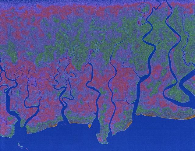
The objective of NASA Shuttle Imaging Radar A SIR-A was to observe the Earth by use of radar imagery, acquire and transmit data of different geologic regions. This is a view of China in 2000.
Radar view of China
A NASA camera on the Deep Space Climate Observatory satellite has returned its first view of the entire sunlit side of Earth from one million miles away.  This color image of Earth was taken by NASA’s Earth Polychromatic Imaging Camera (EPI…
NASA Captures 'EPIC' Earth Image
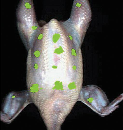
ProVision Technologies, a NASA research partnership center at Sternis Space Center in Mississippi, has developed a new hyperspectral imaging (HSI) system that is much smaller than the original large units used aboard remote sensing aircraft…
Biotechnology
NASA data and expertise are providing valuable information for the ongoing response to the April 25, 2015, magnitude 7.8 Gorkha earthquake in Nepal.
New ALOS-2 Damage Map Assists 2015 Gorkha, Nepal Disaster Response
Helios Prototype on lakebed prior to first battery-powered flight
EC99-45161-1
Two scientists at NASA Marshall Space Flight Center, atmospheric scientist Paul Meyer (left) and solar physicist Dr. David Hathaway, have developed promising new software, called Video Image Stabilization and Registration (VISAR), that may…
Benefit from NASA
F-18 Systems Research Aircraft (SRA) in flight
EC97-44272-6
An in-flight photo of the NASA F-15A used to carry a 10 degree cone to collect aerodynamic data to calibrate the data from wind tunnels. The flight was made on May 17, 1978. Acting as chase for the flight was a NASA F-104 aircraft.
F-15A in flight with 10 degree cone experiment and F-104N chase
In-flight photo of the NASA F-15B used in tests of the X-33 Thermal Protection System (TPS) materials. Flying at subsonic speeds, the F-15B tests measured the air loads on the proposed X-33 protective materials. In contrast, shock loads tes…
F-15B in flight with X-33 Thermal Protection Systems (TPS) on Flight Test Fixture
ER-2 tail number 706, was one of two Airborne Science ER-2s used as science platforms by Dryden. The aircraft were platforms for a variety of high-altitude science missions flown over various parts of the world. They were also used for eart…
Lockheed ER-2 high altitude research aircraft
A NASA CV-990, modified as a Landing Systems Research Aircraft (LSRA), lands on the Edwards AFB main runway in test of the space shuttle landing gear system. In this case, the shuttle tire failed, bursting into flame during the rollout. The…
CV-990 Landing Systems Research Aircraft (LSRA) during Space Shuttle tire test
DC-8 Airborne Laboratory in banked flight over snow-capped Sierra Nevada mountain range
ER-2C tail number 809, was one of two Airborne Science ER-2Cs used as science platforms by Dryden. The aircraft were platforms for a variety of high-altitude science missions flown over various parts of the world. They were also used for ea…
Lockheed ER-2C #809 high altitude research aircraft in flight
During the 1970s, the focus at Dryden shifted from high-speed and high-altitude flight to incremental improvements in technology and aircraft efficiency. One manifestation of this trend occurred in the winglet flight research carried out on…
EC79-11314
X-34 mated to modified L-1011 during takeoff on first captive carry flight
An image of the F-16XL #1 during its functional flight check of the Digital Flight Control System (DFCS) on December 16, 1997. The mission was flown by NASA research pilot Dana Purifoy, and lasted 1 hour and 25 minutes. The tests included p…
EC97-44354-2
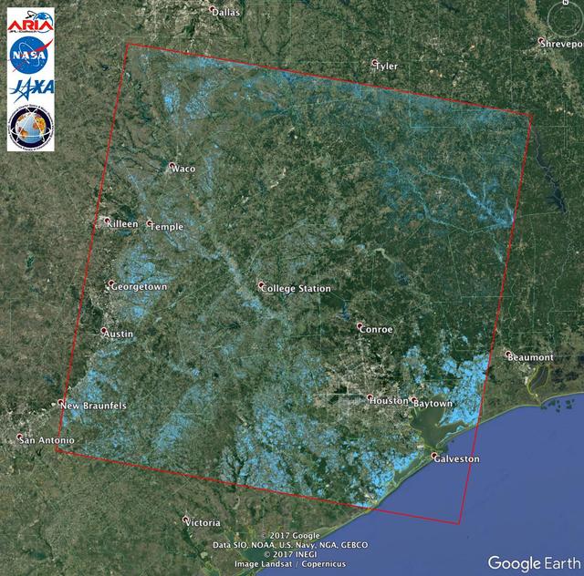
The Advanced Rapid Imaging and Analysis (ARIA) team at NASA's Jet Propulsion Laboratory in Pasadena, California, created this Flood Proxy Map depicting areas of Southeastern Texas that are likely flooded as a result of Hurricane Harvey, sho…
Extent of Texas Flooding Shown in New NASA Map
S93-33258 (15 Mar 1993) --- An optical schematic diagram of one of the four channels of the Wide Field\Planetary Camera-2 (WF\PC-2) shows the path taken by beams from the Hubble Space Telescope (HST) before an image is formed at the camera'…
Schematic diagram of light path in Wide Field Planetary Camera 2
The Moderate Resolution Imaging Spectroradiometer (MODIS) instrument aboard NASA's Aqua satellite captured this image of the Yucatán Peninsula on Feb. 3, 2022. At the center is Belize, a country whose Caribbean coast is home to the Belize B…
Study Uses MODIS Data to Determine Belize Coral Reef Risk
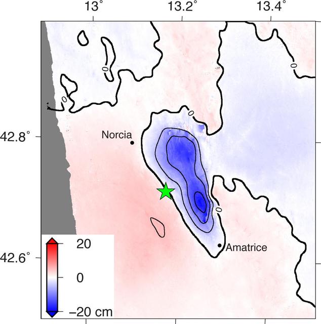
NASA and its partners are contributing observations and expertise to the ongoing response to the Aug. 23, 2016, magnitude 6.2 Amatrice earthquake in central Italy caused widespread building damage to several towns throughout the region. Thi…
Radar Shows Italy Area Moved 8 Inches by Amatrice Earthquake
ProVision Technologies, a NASA research partnership center at Sternis Space Center in Mississippi, has developed a new hyperspectral imaging (HSI) system that is much smaller than the original large units used aboard remote sensing aircraft…
Biotechnology
Closeup of the Helios Prototype, the latest and largest example of a slow-flying ultralight flying wing designed for high-altitude, long-duration Earth science or telecommunications relay missions.
EC99-45140-11
The F-15 ACTIVE touches down on the Edwards runway following its April 14, 1998 flight. The nose is high while the canards have their rear edge raised. the aircraft's speed brake, located on the top of the aircraft behind the canopy, is als…
F-15 ACTIVE touches down on Edwards AFB runway
ER-2 tail number 806, is one of two Airborne Science ER-2s used as science platforms by Dryden. The aircraft are platforms for a variety of high-altitude science missions flown over various parts of the world. They are also used for earth s…
Lockheed ER-2 #806 high altitude research aircraft during landing
ER-2 tail number 806, is one of two Airborne Science ER-2s used as science platforms by Dryden. The aircraft are platforms for a variety of high-altitude science missions flown over various parts of the world. They are also used for earth s…
Lockheed ER-2 #806 high altitude research aircraft in flight
The KC-135 with the winglets in flight over the San Gabriel mountains, south of Edwards AFB. While wind tunnel tests suggested that winglets - developed by NASA Langley's Richard Whitcomb - would significantly reduce drag, flight research p…
EC79-11484
X-34 mated to modified L-1011 during takeoff on first captive carry flight
ER-2 tail number 706, was one of two Airborne Science ER-2s used as science platforms by Dryden. The aircraft were platforms for a variety of high-altitude science missions flown over various parts of the world. They were also used for eart…
Lockheed ER-2 high altitude research aircraft in flight
ER-2 tail number 709, was one of two Airborne Science ER-2s used as science platforms by Dryden. The aircraft were platforms for a variety of high-altitude science missions flown over various parts of the world. They were also used for eart…
Lockheed ER-2 #709 high altitude research aircraft during take off
ER-2 tail number 709, was one of two Airborne Science ER-2s used as science platforms by Dryden. The aircraft were platforms for a variety of high-altitude science missions flown over various parts of the world. They were also used for eart…
Lockheed ER-2 #709 high altitude research aircraft in flight
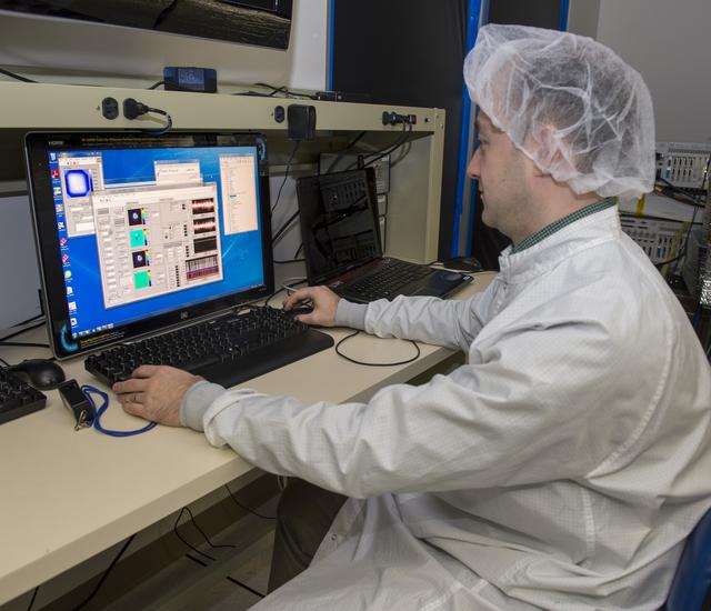
PIAA mirrors made by Tinsley and are inside the enclosure. with Ruslan Belikov
ACD13-0018-003
The objective of NASA Shuttle Imaging Radar A SIR-A was to observe the Earth by use of radar imagery, acquire and transmit data of different geologic regions. This is a view of New Guinea in 2000.
Radar view of New Guinea
ProVision Technologies, a NASA research partnership center at Sternis Space Center in Mississippi, has developed a new hyperspectral imaging (HSI) system that is much smaller than the original large units used aboard remote sensing aircraft…
Biotechnology
The F-16XL #1 (NASA 849) takes off for the first flight of the Digital Flight Control System (DFCS) on December 16, 1997. Like most first flight, the DFCS required months of preparations. During July 1997, crews worked on the engine, cockpi…
EC97-44354-1
On Nov. 27, 2022, Mauna Loa, Earth's largest active volcano, began erupting from the summit caldera inside Hawaii Volcanoes National Park.  Scientists with the Advanced Rapid Imaging and Analysis project (ARIA), a collaboration between NASA…
Satellite Data Shows Ground Motion From Mauna Loa Volcano Eruption
A magnitude 6.0 earthquake struck southern Napa county northeast of San Francisco, California, on Aug. 24, 2014. NASA satellite data reveal ground defomation.
NASA Analyses of Global Positioning System Data and Italian Radar Satellite Data Reveal Napa Quake Ground Deformation
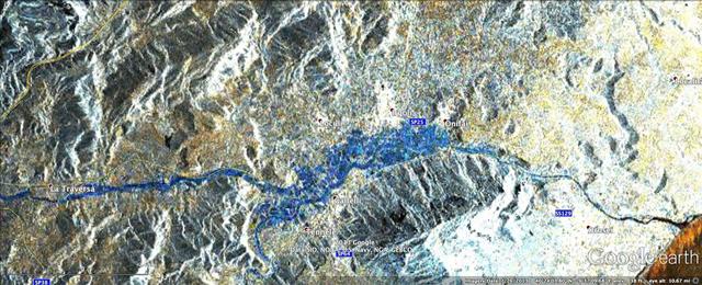
In mid-November 2013, extratropical cyclone Cleopatra brought devastating flooding to the Italian island of Sardinia as shown by the COSMO-SkyMed satellite.
NASA Produces Map to Aid in Italian Flood Response