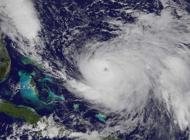
NOAA's GOES-East satellite captured this visible image of Hurricane Joaquin east of the Bahamas on Oct. 3 at 1615 UTC (12:15 p.m. EDT). The national weather forecast for October 3, 2015: Joaquin is no threat for now, but the nor'easter on…

NOAA's GOES-East satellite captured this visible image of Hurricane Joaquin east of the Bahamas on Oct. 3 at 1615 UTC (12:15 p.m. EDT). The national weather forecast for October 3, 2015: Joaquin is no threat for now, but the nor'easter on…

NASA's Aqua satellite captured this image of Hurricane Joaquin over the Bahamas on Oct. 1 at 17:55 UTC (1:55 p.m. EDT). Recently upgraded to Category 4, Hurricane Joaquin has maximum sustained winds of 130 mph which may grow stronger. Cre…

Hurricane Joaquin continued to intensify in the Bahamas on October 1 and NASA and NOAA satellites have been providing valuable data on the storm. NASA's GPM and Terra satellites and NOAA's GOES-East satellite provided rainfall, cloud extent…