
On Oct. 19 at 1500 UTC (11 a.m. EDT), the MODIS instrument aboard NASA's Terra satellite captured this visible image of Hurricane Gonzalo east of Newfoundland, Canada. ..Credit: NASA Goddard MODIS Rapid Response Team ..<b><a href="http://w…
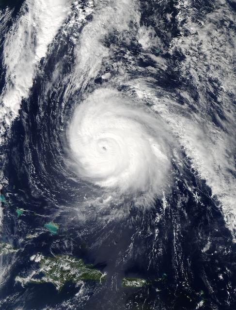
On Oct. 16 at 17:45 UTC NASA's Terra satellite captured this image of Hurricane Gonzalo in the Atlantic Ocean. Image Credit: NASA Goddard MODIS Rapid Response Team-- NASA and NOAA satellites have been providing continuous coverage of Hurr…

On Oct. 17 at 15:15 UTC (11:15 a.m EDT) the MODIS instrument aboard NASA's Aqua satellite saw Hurricane Gonzalo's northern quadrant over Bermuda as it moved to landfall. ..Credit: NASA Goddard MODIS Rapid Response Team ..<b><a href="http:/…

Hurricane Gonzalo has made the jump to major hurricane status and on Oct. 15 was a Category 4 storm on the Saffir-Simpson Hurricane Scale. NOAA's GOES-East satellite provided imagery of the storm. According to the National Hurricane Center,…
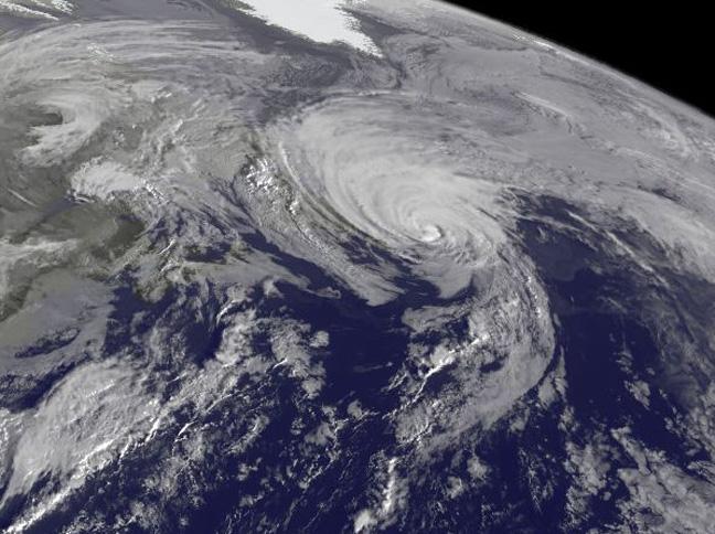
NOAA's GOES-East satellite captured a visible image of the storm on Sunday, Oct. 18 at 1145 UTC (7:45 a.m. EDT) that showed it in the North Atlantic, blanketing eastern Canada and stretching east over open waters. ..Credit: NOAA/NASA GOES P…

On Oct. 18 at 17:35 UTC (1:35 p.m EDT) the MODIS instrument aboard NASA's Aqua satellite saw Hurricane Gonzalo approaching Newfoundland. ..Credit: NASA Goddard MODIS Rapid Response Team..<b><a href="http://www.nasa.gov/audience/formedia/fe…

Hurricane Gonzalo is moving toward the northwest near 12 mph. A turn toward the north-northwest and then north is expected during the next day or so, followed by a north northeastward acceleration by late Thursday. Maximum sustained winds a…