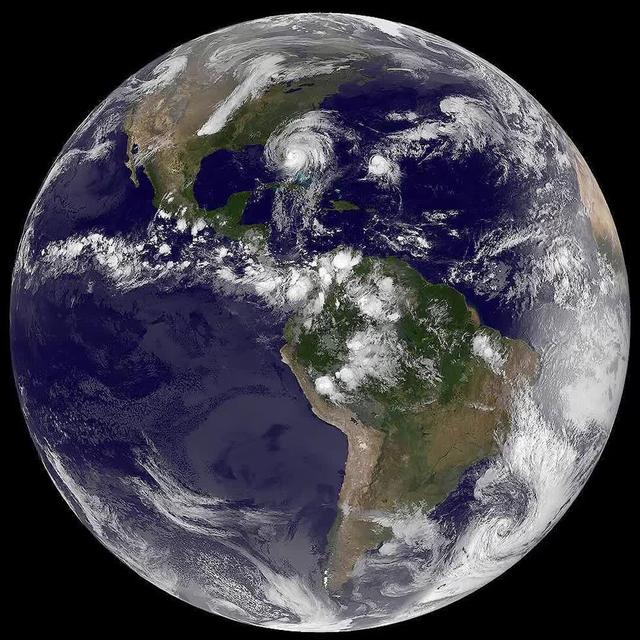
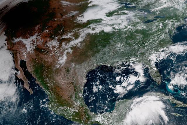
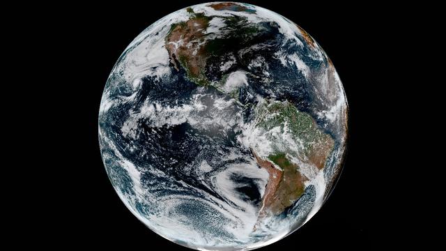
The most recent view of Matthew from space shows this massive storm converging on the Florida coast. This visible image was captured Oct. 7 at 4:45 a.m. EDT from NOAA's GOES-East satellite. Read more about Hurricane Matthew at <a href="h…
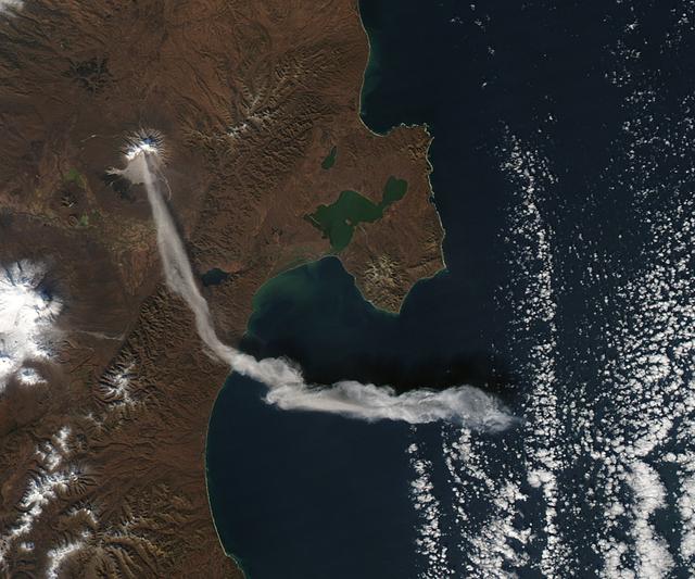
When NASA’s Terra satellite passed over Russia’s Kamchatka Peninsula at noon local time (00:00 Universal Time) on October 6, 2012, Shilveluch Volcano was quiet. By the time NASA’s Aqua satellite passed over the area two hours later (bottom…
S65-18740 (23 March 1965) --- Astronaut John W. Young took this picture during the second orbit of the Gemini-Titan 3 three-orbit mission as the spacecraft "Molly Brown" passed over Northern Mexico at an altitude of 90 miles. The light-brow…
S65-34673 (3-7 June 1965) --- This photograph shows the north end of the Gulf of California at the mouth of the Colorado River as it was seen from the Gemini-4 spacecraft during orbital flight June 3-7, 1965. This picture was part of the Sy…
STS062-85-031 (4-18 March 1994) --- The shallow platforms (bright blue) and deep channels (dark blue) of the Bahamas provide a striking visual from space. On a finer scale, delicate patterns are created by the islands, sandbars and tidal c…
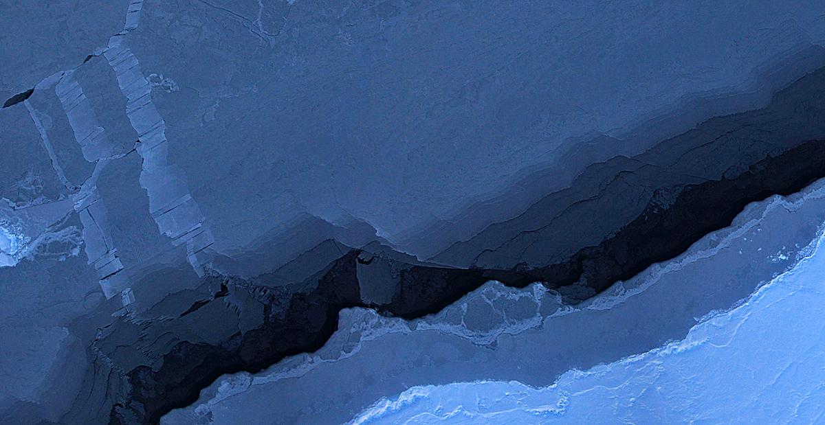
Mosaic image of sea ice in the Beaufort Sea created by the Digital Mapping System (DMS) instrument aboard the IceBridge P-3B. The dark area in the middle of the image is open water seen through a lead, or opening, in the ice. Light blue are…
S65-45697 (21-29 Aug. 1965) --- The western coastline of Baja, California and Cedros Island is photographed from the Gemini-5 spacecraft in orbit over Earth.
S65-18750 (23 March 1965) --- Astronaut John W. Young took this picture over eastern Africa during the Gemini-Titan 3 three-orbit mission on March 23, 1965. The altitude of the Gemini spacecraft "Molly Brown" was 90 miles. Young used a hand…
Caption: Composite shot of all four rockets for the M-TeX and MIST experiments is made up of 30 second exposures. The rocket salvo began at 4:13 a.m. EST, Jan. 26, 2015, from the Poker Flat Research Range, Alaska. Credit: NASA/Jamie Adkin…
S65-45748 (21-29 Aug. 1965) --- Looking northeast, the Imperial Valley and Salton Sea in southern California is photographed from the Earth-orbiting Gemini-5 spacecraft. This picture was taken with a modified 70mm Hasselblad camera, using M…
S65-45731 (21-29 Aug. 1965) --- View of the Gulf of Tonkin, China and the Luichow Peninsula photographed from the Gemini-5 spacecraft in orbit over Earth.
Earth observation taken during day pass by an Expedition 36 crew member on board the International Space Station (ISS). Per Twitter message: Southwest coast of Peru.
Transit of Venus as seen at 762nm in the CO Module. This image is from NASA Astronaut Don Petttit shot from onboard the International Space Station on June 5, 2012. Petttit, who had the foresight to bring a solar filter for his camera, wi…
Every day of every year, NASA satellites provide useful data about our home planet, and along the way, some beautiful images as well. This video includes satellite images of Earth in 2014 from NASA and its partners as well as photos and a t…
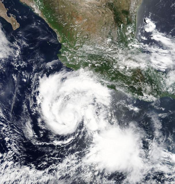
Hilary is a small but strengthening hurricane, with hurricane-force winds extending outward up to 10 miles (20 km) from the center. Tropical-storm-force winds extending outward up to 60 miles (95 km). Hilary began when Tropical Depression…
S65-18759 (23 March 1965) --- Astronaut John W. Young took this picture of clouds over the Indian Ocean during the Gemini-Titan 3 three-orbit mission on March 23, 1965. Young used a hand-held modified 70mm Hasselblad camera with color film.…
Here are a few of our top images from 2016. To see more great NASA Goddard images be sure to follow us on Instagram at <a href="http://www.instagram.com/nasagoddard" rel="nofollow">www.instagram.com/nasagoddard</a> and also on Twitter at <…
This chart describes the Skylab student experiment Ultraviolet (UV) from Quasars, proposed by John C. Hamilton of Aiea, Hawaii. This experiment utilized Skylab's Ultraviolet Stellar Astronomy equipment to photograph quasars in the UV spectr…
STS062-106-094 (4-18 March 1994) --- The Greater Houston metropolitan area, completely clear of clouds, was captured on 70mm film by one of the crew members aboard the Space Shuttle Columbia. The belt system on the north, east and south si…
S65-34661 (3-7 June 1965) --- Among the photographs of Earth's terrain taken from the Gemini-4 spacecraft during its orbital mission was this view of the southeastern tip of the Arabian Peninsula with the Gulf of Oman at upper right. Seif d…
Overnight on October 4-5, 2012, a mass of energetic particles from the atmosphere of the Sun were flung out into space, a phenomenon known as a coronal mass ejection. Three days later, the storm from the Sun stirred up the magnetic field ar…
STS059-52-029 (9-20 April 1994) --- The constellation Orion is backdropped against a colorful display of the Southern Lights (aurora australis) in this 35mm image. Six NASA astronauts went on to spend a week and a half aboard the Space Shu…
Generally the old saying “where there is smoke, there is fire” rings true, but when thick, hot smoke rises high aloft into the atmosphere it may travel hundreds, sometimes thousands of kilometers away from the source. This was the case on…
Images acquired December 21, 2010 - September 20, 2011. To view a HD animation of this go to: <a href="http://www.flickr.com/photos/gsfc/6175313242/in/photostream/">www.flickr.com/photos/gsfc/6175313242/in/photostream/</a> To download the…
STS059-58-018 (9-20 April 1994) --- Part of the Space Shuttle Endeavour and its Space Radar Laboratory (SRL-1) payload are backdropped against a colorful display of the Southern Lights (aurora australis). The vehicle was firing a reaction c…
Earth observation taken during a day pass by an Expedition 37 crew member on board the International Space Station (ISS). Identified via Twitter message as dusk on the Himalayas.
The shadow of the moon blots out the Pacific Northwest in this GOES-16 geocolor image of the 2017 Solar Eclipse. Credit: CIRA View more eclipse imagery at <a href="http://www.nesdis.noaa.gov/content/multimedia" rel="nofollow">www.nesdis…
In orbit above the semi-desert grasslands in Kazakhstan, an astronaut aboard the International Space Station spotted one of the few features that stand out. Lake Tengiz is the only large lake (1590 square kilometers, 615 square miles) in no…
View of the partial solar eclipse from NASA's Goddard Space Flight Center in Greenbelt, Md on Monday, August 21, 2017. A total solar eclipse swept across a narrow portion of the contiguous United States from Lincoln Beach, Oregon to Charl…
S65-34659 (3-7 June 1965) --- Among the many photographs taken from the Gemini-4 spacecraft during its orbital flight around Earth was this view of the Hahramaut Plateau on the southern portion of the Arabian Peninsula. The Wadi Hahramaut i…
Red and white vapor clouds filled the skies over the Marshall Islands as part of NASA’s Equatorial Vortex Experiment (EVEX). The red cloud was formed by the release of lithium vapor and the white tracer clouds were formed by the release of…
NASA's Aqua satellite captured this image of the clouds over Canada. Entwined within the clouds is the smoke billowing up from the wildfires that are currently burning across a large expanse of the country. The smoke has become entrained…
Sometime between July 10 and July 12, an iceberg about the size of Delaware split off from Antarctica’s Larsen C ice shelf. Now that nearly 5,800 square kilometers (2,200 square miles) of ice has broken away, the Larsen C shelf area has shr…
On August 21, 2017, the first total solar eclipse to move across the United States in 99 years occurred. GOES-16 captured the eclipse with the Advanced Baseline Imager (ABI) which had a clear view of the moon’s shadow as it traveled diagona…
S65-34776 (3-7 June 1965) --- This photograph shows the Nile Delta, Egypt, the Suez Canal, Israel, Jordan, Syria, Saudi Arabia, and Iraq as seen from the Gemini-Titan 4 (GT-4) spacecraft during its 12th revolution of Earth.
S65-45737 (22 Aug. 1965) --- Looking northeast, the Strait of Gibraltar, Morocco (foreground) and Spain (background) are photographed from the Gemini-5 spacecraft during its 14th revolution of Earth.
S65-34670 (3-7 June 1965) --- Richat crater in northwest Africa taken from the Gemini-4 spacecraft. Photograph was taken with a modified 70mm Hasselblad camera, using Eastman color film, ASA 64, at a lens setting of 250th of a second at f/1…
Earth Observation taken during a day pass by the Expedition 40 crew aboard the International Space Station (ISS). Folder lists this as: Floods in India.