The Visible Infrared Imaging Radiometer Suite (VIIRS) on the Suomi NPP satellite captured this view of extensive sea-ice fracturing off the northern coast of Alaska. The event began in late-January and spread west toward Banks Island throug…
Extensive Ice Fractures in the Beaufort Sea [detail]
The Visible Infrared Imaging Radiometer Suite (VIIRS) on the Suomi NPP satellite captured this view of extensive sea-ice fracturing off the northern coast of Alaska. The event began in late-January and spread west toward Banks Island throug…
Extensive Ice Fractures in the Beaufort Sea
Image acquired February 27, 2010: An extratropical cyclone named Xynthia brought hurricane-force winds and high waves to Western Europe at the end of February 2010, CNN reported. Winds as fast as 200 kilometers (125 miles) per hour reached…
Violent Storm Strikes Western Europe
Image acquired February 19, 2010:  Tropical Cyclone Gelane had sustained winds of 125 knots (230 kilometers per hour) and gusts up to 150 knots (275 kilometers per hour), according to a report from the U.S. Navy’s Joint Typhoon Warning Cent…
Tropical Cyclone Gelane
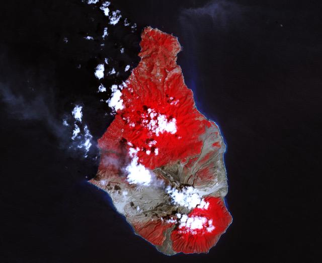
A massive eruption of Montserrat’s Soufrière Hills Volcano covered large portions of the island in debris. The eruption was triggered by a collapse of Soufrière Hills’ summit lava dome on February 11, 2010. Pyroclastic flows raced down the…
Soufriere Hills Volcano Resumes Activity
The Visible Infrared Imaging Radiometer Suite (VIIRS) on the Suomi NPP satellite captured this view of extensive sea-ice fracturing off the northern coast of Alaska. The event began in late-January and spread west toward Banks Island throug…
Extensive Ice Fractures in the Beaufort Sea [annotated]
NASA image acquired August 4, 2010  Though many areas in northwest Pakistan were bracing for heavy rain and additional flash flooding on August 4, 2010, the city of Kheshgi, in northwest Pakistan, had clear skies. This image, taken by the A…
Flooding in Pakistan August 4, 2010
No more images