Spatial distribution of snow water equivalent across the Tuolumne River Basin from April 10 to June 1, 2013 as measured by NASA Airborne Snow Observatory.
An AirSAR 2004 view from the DC-8 as it approaches the Larsen Ice Shelf, which is part of the Antarctic Peninsula. AirSAR 2004 is a three-week expedition in Central and South America by an international team of scientists that is using an a…
The Larsen Ice Shelf in Antarctica viewed from NASA's DC-8 aircraft during the AirSAR 2004 campaign. AirSAR 2004 is a three-week expedition in Central and South America by an international team of scientists that is using an all-weather ima…
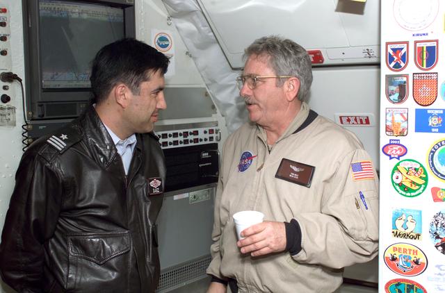
NASA DC-8 Mission Manager Walter Klein and Chilean Air Force Advisor Captain Saez review maps of the Antarctic Peninsula during an AirSAR 2004 mission. AirSAR 2004 is a three-week expedition in Central and South America by an international…
NASA’s DC-8 aircraft at Carlos Ibanez International Airport in Punta Arenas, Chile. A portion of AirSAR hardware is visible on the left rear fuselage. AirSAR 2004 is a three-week expedition in Central and South America by an international t…
NASA's DC-8 flying laboratory takes off from Carlos Ibanez International Airport in Punta Arenas, Chile, during NASA's AirSAR 2004 campaign. AirSAR 2004 is a three-week expedition in Central and South America by an international team of sci…
The Larsen Ice Shelf in Antarctica viewed from NASA's DC-8 aircraft during the AirSAR 2004 campaign. AirSAR 2004 is a three-week expedition in Central and South America by an international team of scientists that is using an all-weather ima…
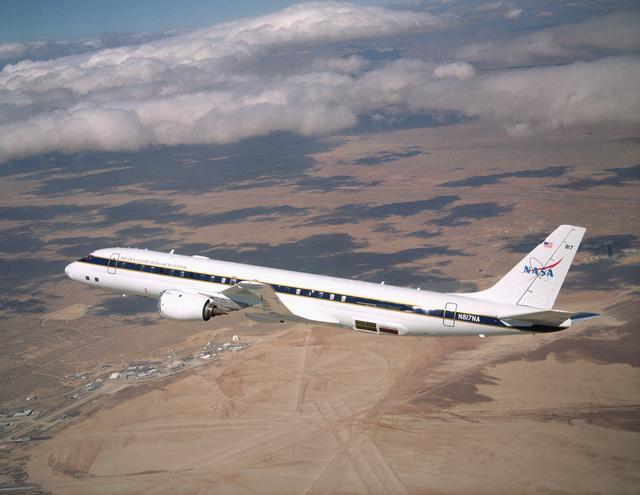
NASA's large Airborne Science research aircraft, a modified DC-8 airliner, displayed new colors in a check flight Feb. 24, 2004, over its home base, the NASA Dryden Flight Research Center at Edwards AFB, California.
Dr. Tom Mace, NASA DFRC Director of Airborne Sciences, talks with a student from Punta Arenas, Chile, during a tour of the DC-8 aircraft while it was in the country supporting the AirSAR 2004 campaign. AirSAR 2004 is a three-week expedition…
NASA's DC-8 Airborne Science research aircraft, in new colors and markings, in flight Feb. 24, 2004. Dark panels on lower fuselage are synthetic aperture radar antennas enabling sophisticated studies of Earth features.
Chilean Air Force Captain Saez and Dr. Tom Mace, DFRC Director of Airborne Sciences, discuss airborne science during a DC-8 ferry flight from Santiago to Punta Arenas, Chile. AirSAR 2004 is a three-week expedition by an international team o…
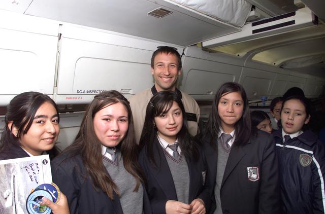
NASA Dryden Mission Manager Walter Klein poses with school children that visited the DC-8 during AirSAR 2004 in Punta Arenas, Chile. AirSAR 2004 is a three-week expedition by an international team of scientists that uses an all-weather imag…
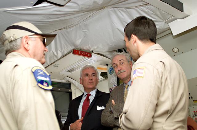
Dr. Tom Mace, NASA DFRC Director of Airborne Sciences, and Walter Klein(far right), NASA DFRC Airborne Science Mission Manager, brief John Danilovich, US Ambassador to Costa Rica, and NASA Administrator Sean O'Keefe onboard NASA's DC-8 duri…
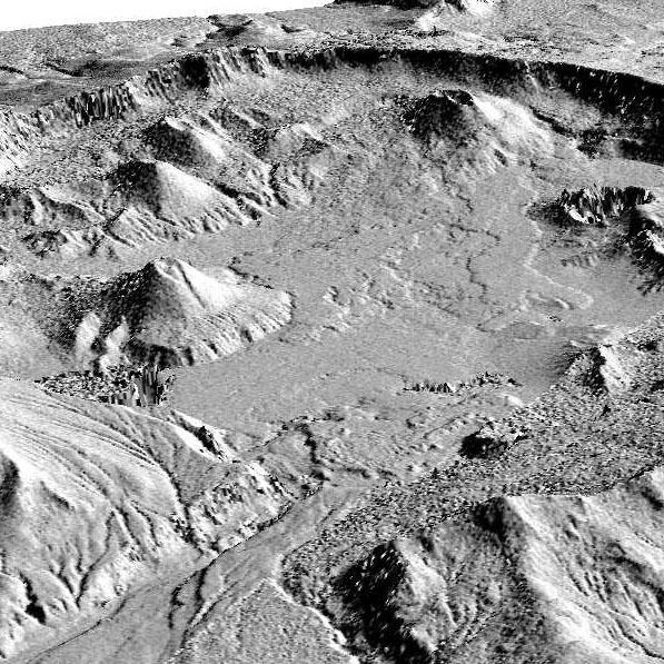
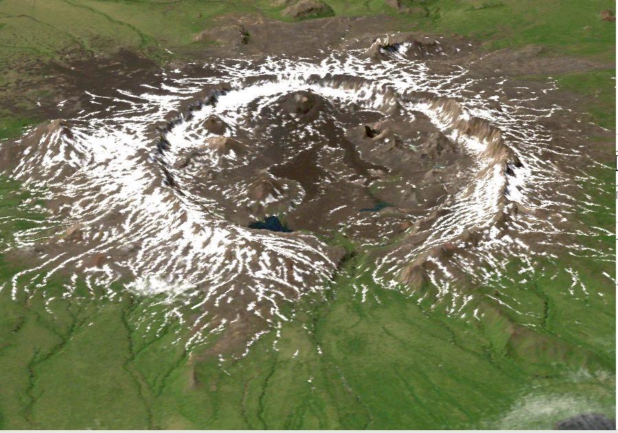
This perspective view shows the caldera of the Okmok volcano in Alaska Aleutian Islands acquired by NASA Airborne Synthetic Aperture Radar AIRSAR in 2001.
This perspective view shows the caldera of the Okmok volcano in Alaska Aleutian Islands acquired by NASA Airborne Synthetic Aperture Radar AIRSAR in 2001.
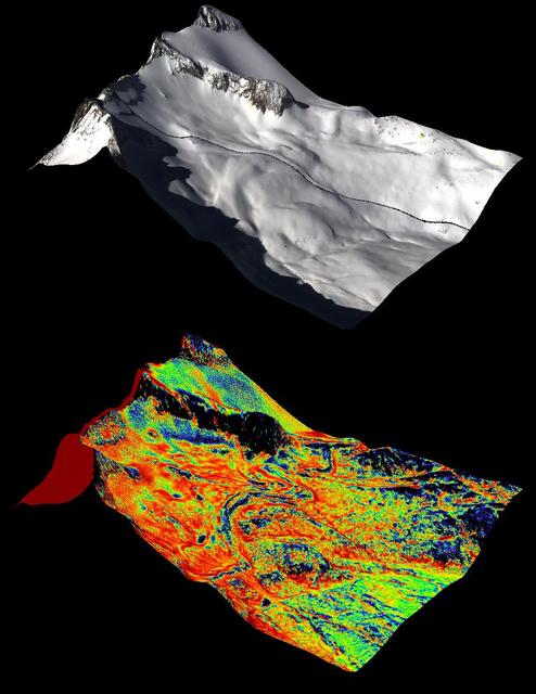
A natural color image of Mt. Lyell, the highest point in the Tuolumne River Basin top image is compared with a three-dimensional color composite image of Mt. Lyell from NASA Airborne Snow Observatory depicting snow depth bottom image.
NASA Airborne Snow Observatory is two instruments combined that provides information on every patch of snow, including how deep it is and how fast it melting. This is a frame from an animation.
The Larsen Ice Shelf in Antarctica viewed from NASA's DC-8 aircraft during the AirSAR 2004 campaign. AirSAR 2004 is a three-week expedition in Central and South America by an international team of scientists that is using an all-weather ima…
The Larsen Ice Shelf in Antarctica viewed from NASA's DC-8 aircraft during the AirSAR 2004 campaign. AirSAR 2004 is a three-week expedition in Central and South America by an international team of scientists that is using an all-weather ima…
NASA JPL scientists Yunling Lou and Dr. Eric Rignot work on line selection while flying AirSAR missions over the Antarctic Peninsula. AirSAR 2004 is a three-week expedition in Central and South America by an international team of scientists…
The Larsen Ice Shelf in Antarctica viewed from NASA's DC-8 aircraft during the AirSAR 2004 campaign. AirSAR 2004 is a three-week expedition in Central and South America by an international team of scientists that is using an all-weather ima…
The Larsen Ice Shelf in Antarctica viewed from NASA's DC-8 aircraft during the AirSAR 2004 campaign. AirSAR 2004 is a three-week expedition in Central and South America by an international team of scientists that is using an all-weather ima…
L to R; NASA Dryden Mission Manager Walter Klein (in tan flight suit), JPL AirSAR Scientist Tim Miller, and Mission Manager David Bushman briefing press in Santiago, Chile, for NASA's AirSAR 2004 mission. AirSAR 2004 is a three-week expedit…
VIP group in hangar during AirSAR 2004 Mesoamerica campaign, L-R: Dr. Gahssem Asrar, NASA Associate Administrator for Earth Science Enterprises; Fernando Gutierrez, Costa Rican Minister of Science and Technology(MICIT); Jorge Andres Diaz, D…
Reflectors setup in the La Selva region of the Costa Rican rain forest by scientist Paul Siqueira from NASA’s Jet Propulsion Lab. These reflectors are used by JPL scientists onboard Dryden's DC-8 aircraft to calibrate the Airborne Synthetic…
School children from Punta Arenas, Chile, talk with Dr. David Imel, an AirSAR scientist from NASA JPL, during AirSAR 2004. AirSAR 2004 is a three-week expedition by an international team of scientists that uses an all-weather imaging tool,…
Reflectors setup in the La Selva region of the Costa Rican rain forest by scientist Paul Siqueira from NASA’s Jet Propulsion Lab. These reflectors are used by JPL scientists onboard Dryden's DC-8 aircraft to calibrate the Airborne Synthetic…
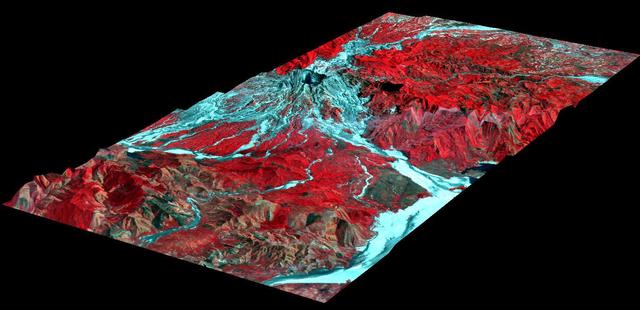
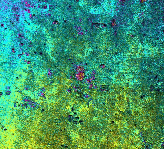
This radar image acquired by NASA Airborne Synthetic Aperture Radar AIRSAR in August, 2000, shows the western end of the island of Upolu in the nation of Western Samoa.
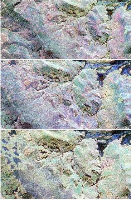
This sequence of three images in northern Colorado, taken by NASA Airborne Synthetic Aperture Radar AIRSAR in 2002, shows Fraser, Colorado, before snowfall, the morning after snow, and after the snow melted.
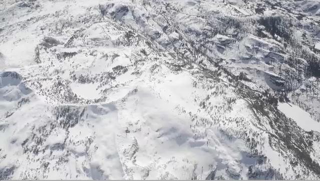
Mt. Dana and Dana Plateau in the Tuolumne River Basin within Yosemite National Park, Calif., as seen out the window of a Twin Otter aircraft carrying NASA Airborne Snow Observatory on April 3, 2013.
NASA Airborne Snow Observatory measurements of snow water equivalent top image and snow albedo, or reflectivity bottom image for the Tuolumne River Basin in California Sierra Nevada on April 21, 2013.
James Ross Island captured by NASA photographer James Ross(no relation), from NASA's DC-8 aircraft during an AirSAR 2004 mission over the Antarctic Peninsula. James Ross Island, named for 19th century British polar explorer Sir James Clark…
The Larsen Ice Shelf in Antarctica viewed from NASA's DC-8 aircraft during the AirSAR 2004 campaign. AirSAR 2004 is a three-week expedition in Central and South America by an international team of scientists that is using an all-weather ima…
NASA’s DC-8 aircraft prior to launch from Carlos Ibanez International Airport in Punta Arenas, Chile, during AirSAR 2004. AirSAR 2004 is a three-week expedition in Central and South America by an international team of scientists that is usi…
A penguin near Punta Arena, Chile, photographed in its natural summer habitat during NASA's AirSAR 2004 campaign. AirSAR 2004 is a three-week expedition in Central and South America by an international team of scientists that is using an al…
The Larsen Ice Shelf in Antarctica viewed from NASA's DC-8 aircraft during the AirSAR 2004 campaign. AirSAR 2004 is a three-week expedition in Central and South America by an international team of scientists that is using an all-weather ima…
Pilot Bill Brockett (left) and Chilean Air Force Captain Saez with school children in the cockpit of NASA Dryden's DC-8 flying laboratory. Brockett explained NASA's AirSAR 2004 mission in Chile. AirSAR 2004 is a three-week expedition by an…
NASA's large Airborne Science research aircraft, a modified DC-8 airliner, displayed new colors in a check flight Feb. 24, 2004, over its home base, the NASA Dryden Flight Research Center at Edwards AFB, California.
NASA's DC-8 Airborne Science research aircraft, in new colors and markings, takes off Feb. 24, 2004. Dark panels on lower fuselage are synthetic aperture radar antennas enabling sophisticated studies of Earth features.
NASA Administrator Sean O'Keefe speaking at the AirSAR 2004 Mesoamerica hangar naming ceremony. AirSAR 2004 Mesoamerica is a three-week expedition by an international team of scientists that will use an all-weather imaging tool, called the…
NASA Dryden Mission Manager Walter Klein talks with school children from Punta Arenas, Chile, during a tour of the DC-8 aircraft while it was in the country supporting the AirSAR 2004 campaign. AirSAR 2004 is a three-week expedition by an i…
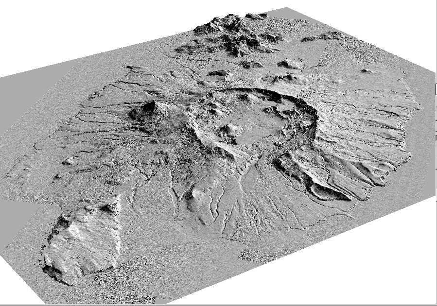
This image is a perspective view acquired by NASA Airborne Synthetic Aperture Radar AIRSAR in 2001, is of Umnak Island, one of Alaska Aleutian Islands. The active Okmok volcano appears in the center of the island.