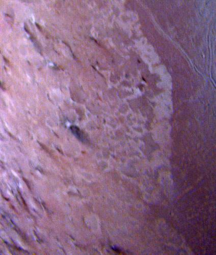
This false color image of Triton is a composite of images taken through the violet, green and ultraviolet filters. The image was taken early on Aug. 25, 1989 when Voyager 2 was about 190,000 kilometers 118,000 miles from Triton surface.

This color photo of Neptune large satellite Triton was obtained on Aug. 24 1989. In reality, there is no part of Triton that would appear blue to the eye. The bright southern hemisphere of Triton, which fills most of this frame, is generall…

Part of the complex geologic history of icy Triton, Neptune largest satellite, is shown in this NASA Voyager 2 photo. The photo was received as part of a Triton-mapping sequence in 1989.

NASA Voyager 2 spacecraft flew by Triton, a moon of Neptune, in the summer of 1989. Dr. Paul Schenk, a scientist at the Lunar and Planetary Institute in Houston, used Voyager data to construct the best-ever global color map of Triton.

This view of the volcanic plains of Neptune moon Triton was produced using topographic maps derived from images acquired by NASA Voyager spacecraft during its August 1989 flyby, 20 years ago this week.

This image of Triton was taken on Aug. 25 1989 by NASA Voyager 2. The image was received at JPL four hours later at about 4:20 a.m. The smallest detail that can be seen is about 2.5 kilometers 1.5 miles across.

This composite view from NASA Voyager 2 shows Neptune on Triton horizon. The foreground in this computer generated view of Triton maria as they would appear from a point approximately 45 km above the surface. http://photojournal.jpl.nasa.g…
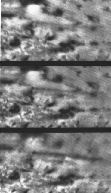
Triton Volcanic Plumes
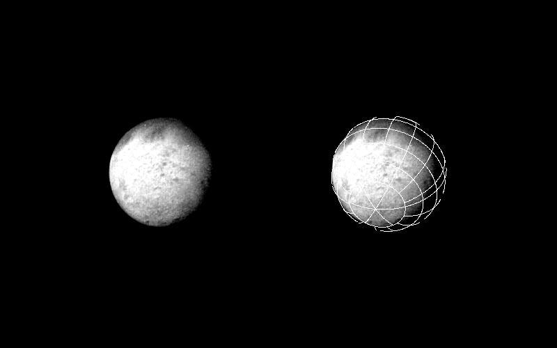
This photo of Triton is one of a continuing series of observatory phase images obtained by NASA Voyager spacecraft. Lines inscribed on the image at right form a reference grid used by the Imaging Science Team.

Intriguing patterns of unknown origin appeared on the surface of Neptune largest satellite, Triton, in this image returned by NASA Voyager 2 on Aug. 22, 1989. Voyager images showed that Triton is one of the brightest objects in the solar sy…

Mosaic of Triton constructed from 16 individual images. After globally minimizing the camera pointing errors, the frames we reprocessed by map projections, photometric function removal and placement in the mosaic.

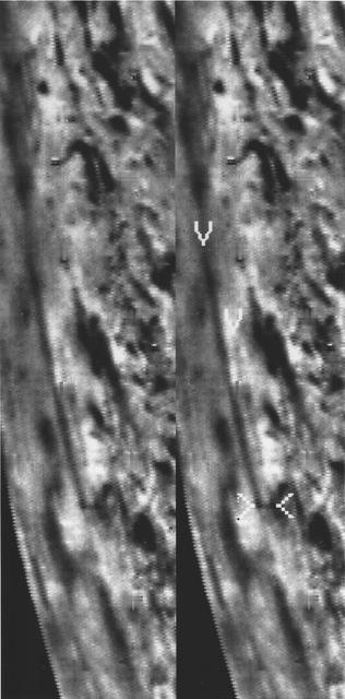
NASA's Voyager 2 acquired this black and white image of Triton, Neptune's largest satellite, during the night of Aug. 24-25, 1989. Triton's limb cuts obliquely across the middle of the image. The field of view is about 1,000 km (600 miles)…

This polar projection from NASA Voyager 2 of Triton southern hemisphere provides a view of the southern polar cap and bright equatorial fringe. The margin of the cap is scalloped and ranges in latitude from +10 degrees to -30 degrees. The b…

This computer generated montage created from images obtained by NASA Voyager 2 shows Neptune as it would appear from a spacecraft approaching Triton, Neptune largest moon at 2706 km 1683 mi in diameter. http://photojournal.jpl.nasa.gov/cat…

This view of the volcanic plains of Neptune moon Triton was produced using topographic maps derived from images acquired by NASA Voyager spacecraft during its August 1989 flyby, 20 years ago this week.

This view of the volcanic plains of Neptune moon Triton was produced using topographic maps derived from images acquired by NASA Voyager spacecraft during its August 1989 flyby, 20 years ago this week.

Global color mosaic of Triton, taken in 1989 by Voyager 2 during its flyby of the Neptune system. Color was synthesized by combining high-resolution images taken through orange, violet, and ultraviolet filters; these images were displayed a…
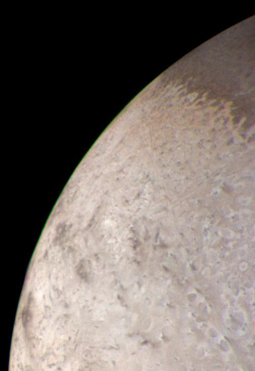
This natural color image of the limb of Triton was taken early in the morning of Aug. 25 1989, when the Voyager 2 spacecraft was at a distance of about 210,000 kilometers 128,000 miles from the icy satellite.

NASA Voyager 2 was 530,000 kilometers 330,000 miles from Neptune largest satellite, Triton, when this photo was taken, Aug. 24, 1989. This is the first photo of Triton to reveal surface topography.

Features as small as 100 km 62 miles across can be seen in this color image of Neptune satellite Triton, photographed by NASA Voyager 2 on Aug. 20, 1989, while it was still 5.4 million km 3.3 million miles from Neptune.

This picture of Triton is a mosaic of the highest resolution images taken by NASA Voyager 2 on Aug. 25, 1989 from a distance of about 40,000 kilometers 24,800 miles.

A new mission competing for selection under NASA's Discovery Program would explore Neptune's largest moon, Triton, which is potentially an ocean world with liquid water under its icy crust. Trident aims to answer the questions outlined in t…

This image from NASA's Voyager 2 of the south polar terrain of Triton, taken on Aug. 25, 1989 reveals about 50 dark plumes or 'wind streaks' on the icy surface. The plumes originate at very dark spots generally a few miles in diameter and s…

NASA Voyager 2 obtained this color image of Neptune largest satellite,Triton, on Aug. 22, 1989. The south pole of Triton is tipped toward the sun and it is summer in the southern hemisphere.
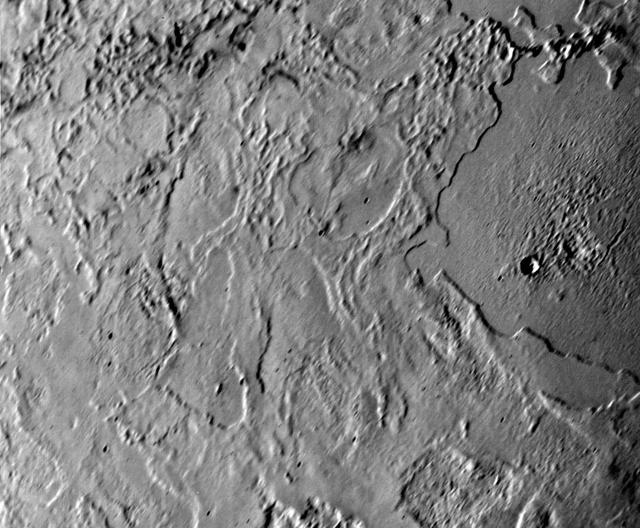
NASA Voyager 2 took this picture of Neptune largest satellite,Triton, from less than 80,000 km 50,000 miles. The image shows an area in Triton northern hemisphere. The Sun is just above the horizon, so features cast shadows that accentuate…

This is one of the most detailed views of the surface of Triton taken by NASA Voyager 2 on its flyby of the large satellite of Neptune early in the morning of Aug. 25, 1989. The picture was stored on the tape recorder and relayed to Earth l…

NASA Voyager 2 obtained this parting shot of Triton, Neptune largest satellite, shortly after closest approach to the moon and passage through its shadow on the morning of Aug. 25, 1989.
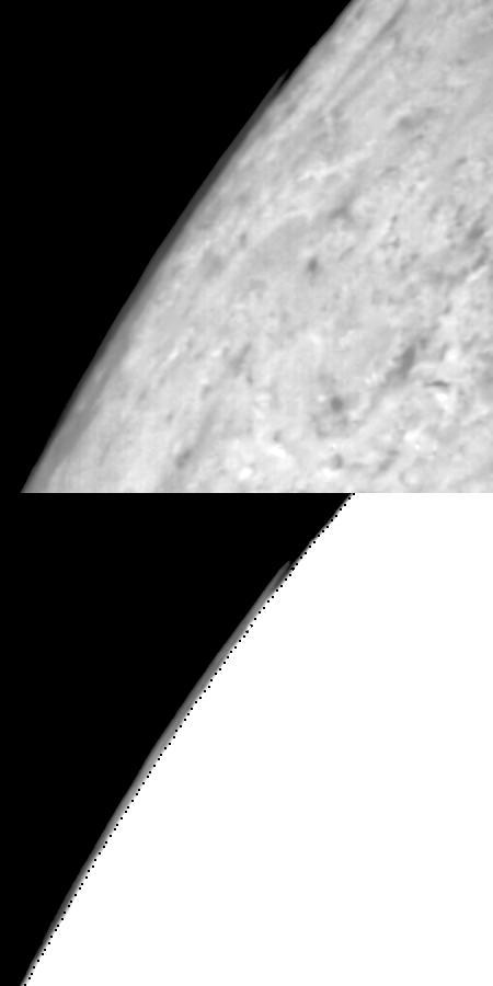
This mosaic from NASA Galileo Probe is of an equatorial hotspot on Jupiter and shows the features of a hazy cloud layer tens of kilometers above Jupiter main visible cloud deck.
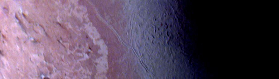
Voyager violet, green, and ultraviolet images of Triton were map projected into cylindrical coordinates and combined to produce this false color terrain map. Several compositionally distinct terrain and geologic features are portrayed. At c…
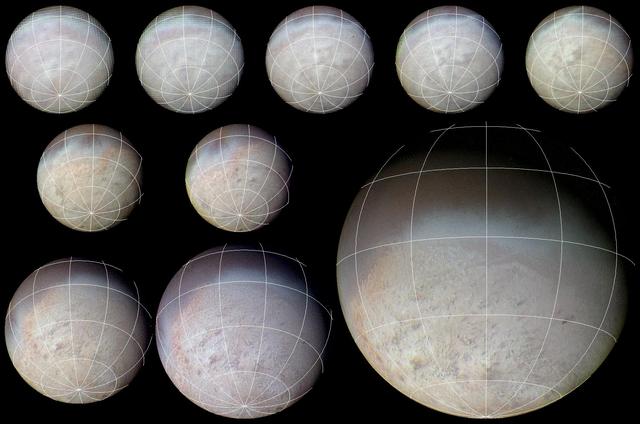
This color image from NASA Voyager 2 was reconstructed by making a computer composite of three black and white images taken through red, green, and blue filters. Details on Triton surface unfold dramatically in this sequence of approach ima…

This simulated voyage over the surface of Neptune large moon Triton was produced using topographic maps derived from images acquired by NASA Voyager spacecraft during its August 1989 flyby, 20 years ago this week.

NASA Voyager 2 spacecraft flew by Triton, a moon of Neptune, on August 25, 1989. This frame from a video using Voyager data recreates that exciting encounter.

This image, taken by NASA Voyager 2 early in the morning of Aug. 23, 1989, is a false color image of Triton, Neptune largest satellite; mottling in the bright southern hemisphere is present.
Triton Dark Plume