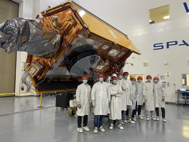
The Sentinel-6 Michael Freilich satellite undergoes final preparations in a clean room at Vandenberg Air Force Base in California for an early November launch.      The satellite is named after Dr. Michael Freilich, the former director of N…
Sentinel-6 Michael Freilich processing
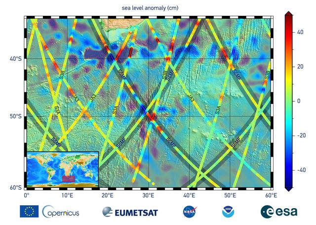
This graphic, released on Dec. 10, 2020, shows the first sea level measurements taken by Sentinel-6 Michael Freilich (S6MF), which launched Nov. 21, 2020. It focuses on the ocean off the southern tip of Africa, where red colors indicate hig…
Sentinel-6 Michael Freilich First Light Sea Level
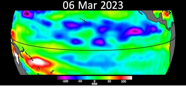
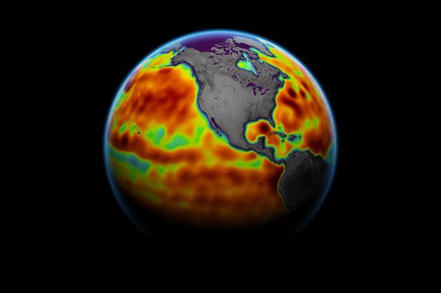
Sea level data from the U.S.-European satellite Sentinel-6 Michael Freilich shows early signs of a developing El Niño along the equatorial Pacific Ocean. The measurements show Kelvin waves, low waves that can be tens of miles (hundreds of k…
Early El Niño Signs
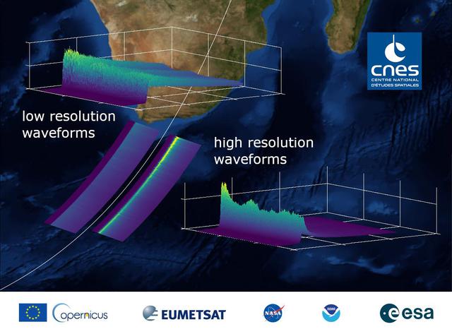
This graphic, released on Dec. 10, 2020, shows the basic radar measurements, called waveforms, collected by the instrument that monitors sea level on the Sentinel-6 Michael Freilich satellite, which launched Nov. 21, 2020. The instrument, c…
Sentinel-6 Michael Freilich First Light Waveform
This illustration shows the rear of the Sentinel-6 Michael Freilich spacecraft in orbit above Earth with its deployable solar panels extended. As the world's latest ocean-monitoring satellite, it is launching on Nov. 10, 2020, to collect th…
The Rear of the Sentinel-6 Michael Freilich Satellite (Illustration)
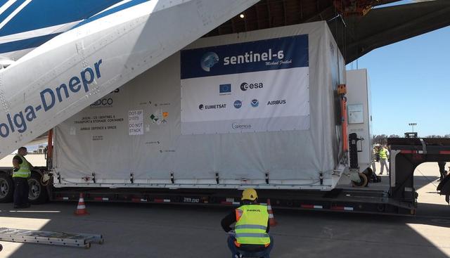
A shipping container containing the Sentinel-6 Michael Freilich satellite is removed from an Antonov 124 aircraft at Vandenberg Air Force Base in California on Sept. 24, 2020. The flight arrived at around 10:40 a.m. PDT (1:40 p.m. EDT) afte…
Sentinel-6 Michael Freilich Arrives at Vandenberg Air Force Base
The Sentinel-6 Michael Freilich satellite is encapsulated in a protective nosecone, or payload fairing, in the SpaceX Payload Processing Facility at Vandenberg Air Force Base in California. The fairing will sit atop a SpaceX Falcon 9 rocket…
Sentinel-6 Michael Freilich Encapsulated
This map shows sea level measured by the Sentinel-6 Michael Freilich satellite from June 5 to15. Red areas are regions where sea level is higher than normal, and blue areas indicate areas where it's lower than normal.  The measurements are…
Sentinel-6 Michael Freilich Sea Surface Height
This illustration shows the front of the Sentinel-6 Michael Freilich spacecraft in orbit above Earth with its deployable solar panels extended. As the world's latest ocean-monitoring satellite, it is launching on Nov. 10, 2020, to collect t…
The Front of the Sentinel-6 Michael Freilich Satellite (Illustration)
A shipping container containing the Sentinel-6 Michael Freilich satellite is transported on a truck to the SpaceX payload processing facility at Vandenberg Air Force Base after arriving in California on Sept. 24, 2020. An Antonov aircraft c…
Sentinel-6 Michael Freilich Transported for Payload Processing
Technicians and engineers working on the Sentinel-6 Michael Freilich satellite pose in front of the spacecraft as it sits in a protective nosecone, or payload fairing, in the SpaceX Payload Processing Facility at Vandenberg Air Force Base i…
Sentinel-6 Michael Freilich Spacecraft Team and Fairing
These three maps based on satellite data show sea levels in the Pacific Ocean during developing El Niño events in early October of 1997, 2015, and 2023. Higher-than-average ocean heights are shown in red and white, while lower-than-average…
Comparing Sea Level During El Niño Events
This illustration shows the Sentinel-6 Michael Freilich spacecraft in orbit above Earth with its deployable solar panels extended. As the world's latest ocean-monitoring satellite, it will collect the most accurate data yet on global sea le…
The Sentinel-6 Michael Freilich Satellite Orbits Earth (Illustration)
No more images