
As the northern hemisphere experiences the heat of summer, ice moves and melts in the Arctic waters and the far northern lands surrounding it. The Moderate Resolution Imaging Spectroradiometer (MODIS) aboard NASA’s Aqua satellite captured t…
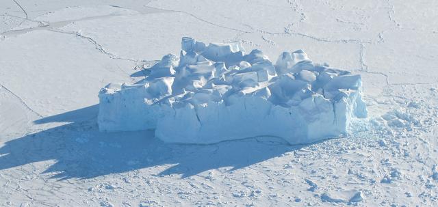
An iceberg embedded in sea ice as seen from the IceBridge DC-8 over the Bellingshausen Sea on Oct. 19, 2012. Credit: NASA / James Yungel NASA's Operation IceBridge is an airborne science mission to study Earth's polar ice. For more informa…

The U.S. Coast Guard Cutter Healy encountered only small patches of sea ice in the Chukchi Sea during the final days collecting ocean data for the 2011 ICESCAPE mission. The ICESCAPE mission, or "Impacts of Climate on Ecosystems and C…
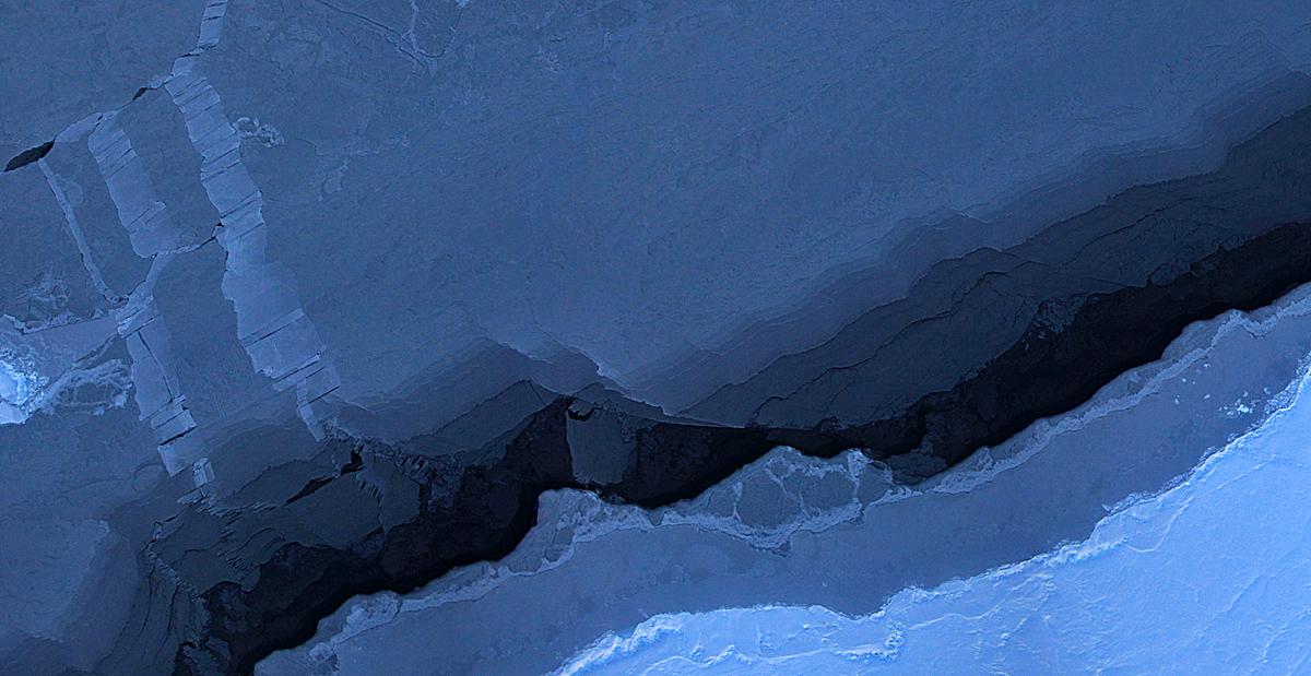
Mosaic image of sea ice in the Beaufort Sea created by the Digital Mapping System (DMS) instrument aboard the IceBridge P-3B. The dark area in the middle of the image is open water seen through a lead, or opening, in the ice. Light blue are…
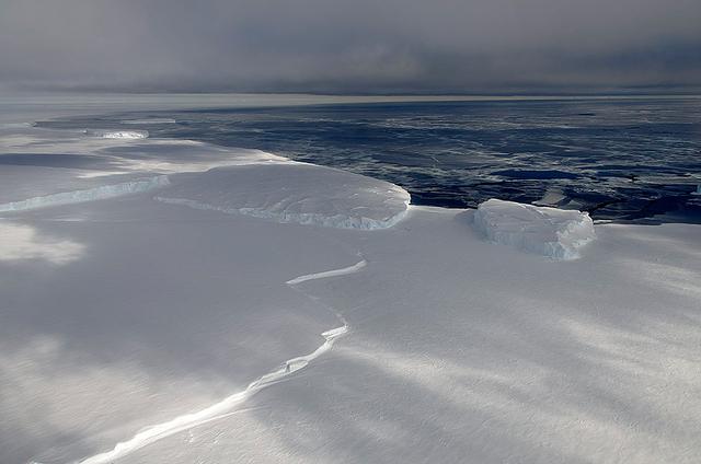
November 21, 2013 - NASA's Operation IceBridge P-3 landed a few minutes ago after a successful survey of sea ice in the Ross Sea. In this photo taken by project scientist Michael Studinger we see icebergs in Sulzberger Bay off of the easter…

Located off the east coast of Russia, the Sea of Okhotsk stretches down to 45 degrees North latitude, and sea ice forms regularly in the basin. In fact, it is the lowest latitude for seasonal sea ice formation in the world. On January 4, 20…
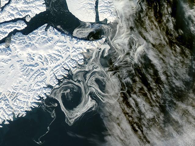
NASA image acquired October 16, 2012 The MODIS instrument on NASA's Aqua satellite captured this visible image of Sea Ice off eastern Greenland on October 16, 2012. NASA/GSFC/Jeff Schmaltz/MODIS Land Rapid Response Team <b><a href="htt…

The Visible Infrared Imaging Radiometer Suite (VIIRS) on the Suomi NPP satellite captured this view of extensive sea-ice fracturing off the northern coast of Alaska. The event began in late-January and spread west toward Banks Island throug…

Scientists on board the U.S. Coast Guard Cutter Healy in the Beaufort Sea, northeast of Barrow, Alaska, finished collecting the mission¹s sea ice data and cruised south on July 20, 2011, through thin ice and ultimately into the open ocean.…

This north-looking view of southwestern Greenland was taken in November, 1994, and shows numerous indentations, many of which contain small settlements. These fjords were carved by the glaciers of the last ice age 10,000 years ago. Even tod…
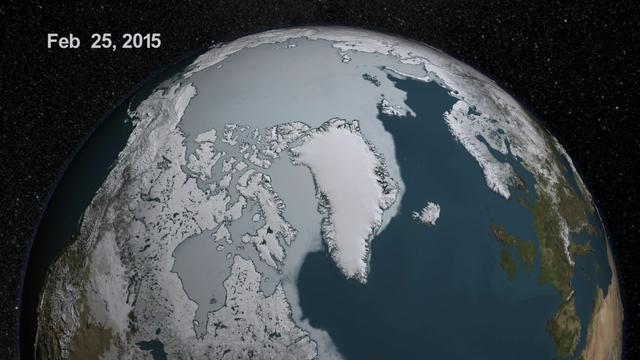
The sea ice cap of the Arctic appeared to reach its annual maximum winter extent on February 25, according to data from the NASA-supported National Snow and Ice Data Center (NSIDC) at the University of Colorado, Boulder. At 5.61 million squ…

This spectacular north looking view of south Greenland (62.0N, 46.0W) shows numerous indentations along the coastline, many of which contain small settlements. These indentations are fiords carved by glaciers of the last ice age. Even today…

Rocket Lab’s Electron rocket called “PREFIRE and Ice,” is vertical on the pad awaiting liftoff at Launch Complex 1 in Mahia, New Zealand, ahead of NASA’s PREFIRE (Polar Radiant Energy in the Far-InfraRed Experiment) mission Wednesday, June…

Technicians integrate NASA’s PREFIRE (Polar Radiant Energy in the Far-InfraRed Experiment) payload inside the Rocket Lab Electron rocket payload fairing on Wednesday, May 15, 2024, at the company’s facility in New Zealand. The agency’s PREF…
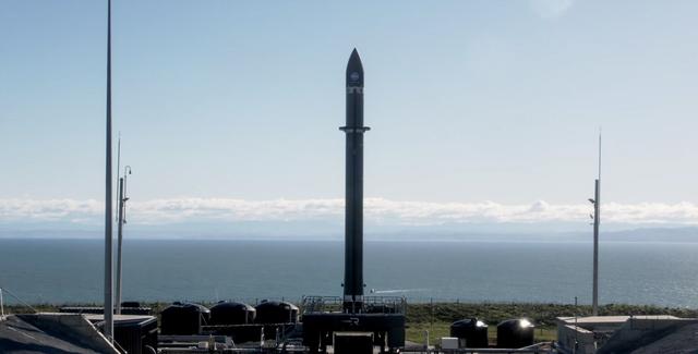
Rocket Lab’s Electron rocket is vertical on the pad Saturday, May 25, 2024, at Launch Complex 1 in Mahia, New Zealand, loaded with the first of two identical 6U CubeSats for NASA’s PREFIRE (Polar Radiant Energy in the Far-InfraRed Experimen…

A Rocket Lab Electron rocket lifts off from Launch Complex 1 in Māhia, New Zealand at 7:41 p.m. NZST (3:41 a.m. EDT) Saturday, May 25, 2024, on the first of two launches which Rocket Lab named “Ready, Aim, PREFIRE,” for NASA’s PREFIRE (Pola…
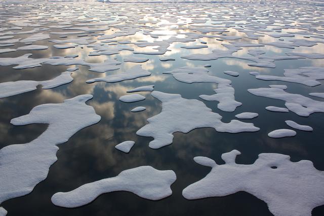
On July 20, the U.S. Coast Guard Cutter Healy steamed south in the Arctic Ocean toward the edge of the sea ice. The ICESCAPE mission, or "Impacts of Climate on Ecosystems and Chemistry of the Arctic Pacific Environment," is NASA'…
As the sun sets over the Arctic, the end of this year’s melt season is quickly approaching and the sea ice cover has already shrunk to the fourth lowest in the satellite record. With possibly some days of melting left, the sea ice extent co…
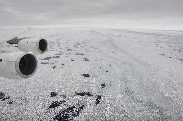
Sea ice is seen out the window of NASA's DC-8 research aircraft as it flies 2,000 feet above the Bellingshausen Sea in West Antarctica on Wednesday, Oct., 21, 2009. This was the fourth science flight of NASA’s Operation Ice Bridge airborne…
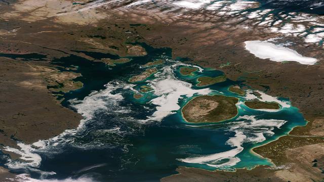
The remnants of sea ice along the Northwestern Passage in northern Canada are seen swirling with the blue green of phytoplankton in this image from the Suomi NPP VIIRS sensor, acquired on August 11, 2013. NASA/NOAA <b><a href="http://www.…

On April 5, 2015, the Moderate Resolution Imaging Spectroradiometer (MODIS) on NASA’s Terra satellite acquired this natural-color image of sea ice off the coast of East Antarctica’s Princess Astrid Coast. White areas close to the continent…
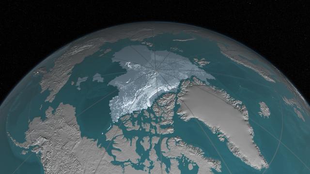
Arctic sea ice, the vast sheath of frozen seawater floating on the Arctic Ocean and its neighboring seas, has been hit with a double whammy over the past decades: as its extent shrunk, the oldest and thickest ice has either thinned or melte…

Polar bears already face shorter ice seasons - limiting prime hunting and breeding opportunities. Nineteen separate polar bear subpopulations live throughout the Arctic, spending their winters and springs roaming on sea ice and hunting. Th…

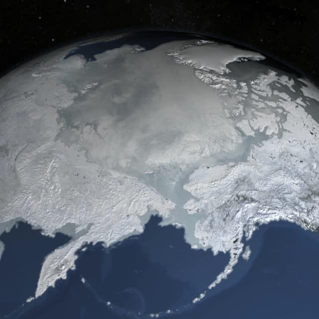
On February 4, 2014 the Moderate Resolution Imaging Spectroradiometer (MODIS) flying aboard NASA’s Aqua satellite captured a true-color image of sea ice off of western Alaska. In this true-color image, the snow and ice covered land appears…

Low-lying clouds over sea ice on the Bellingshausen Sea. Credit: NASA / Maria-Jose Vinas NASA's Operation IceBridge is an airborne science mission to study Earth's polar ice. For more information about IceBridge, visit: <a href="http://w…

An iceberg trapped in sea ice in the Amundsen Sea, seen from the IceBridge DC-8 during the Getz 07 mission on Oct. 27. Credit: NASA / Maria-Jose Vinas NASA's Operation IceBridge is an airborne science mission to study Earth's polar ice.…

The northeast coast of Hokkaido and Kunashir Island, Japan (44.0N, 143.0E) are seen bordered by drifting sea ice. The sea ice has formed a complex pattern of eddies in response to surface water currents and winds. Photos of this kind aid re…

STS066-117-014 (3-14 Nov. 1994) --- Malaspina Glacier can be seen in this north-northeastern photograph taken in November, 1994. The glacier, located in the south shore of Alaska is a classic example of a piedmont glacier lying along the fo…
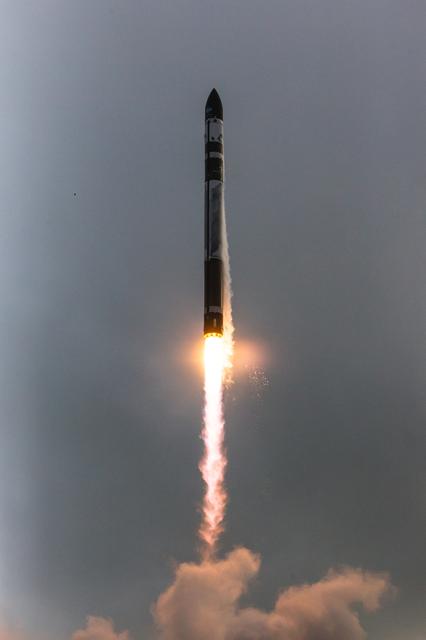
Rocket Lab’s Electron rocket called “PREFIRE and Ice,” lifts off from Launch Complex 1 in Māhia, New Zealand at 3:15 p.m. NZST Wednesday, June 5, 2024 (11:15 p.m. EDT, Tuesday, June 4), on the second of two launches for NASA’s PREFIRE (Pola…

Technicians process NASA’s PREFIRE (Polar Radiant Energy in the Far-InfraRed Experiment) ahead of integration with a Rocket Lab Electron rocket on Thursday, May 2, 2024, at the company’s facility in New Zealand. The agency’s PREFIRE mission…
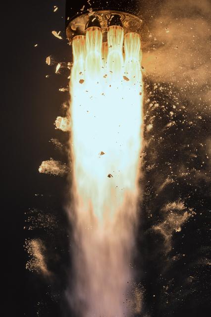
Rocket Lab’s Electron rocket called “PREFIRE and Ice,” lifts off from Launch Complex 1 in Māhia, New Zealand at 3:15 p.m. NZST Wednesday, June 5, 2024 (11:15 p.m. EDT, Tuesday, June 4), on the second of two launches for NASA’s PREFIRE (Pola…

Rocket Lab’s Electron rocket called “PREFIRE and Ice,” is vertical on the pad awaiting liftoff at Launch Complex 1 in Mahia, New Zealand, ahead of NASA’s PREFIRE (Polar Radiant Energy in the Far-InfraRed Experiment) mission Wednesday, June…
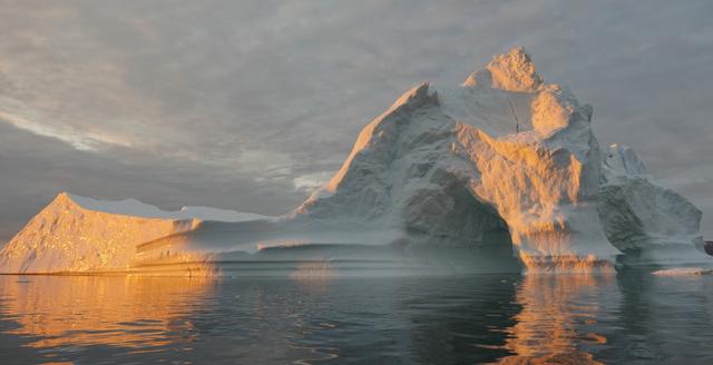
Sea level rise is a natural consequence of the warming of our planet. We know this from basic physics. When water heats up, it expands. So when the ocean warms, sea level rises. When ice is exposed to heat, it melts. And when ice on land m…

On July 12, 2011, crew from the U.S. Coast Guard Cutter Healy retrieved a canister dropped by parachute from a C-130, which brought supplies for some mid-mission fixes. The ICESCAPE mission, or "Impacts of Climate on Ecosystems and Ch…

Antarctica—the continent at the southernmost reach of the planet—is fringed by cold, often frozen waters of the Southern Ocean. The extent of sea ice around the continent typically reaches a peak in September and a minimum in February. The…
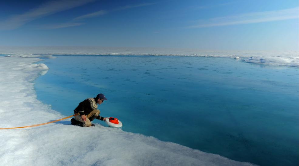
Laurence Smith, chair of geography at University of California, Los Angeles, deploys an autonomous drift boat equipped with several sensors in a meltwater river on the surface of the Greenland ice sheet on July 19, 2015. “Surface melting i…
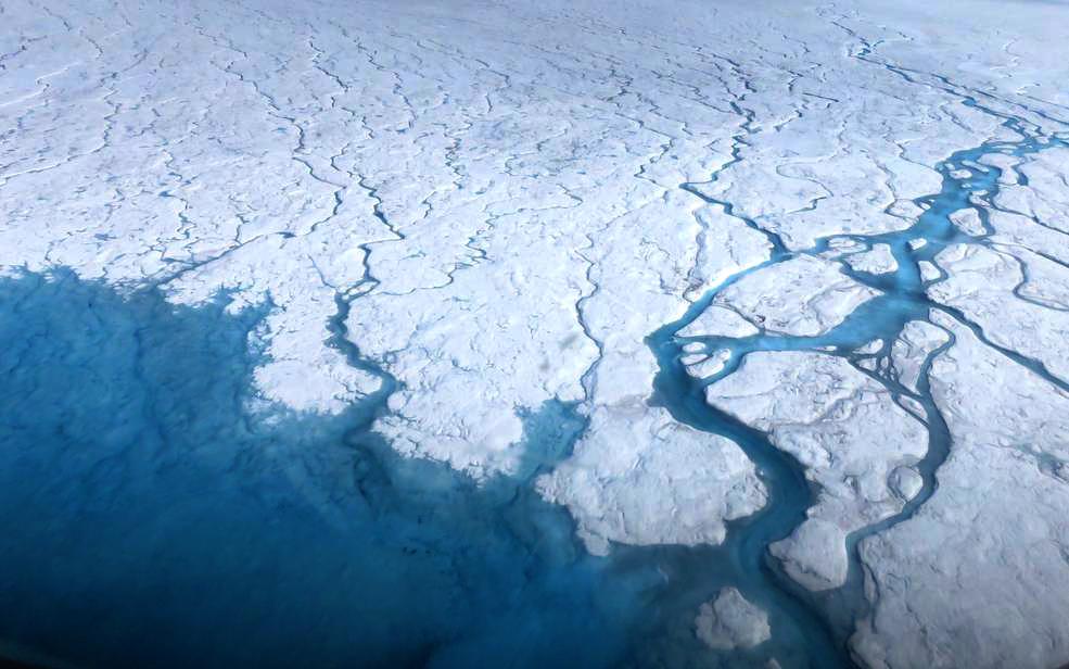
Streams and rivers that form on top of the Greenland ice sheet during spring and summer are the main agent transporting melt runoff from the ice sheet to the ocean. “Surface melting in Greenland has increased recently, and we lacked a rigo…
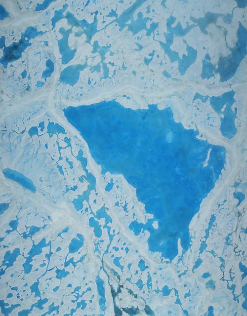
This summer, with sea ice across the Arctic Ocean shrinking to below-average levels, a NASA airborne survey of polar ice just completed its first flights. Its target: aquamarine pools of melt water on the ice surface that may be acceleratin…

NASA image acquired August 17, 2010 In mid-August 2010, the Northwest Passage was almost—but not quite—free of ice. The ice content in the northern route through the passage (through the Western Parry Channel) was very light, but ice remai…

The Visible Infrared Imaging Radiometer Suite (VIIRS) on the Suomi NPP satellite captured this view of extensive sea-ice fracturing off the northern coast of Alaska. The event began in late-January and spread west toward Banks Island throug…

The Visible Infrared Imaging Radiometer Suite (VIIRS) on the Suomi NPP satellite captured this view of extensive sea-ice fracturing off the northern coast of Alaska. The event began in late-January and spread west toward Banks Island throug…

A small hole in the clouds revealed newly formed sea ice in the Bellingshausen Sea next to an ice berg on Nov. 5, 2014 flight. Image Credit: NASA/Digital Mapping System NASA’s Operation IceBridge collected some rare images on a flight out…

Wonders in the Antarctic Sea and Sky NASA aircraft and scientists have returned to the United States after a short ice-surveying mission to #Antarctica. Despite having only a week of flying time, the team returned with crucial scientific d…
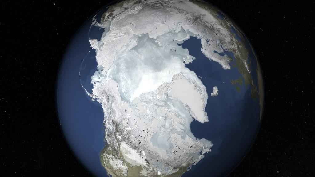
The sea ice cap of the Arctic appeared to reach its annual maximum winter extent on Feb. 25, according to data from the NASA-supported National Snow and Ice Data Center (NSIDC) at the University of Colorado, Boulder. At 5.61 million square…

SL4-141-4340 (20 Jan. 1974) --- An oblique view of the southern part of the Sea of Okhotsk, north of Japan, as photographed from the Skylab space station in Earth orbit by one of the Skylab 4 crewmen. The camera used was a hand-held 70mm Ha…

A Rocket Lab Electron rocket lifts off from Launch Complex 1 in Māhia, New Zealand at 7:41 p.m. NZST (3:41 a.m. EDT) Saturday, May 25, 2024, on the first of two launches which Rocket Lab named “Ready, Aim, PREFIRE,” for NASA’s PREFIRE (Pola…

Technicians integrate NASA’s PREFIRE (Polar Radiant Energy in the Far-InfraRed Experiment) payload inside the Rocket Lab Electron rocket payload fairing on Wednesday, May 15, 2024, at the company’s facility in New Zealand. The agency’s PREF…
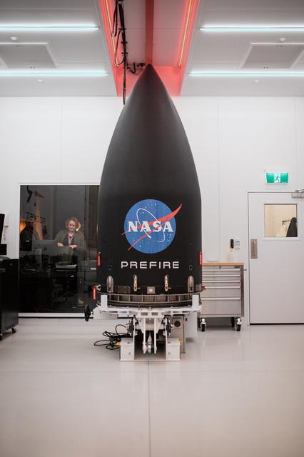
Technicians integrate NASA’s PREFIRE (Polar Radiant Energy in the Far-InfraRed Experiment) payload inside the Rocket Lab Electron rocket payload fairing on Wednesday, May 15, 2024, at the company’s facility in New Zealand. The agency’s PREF…