Launched February 11, 2000, the STS-99 Shuttle Radar Topographic Mission (SRTM) was the most ambitious Earth mapping mission to date. A 200-ft long (60 meter) mast supporting the SRTM where it jutted into space from the Space Shuttle Endeav…
Space Shuttle Projects
This anaglyph, from NASA Shuttle Radar Topography Mission, is of the Nyiragongo volcano in the Congo. 3D glasses are necessary to view this image.
Nyiragongo volcano, Congo, Anaglyph, SRTM / Landsat
This anaglyph, from NASA Shuttle Radar Topography Mission, is of Honolulu, on the island of Oahu .3D glasses are necessary to view this image.
Anaglyph, Landsat overlay Honolulu, Hawaii
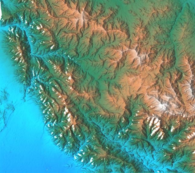
Russia Kamchatka Peninsula, lying between the Sea of Okhotsk to the west and the Bering Sea and Pacific Ocean to the east, is one of the most active volcanic regions along the Pacific Ring of Fire.
Colored Height and Shaded Relief, Kamchatka Peninsula
California topography poses challenges for road builders. Northwest of Los Angeles, deformation of Earth crust along the Pacific-North American crustal plate boundary has made transportation difficult.
SRTM Stereo Pair with Landsat Overlay: Los Angeles to San Joaquin Valley, California
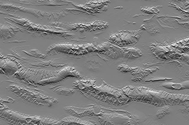
The Zagros Mountains in Iran offer a visually stunning topographic display of geologic structure in layered sedimentary rocks.
Zagros Mountains, Iran, SRTM Shaded Relief
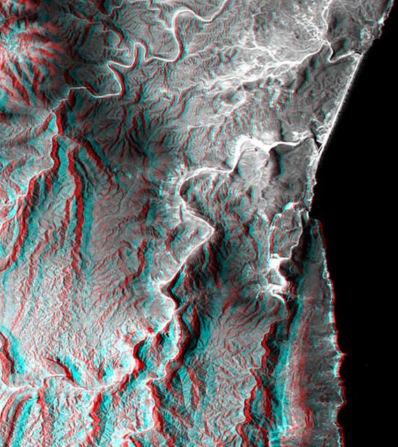
This anaglyph, from NASA Shuttle Radar Topography Mission, is of the coastal area in southernmost Oman; the Arabian Sea is on the right. 3D glasses are necessary to view this image.
Anaglyph, Landsat overlay, Southernmost Coastal Oman
In the lower center of this perspective view of upstate New York, the city of Syracuse hugs the southeastern banks top right side of Lake Onondaga, the smaller of the two dark features that dominate the scene.
SRTM Perspective View with Landsat Overlay: Syracuse, Oneida Lake, Upstate New York
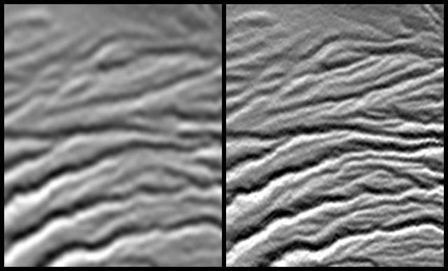
These two images show exactly the same area, Lake Balbina near Manaus, Brazil. The image on the left was created using the best global topographic data set previously available, the U.S. Geological Survey GTOPO30.
Shaded Relief with Height as Color, Lake Balbina, near Manaus, Brazil
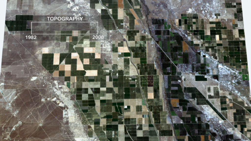
This frame from an animation depicts ground subsidence resulting from the extraction of oil. The oil fields are located near the community of Lost Hills, California, approximately 100 km northwest of Bakersfield.
Lost Hills Subsidence Animation
Volcanic, tectonic, erosional and sedimentary landforms are all evident in this comparison of two elevation models of a region along the East African Rift at Lake Kivu. The area shown covers parts of Congo, Rwanda and Uganda.
Shaded Relief with Height as Color, Virunga and Nyiragongo Volcanoes and the East African Rift Valley
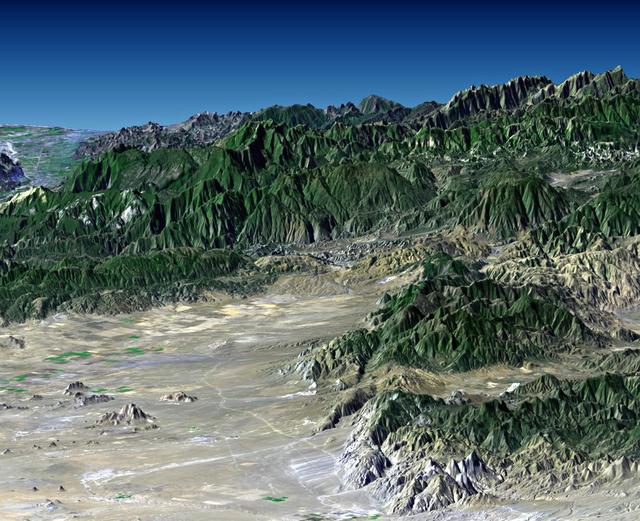
Southern California dramatic topography plays acritical role in its climate, hydrology, ecology, agriculture, and habitability.
Perspective with Landsat Overlay: Mojave to Ventura, California
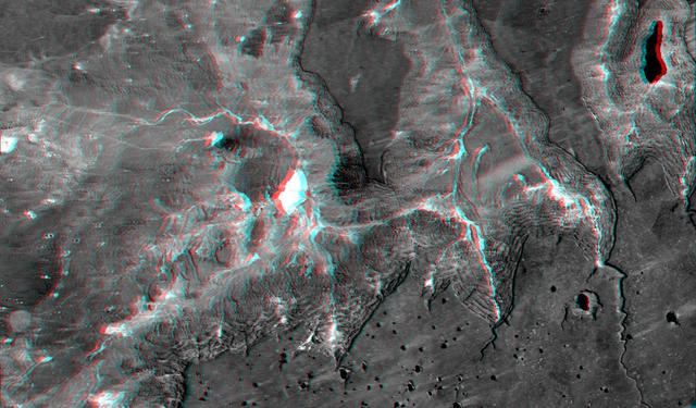
Manicouagan Crater is one of the world largest and oldest known impact craters and perhaps the one most readily apparent to astronauts in orbit. The age of the impact is estimated at 214 million years before present.
Stereo Pair, with Topographic Height as Color, Manicouagan Crater, Quebec, Canada
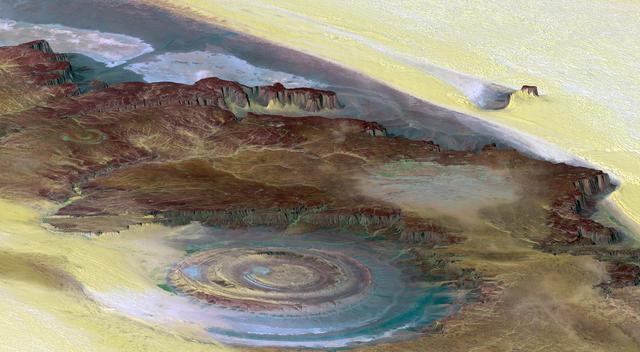
This prominent circular feature, known as the Richat Structure, in the Sahara desert of Mauritania is often noted by astronauts because it forms a conspicuous bull-eye on the otherwise rather featureless expanse of the desert.
Richat Structure, Mauritania
This topographic acquired by NASA Shuttle Radar Topography Mission SRTM from data collected on February 16, 2000 shows the relationship of the urban area of Pasadena, California to the natural contours of the land.
San Gabriel Mountains, California, Shaded relief, Color as Height
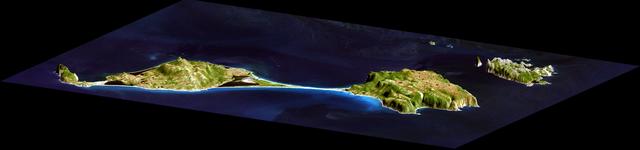
This image acquired by NASA Shuttle Radar Topography Mission SRTM from data collected on February 12, 2000 shows two islands, Miquelon and Saint Pierre, located south of Newfoundland, Canada.
3-D perspective of Saint Pierre and Miquelon Islands
The Lake Palanskoye in northern Kamchatka was formed when a large landslide disrupted the drainage pattern, forming a natural dam.
Stereo Pair, Lake Palanskoye Landslide, Kamchatka Peninsula, Russia
Launched February 11, 2000, the STS-99 Shuttle Radar Topographic Mission (SRTM) was the most ambitious Earth mapping mission to date. This illustration shows the Space Shuttle Endeavour orbiting some 145 miles (233 kilometers) above Earth.…
Space Shuttle Projects
This perspective view acquired by NASA Shuttle Radar Topography Mission SRTM from data collected in the year 2000 shows Patagonia, Argentina, a spectacular landscape formed by volcanoes, rivers, and wind.
Perspective view of shaded relief, color as height, Patagonia, Argentina
This anaglyph, from NASA Shuttle Radar Topography Mission, shows the eastern flank of the Andes Mountains, southeast of San Martin de Los Andes, Argentina. 3D glasses are necessary to view this image.
SRTM Anaglyph: Corral de Piedra, Argentina
This topographic radar image acquired by NASA Shuttle Radar Topography Mission SRTM in Feb. 2000 shows the city of Honolulu, Hawaii and adjacent areas on the island of Oahu. Honolulu lies on the south shore of the island.
Honolulu, Hawaii Radar Image, Wrapped Color as Height
The topography of the Gulf Coast states is well shown in this color-coded shaded relief map generated with data from NASA Shuttle Radar Topography Mission.
Gulf Coast, Shaded Relief and Colored Height
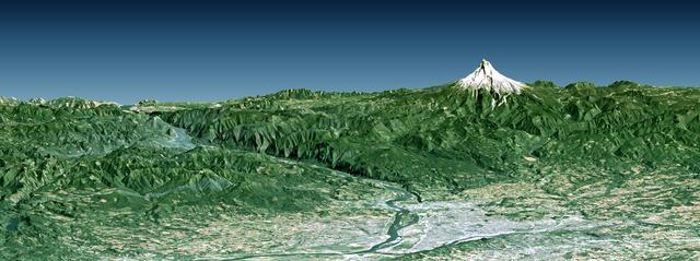
Portland, the largest city in Oregon, is located on the Columbia River at the northern end of the Willamette Valley. On clear days, Mount Hood highlights the Cascade Mountains backdrop to the east.
Portland, Mount Hood, & Columbia River Gorge, Oregon, Perspective View
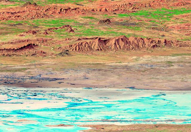
The earthquake that struck western India on January 26, 2001, was the country strongest in the past 50 years. This perspective view shows the area of the earthquake epicenter in the lower left corner.
SRTM Perspective View with Landsat Overlay: Rann of Kachchh, India
The diversity of landforms that make up the state of California is evident in this new [sic] rendition of the 3-D topography of the state.
Shaded Relief with Color as Height, California Mosaic
San Joaquin, the name given to the southern portion of California vast Central Valley, as shown in this image acquired by NASA Shuttle Radar Topography Mission SRTM on February 16, 2000.
SRTM Perspective View with Landsat Overlay: San Joaquin Valley, California
This anaglyph, from NASA Shuttle Radar Topography Mission, shows the Kamchatka Peninsula in eastern Russia. Sredinnyy Khrebet, the mountain range that makes up the spine of the peninsula. 3D glasses are necessary to view this image.
SRTM Anaglyph: Sredinnyy Khrebet, Kamchatka Peninsula, Russia
The prominent circular feature seen here is known as the Richat Structure, in the Sahara desert of Mauritania. This anaglyph is from NASA Shuttle Radar Topography Mission. 3D glasses are necessary to view this image.
Richat Structure, Mauritania, Anaglyph, Landsat Image over SRTM Elevation
The Sovereign Democratic Republic of the Fiji Islands, commonly known as Fiji, is shown in this image acquired by NASA Shuttle Radar Topography Mission SRTM on February 19, 2000.
SRTM Stereo Pair: Fiji Islands
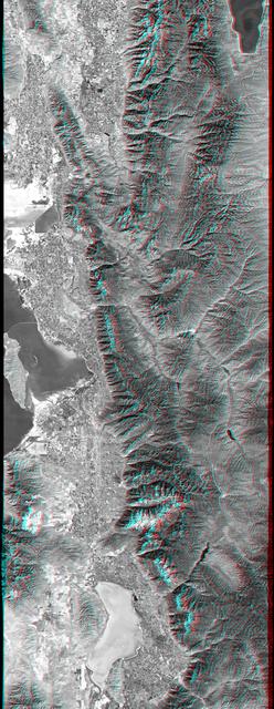
This anaglyph, from NASA Shuttle Radar Topography Mission, is of Salt Lake City, Utah. 3D glasses are necessary to view this image.
Anaglyph, Salt Lake City, Utah
This anaglyph, from NASA Shuttle Radar Topography Mission, shows basalt cliffs along the northwest edge of the Meseta de Somuncura plateau near Sierra Colorada, Argentina. 3D glasses are necessary to view this image.
Anaglyph: Basalt Cliffs, Patagonia, Argentina
The Kamchatka Peninsula in eastern Russia is shown in this scene created from a preliminary elevation model derived from the first data collected during NASA Shuttle Radar Topography Mission SRTM on February 12, 2000.
SRTM Colored Height and Shaded Relief: Sredinnyy Khrebet, Kamchatka Peninsula, Russia
Launched February 11, 2000, the STS-99 Shuttle Radar Topographic Mission (SRTM) was the most ambitious Earth mapping mission to date. This photograph shows a 200-ft long (60 meter) mast supporting the SRTM jutted into space from the Space S…
Space Shuttle Projects
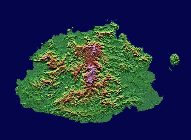
The Sovereign Democratic Republic of the Fiji Islands, commonly known as Fiji, is an independent nation consisting of some 332 islands surrounding the Koro Sea in the South Pacific Ocean. This image shows Viti Levu, the largest island in th…
Shaded relief, color as height, Fiji
These two images show exactly the same area, Kerguelen Island in the southern Indian Ocean. The image on the left was created using the best global topographic data set previously available, the U.S. Geological Survey GTOPO30.
Shaded Relief with Height as Color, Kerguelen Island, south Indian Ocean
This image of the world was generated with data from NASA Shuttle Radar Topography Mission SRTM.
World in Mercator Projection, Shaded Relief and Colored Height
A site in the Crater Highlands of Tanzania reveals the difference between NASA Shuttle Radar Topography Mission SRTM digital elevation model data as originally released in 2004 left and as now released at full resolution in 2014 right.
Tanzania Images Highlight Improvements in Full-Resolution SRTM Africa Data
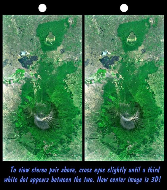
Mount Meru is an active volcano located just 70 kilometers 44 mileswest of Mount Kilimanjaro.
Stereo Pair with Landsat Overlay, Mount Meru, Tanzania
This perspective view shows the capital city of San Jose, Costa Rica, in the right center of the image gray area.
SRTM Perspective View with Landsat Overlay: San Jose, Costa Rica
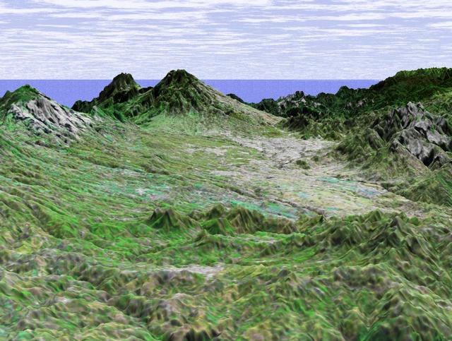
This depiction of an area south of San Martin de Los Andes, Argentina, is the first Shuttle Radar Topography Mission SRTMview of the Andes Mountains, the tallest mountain chain in the western hemisphere.
SRTM Perspective of Colored Height and Shaded Relief Laguna Mellquina, Andes Mountains, Argentina
This stereoscopic image pair is a perspective view that shows the western part of the city of Pasadena, California, looking north toward the San Gabriel Mountains. Portions of the cities of Altadena and La Canada Flintridge are also shown.
Stereo Pair, Pasadena, California
This anaglyph, from NASA Shuttle Radar Topography Mission, is of Malaspina Glacier in southeastern Alaska. 3D glasses are necessary to view this image.
Malaspina Glacier, Alaska, Anaglyph with Landsat Overlay
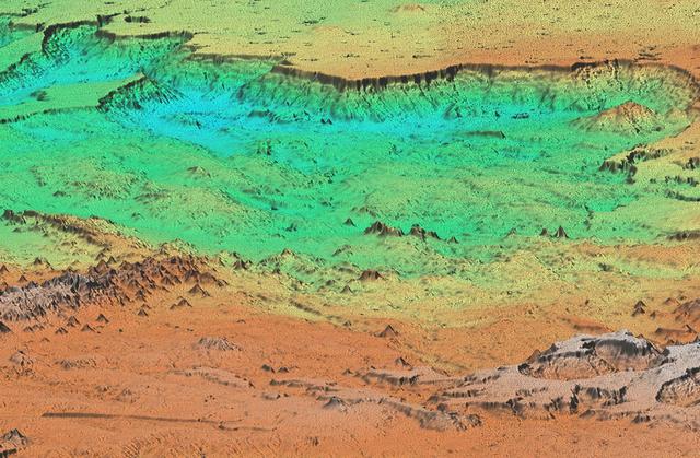
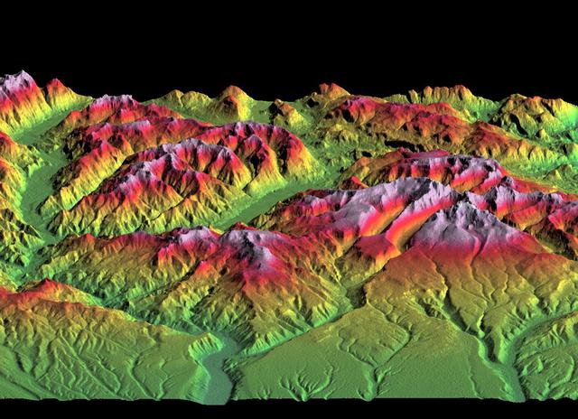
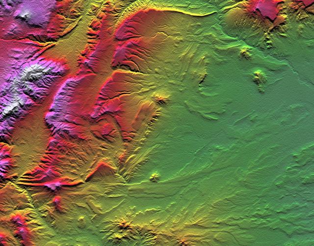
Topographic data provided by NASA Shuttle Radar Topography Mission can provide many clues to geologic history and processes.
SRTM Colored Height and Shaded Relief: Near Zapala, Argentina
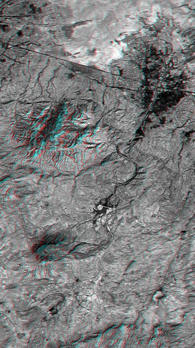
This anaglyph NASA Shuttle Radar Topography Mission, shows the city of Bhuj, India. 3D glasses are necessary to view this image.
SRTM Anaglyph: Northwest of Bhuj, India
This image shows the northern part of central New York State, a landscape sculpted by the ice sheets of the last ice age. Lake Ontario runs across the top of the image.
Radar with Color-wrapped Height Fringes, Syracuse and vicinity, New York State
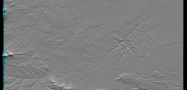
This anaglyph, from NASA Shuttle Radar Topography Mission, shows the city of Bhuj, India. 3D glasses are necessary to view this image.
SRTM Anaglyph: Piñon Canyon region, Colorado
This anaglyph, from NASA Shuttle Radar Topography Mission, shows Wheeler Ridge and vicinity, California, a site of major tectonic activity. 3D glasses are necessary to view this image.
SRTM Anaglyph: Wheeler Ridge, California
This image, produced from instrument data aboard NASA Space Shuttle Endeavour, is a stereoscopic view of the topography of Port-au-Prince, Haiti where a magnitude 7.0 earthquake occurred on January 12, 2010. You need 3-D glasses to view thi…
Southern Haiti Anaglyph