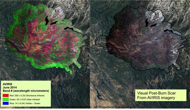
At left, a NASA AVIRIS map shows the spectral signature of the 2013 Rim fire in and near Yosemite National Park, California, the third largest in the state's history, burning more than 250,000 acres. Almost two years later, forest restorati…
NASA AVIRIS Map shows Spectral Signature of 2013 Rim Fire
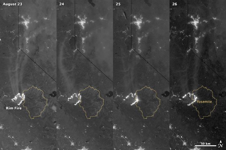
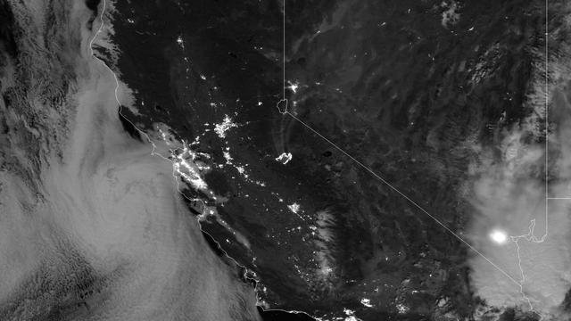
The winter of 2013 was among the driest on record for California, setting the stage for an active fire season. By August 26, the Rim Fire had made its way into the record books. At just 15 percent contained, the fire is now the 13th largest…
Nighttime View of California’s Rim Fire
The winter of 2013 was among the driest on record for California, setting the stage for an active fire season. By August 26, the Rim Fire had made its way into the record books. At just 15 percent contained, the fire is now the 13th largest…
Nighttime View of California’s Rim Fire
On August 23, 2013, the Moderate Resolution Imaging Spectroradiometer (MODIS) on NASA’s Aqua satellite acquired this image of the drought-fueled Rim fire burning in central California, near Yosemite National Park.  Red outlines indicate hot…
Rim Fire, California
The Rim Fire burning in the Stanislaus National Forest in California has crossed into the Yosemite National Park. The fire has burned more than 105,000 acres, approximately 162 square miles, of brush, oak and pine trees in steep and margina…
Rim Fire Expands into Yosemite National Park
On August 25, 2013, the Moderate Resolution Imaging Spectroradiometer (MODIS) on NASA’s Terra satellite acquired this image of the drought-fueled Rim fire burning in central California, near Yosemite National Park.  Red outlines indicate ho…
Satellite View of Rim Fire On August 25, 2013
No more images