NASA used barges for transporting full-sized stages for the Saturn I, Saturn IB, and Saturn V vehicles between the Marshall Space Flight Center (MSFC), the manufacturing plant at the Michoud Assembly Facility (MAF), the Mississippi Test Fac…
Saturn Apollo Program
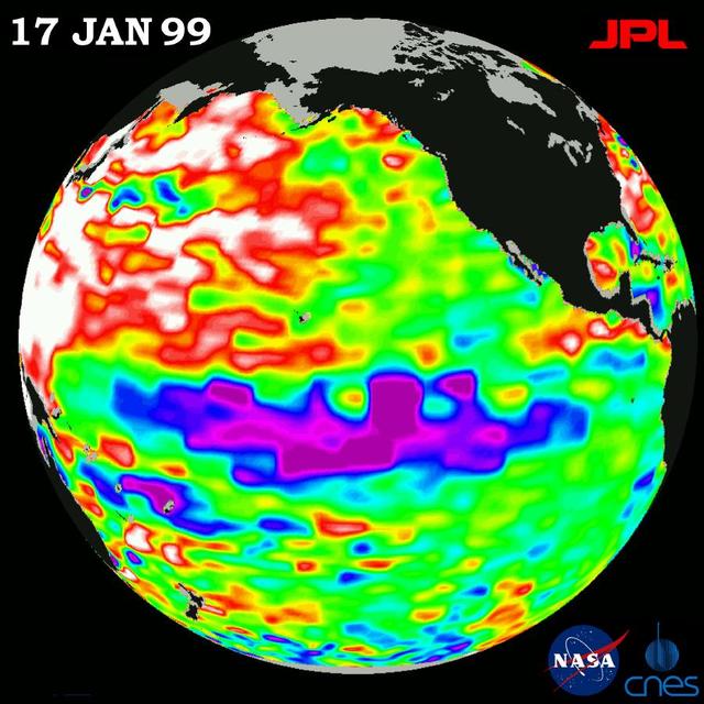
This image of the Pacific Ocean was produced using sea-surface height measurements taken by NASA U.S.-French TOPEX/Poseidon satellite.
TOPEX/El Niño Watch - La Niña Weakening, January 17, 1999
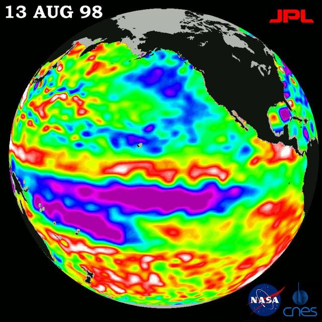
This image of the Pacific Ocean was produced using sea-surface height measurements taken by NASA U.S.-French TOPEX/Poseidon satellite.
TOPEX/El Niño Watch - Little Change in Pacific, August 13, 1998
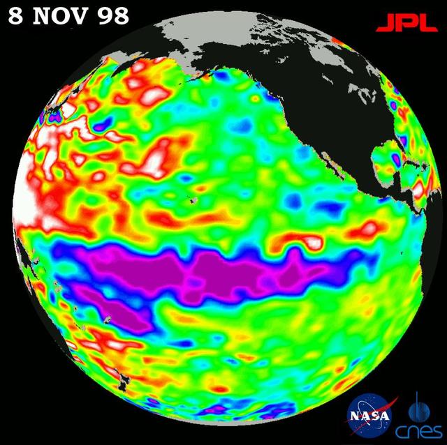
This image of the Pacific Ocean was produced using sea-surface height measurements taken by NASA U.S.-French TOPEX/Poseidon satellite.
TOPEX/El Niño Watch - La Niña looks frozen in Pacific, November 8, 1998
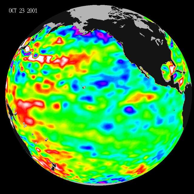
Like fall and winter of 2000, this year NASA Topex/Poseidon satellite data shows that the Pacific ocean continues to be dominated by the strong Pacific Decadal Oscillation, which is larger than the El Niño/La Niña pattern.
Pacific Decadal Oscillation
This image of the Pacific Ocean was produced using sea surface height measurements taken by NASA U.S.-French TOPEX/Poseidon satellite.
TOPEX/El Niño Watch - El Niño Warm Water Pool Returns to Near Normal State, Mar, 14, 1998
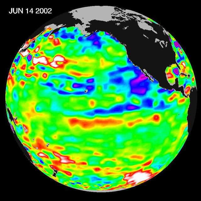
The Pacific Ocean doesnt show signs of anything that looks like the whopper El Niño of 1997-1998, according to the latest information from NASA U.S.-French ocean-observing satellite Topex/Poseidon.
Pacific Ocean in Holding Pattern for El Niño
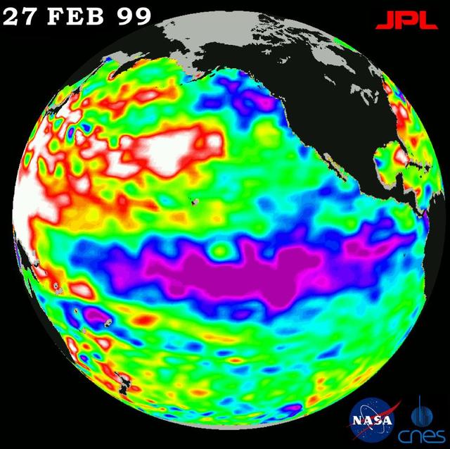
The cold pool of water in the Pacific known as La Niña still persists, although it is slowly weakening, according to scientists studying new data from NASA U.S.-French TOPEX/Poseidon satellite.
TOPEX/El Niño Watch - La Niña Hangs On, February 27, 1999
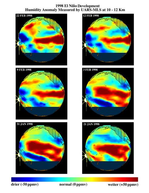
This series of six images shows the evolution of atmospheric water vapor over the Pacific Ocean during the 1998 El Ni?o condition.
TOPEX/El Ni?o Watch - Moisture in the Atmosphere, Jan & Feb, 1998
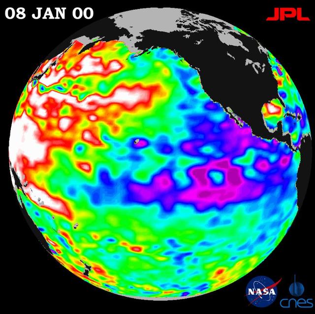
A giant horseshoe pattern of higher than normal sea-surface heights developing over the last year is beginning to dominate the entire western Pacific and Asiatic oceans.
TOPEX/El Niño Watch - La Niña Persistence May be Part of Larger Climate Pattern, January 8, 2000
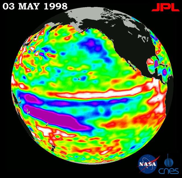
This image of the Pacific Ocean was produced using sea-surface height measurements taken by NASA U.S.-French TOPEX/Poseidon satellite.
TOPEX/El Niño Watch - El Niño is Still Lingering in the Pacific May 3, 1998
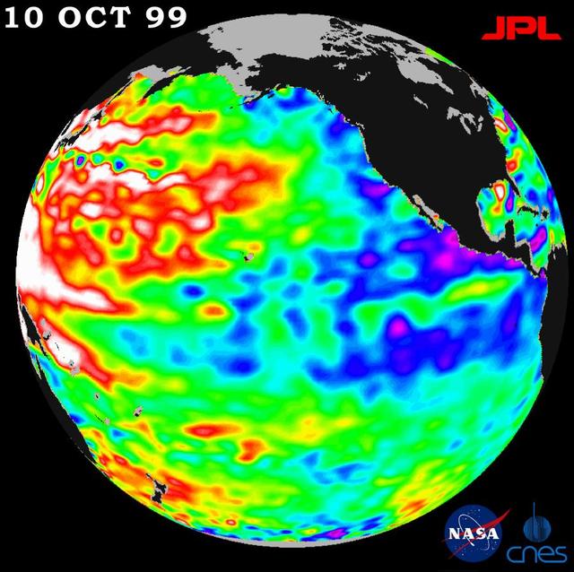
A repeat of last year mild La Niña conditions -- with a stormy winter in the Pacific Northwest and a dry winter in the southwestern United States -- will be the likely outcome of sea-surface heights observed by NASA TOPEX/Poseidon satellite…
TOPEX/El Niño Watch - La Niña Conditions Likely to Prevail, October 10, 1999
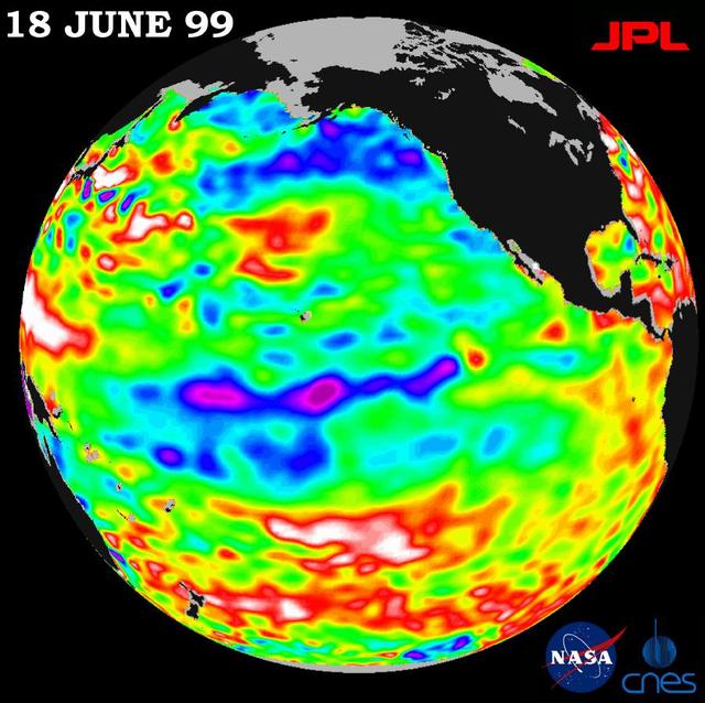
Lingering just a month ago in the eastern Pacific Ocean, the La Niña phenomenon, with its large volume of chilly water, barely has a pulse this month, according to new satellite data from NASA U.S.-French TOPEX/Poseidon mission.  The data,…
TOPEX/El Niño Watch - La Niña Barely Has a Pulse, June 18, 1999
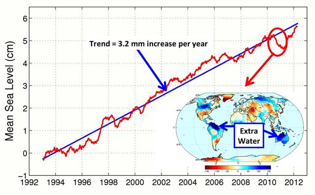
This figure shows changes in global mean sea level as measured by satellite altimetry NASA/CNES Topex/Poseidon and Jason-1; and NASA/CNES/NOAA/EUMETSAT Jason-2 between 1992 to 2012.
After Brief Dip, Global Mean Sea Level Resumes Climb
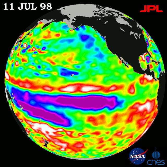
Height measurements taken by NASA U.S.-French TOPEX/Poseidon satellite. The image shows sea surface height relative to normal ocean conditions on July 11, 1998; sea surface height is an indicator of the heat content of the ocean.
TOPEX/El Niño Watch - Satellite shows Pacific Stabilizing, July 11, 1998
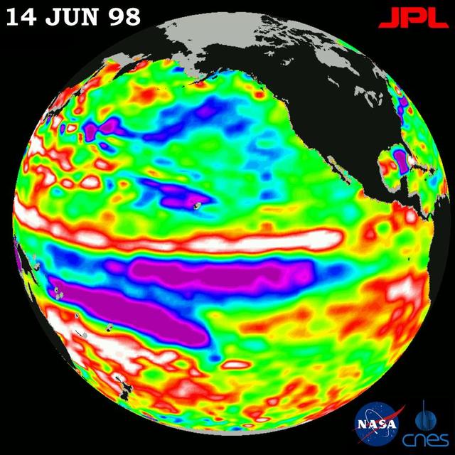
This image of the Pacific Ocean was produced using sea-surface height measurements taken by NASA U.S.-French TOPEX/Poseidon satellite.
TOPEX/El Niño Watch - El Niño in Retreat, Pacific in Transition, June 14, 1998
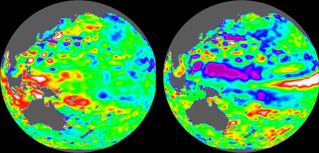
These images of the Pacific Ocean near Indonesia were produced using sea surface height measurements taken by NASA U.S.-French TOPEX/Poseidon satellite.
TOPEX/El Niño Watch - Indonesia Area, December, 1996 and August, 1997
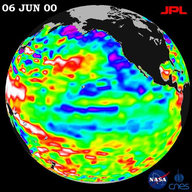
After dominating the tropical Pacific Ocean for more than two years, the 1998-2000 La Niña cool pool is continuing its slow fade and seems to be retiring from the climate stage, according to satellite data from NASA U.S.-French TOPEX/Poseid…
TOPEX/El Niño Watch - Strong, Long-lasting La Niña Just Fading Away, June 19, 2000
New sea surface height measurements from NASA TOPEX/Poseidon satellite show that the sea level and temperature of the entire Pacific is out of balance, including a large area of abnormally cool water along the west coast of North America.
TOPEX El Niño/La Niña - Entire Pacific is out of Whack, April 7, 1999
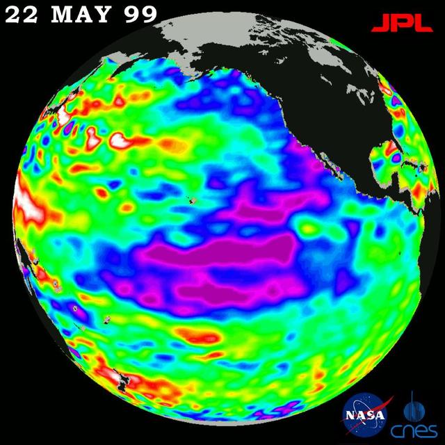
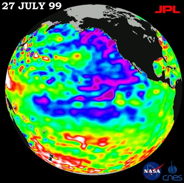
The North Pacific Ocean continues to run hot and cold, with abnormally low sea levels and cool waters in the northeastern Pacific contrasting with unusually high sea levels and warm waters in the northwestern Pacific.
TOPEX/El Niño Watch - Pacific Ocean Conditions are Split: Cold in East, Hot in West, July 27, 1999
This image of the Pacific Ocean was produced using sea surface height measurements taken by NASA U.S.-French TOPEX/Poseidon satellite.
TOPEX/El Niño Watch - Warm Water Pool is Thinning, Feb, 5, 1998
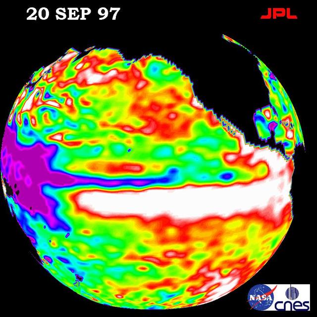
This image of the Pacific Ocean was produced using sea surface height measurements taken by NASA U.S./French TOPEX/POSEIDON satellite.
TOPEX/El Niño Watch- September 20, 1997
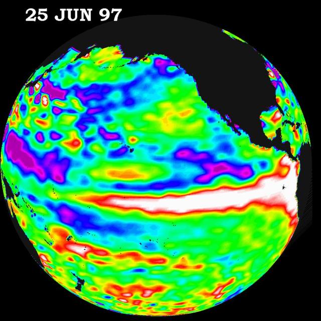
This image of the Pacific Ocean was produced using sea surface height measurements taken by NASA U.S./French TOPEX/POSEIDON satellite.
TOPEX/El Niño Watch - June 25, 1997
This image of the Pacific Ocean was produced using sea surface height measurements taken by NASA U.S./French TOPEX/Poseidon satellite. The image shows sea surface height relative to normal ocean conditions on Dec. 1, 1997.
TOPEX/El Niño Watch - Double
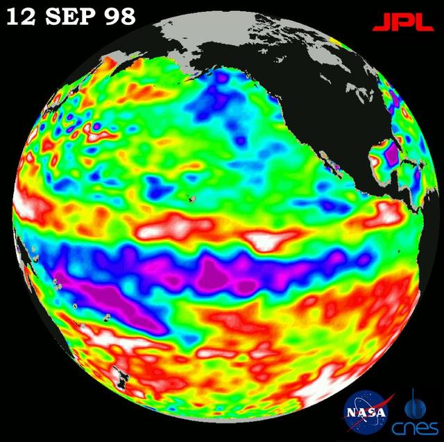
This image of the Pacific Ocean was produced using sea-surface height measurements taken by NASA U.S.-French TOPEX/Poseidon satellite.
TOPEX/El Niño Watch - Satellite Shows Pacific Running Hot and Cold, September 12, 1998
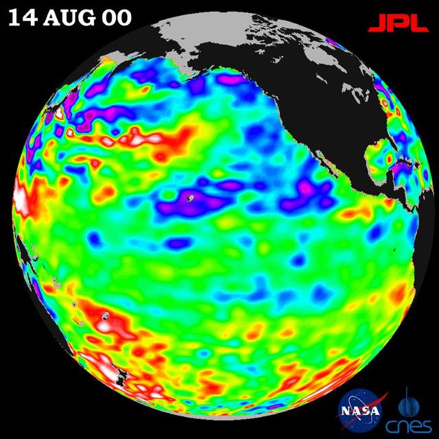
After three years of El Niño and La Niña, the Pacific is finally calming down in the tropics but still shows signs of being abnormal elsewhere, according to the satellite data from NASA U.S.-French TOPEX/Poseidon mission.
TOPEX/El Niño Watch - Los Niños may be Gone, But Pacific Pattern Remains August 14, 2000
This image of the Pacific Ocean was produced using sea surface height measurements taken by NASA U.S.-French TOPEX/Poseidon satellite.
TOPEX/El Niño Watch - El Niño Warm Water Pool Decreasing, Jan, 08, 1998
      This graph shows the rise in global mean sea level from 1993 to 2024 based on data from a series of five international satellites. The solid red line indicates the trajectory of this increase, which has more than doubled over the thre…
Satellite Record of Sea Level Rise From 1993 to 2024
This image of the Pacific Ocean was produced using sea surface height measurements taken by NASA U.S./French TOPEX/Poseidon satellite.
TOPEX/El Niño Watch - October 3, 1997
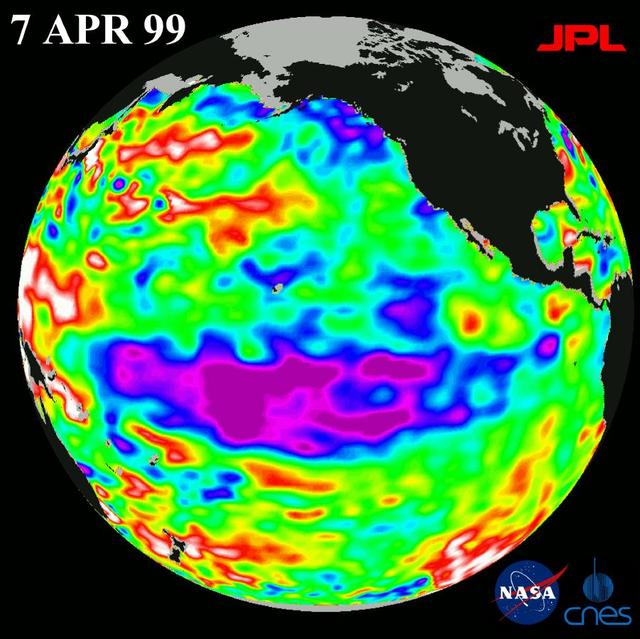
The cold pool of water in the Pacific known as La Nina is beginning to fade, but ocean conditions have not returned to normal, according to scientists studying images from the U.S.-French TOPEX/Poseidon satellite.  http://photojournal.jpl.n…
TOPEX El Niño/La Niña -La Niña Begins to Fade, April 7, 1999
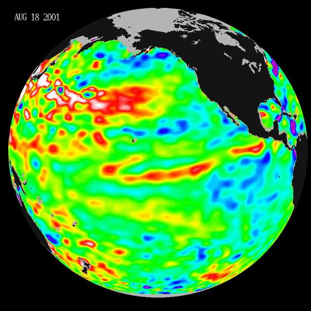
These data, taken during a 10-day collection cycle ending August 18, 2001, show that above-normal sea-surface heights and warmer ocean temperatures still blanket the far-western tropical Pacific and much of the north and south mid-Pacific.
Pacific Decadal Oscillation Still Rules in Pacific; No Niño Anytime Soon
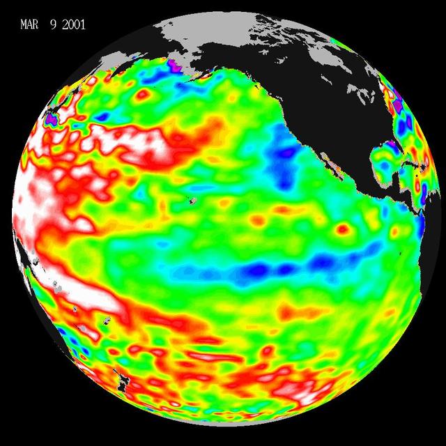
Data taken during a 10-day collection cycle ending March 9, 2001, show that above-normal sea-surface heights and warmer ocean temp. red and white areas still blanket the far-western tropical Pacific and much of the north and south mid-Pacif…
Warm Ocean Temperatures Blanket the Far-Western Pacific
This image of the Pacific Ocean was produced using sea surface height measurements taken by the U.S./French TOPEX/Poseidon satellite. The image shows sea surface height relative to normal ocean conditions on Nov. 10, 1997.
TOPEX/El Niño Watch - Warm Water Pool is Increasing, Nov. 10, 1997
This image of the Pacific Ocean was produced using sea surface height measurements taken by NASA U.S.-French TOPEX/Poseidon satellite.
TOPEX/El Niño Watch - Satellite shows El Niño-related Sea Surface Height, Mar, 14, 1998
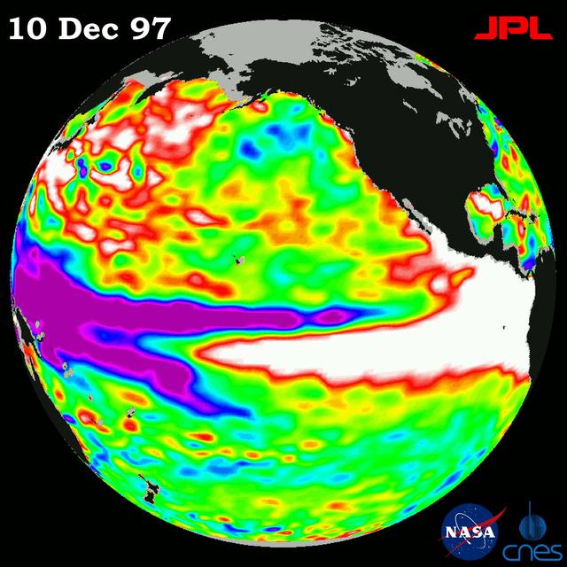
This image of the Pacific Ocean was produced using sea surface height measurements taken by NASA U.S.-French TOPEX/Poseidon satellite.
TOPEX/El Niño Watch - El Niño Rhythm, Dec, 10, 1997
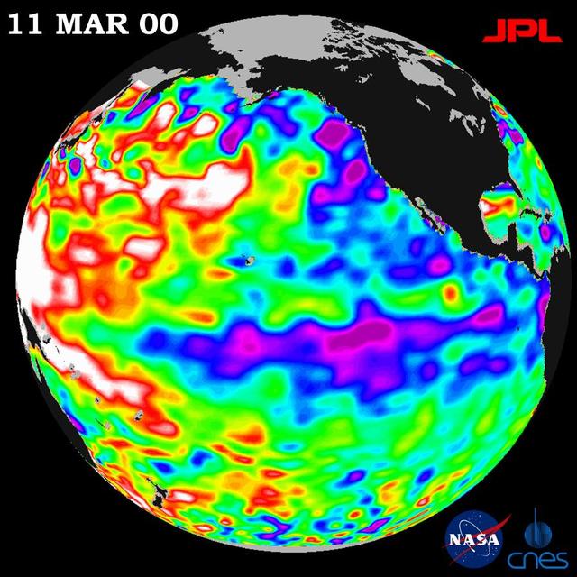
NASA TOPEX/Poseidon data, collected over a 10-day sampling cycle from March 1 to 11, 2000, showed a La Niña condition.
TOPEX/El Niño Watch - La Niña Still a cool Problem Child, March 23, 2000
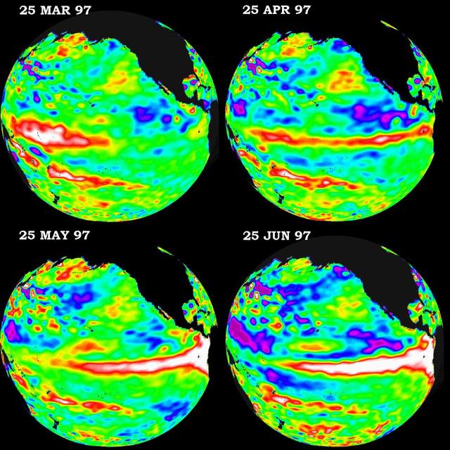
These four views of the Pacific Ocean were produced using sea surface height measurements taken by NASA U.S./French TOPEX/POSEIDON satellite.
TOPEX/El Niño Watch - March thru June, 1997
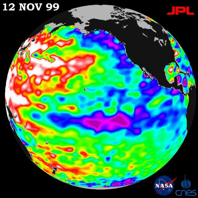
Unusually warm ocean temperatures off Asia and cool waters in the eastern and equatorial Pacific are signaling La Niña mild return, according to the latest sea-surface heights observed by the joint NASA-French space agency TOPEX/Poseidon sa…
TOPEX/El Niño Watch - Mild La Niña Conditions Developing, November 12, 1999
This image of the Pacific Ocean was produced using sea surface height measurements taken by NASA U.S./French TOPEX/POSEIDON satellite.
TOPEX/El Niño Watch - October 23, 1997
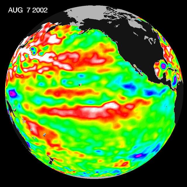
This Topex/Poseidon image of sea-surface heights was taken during a 10-day collection cycle ending August 7, 2002. Sea-surface heights are a measure of how much heat is stored in the ocean below to influence future planetary climate events.…
Watching for the Next El Niño
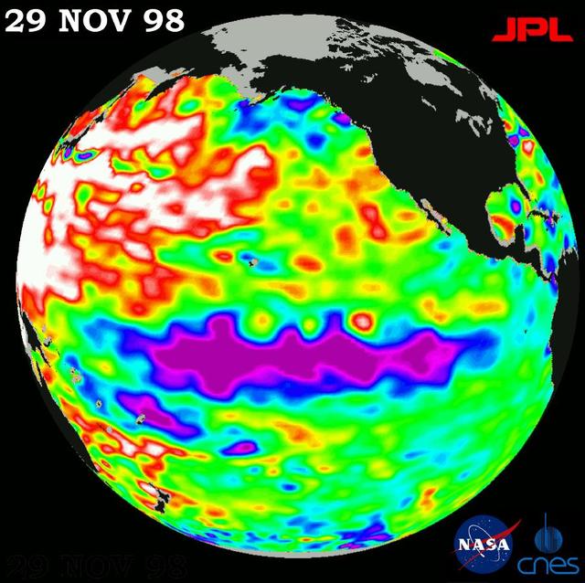
This image of the Pacific Ocean was produced using sea-surface height measurements taken by NASA U.S.-French TOPEX/Poseidon satellite.
TOPEX/El Niño Watch - Topex/Poseidon Shows Unusual Pacific, November 29, 1998
      This graph shows the rise in global mean sea level from 1993 to 2023 based on data from a series of five international satellites. The solid red line indicates the trajectory of this increase, which has more than doubled over the thre…
2023 Sea Level Rise Update
No more images