This dark mound, called "Ireson Hill," rises about 16 feet (5 meters) above redder layered outcrop material of the Murray formation on lower Mount Sharp, Mars, near a location where NASA's Curiosity rover examined a linear sand dune in Febr…
'Ireson Hill' on Mount Sharp, Mars
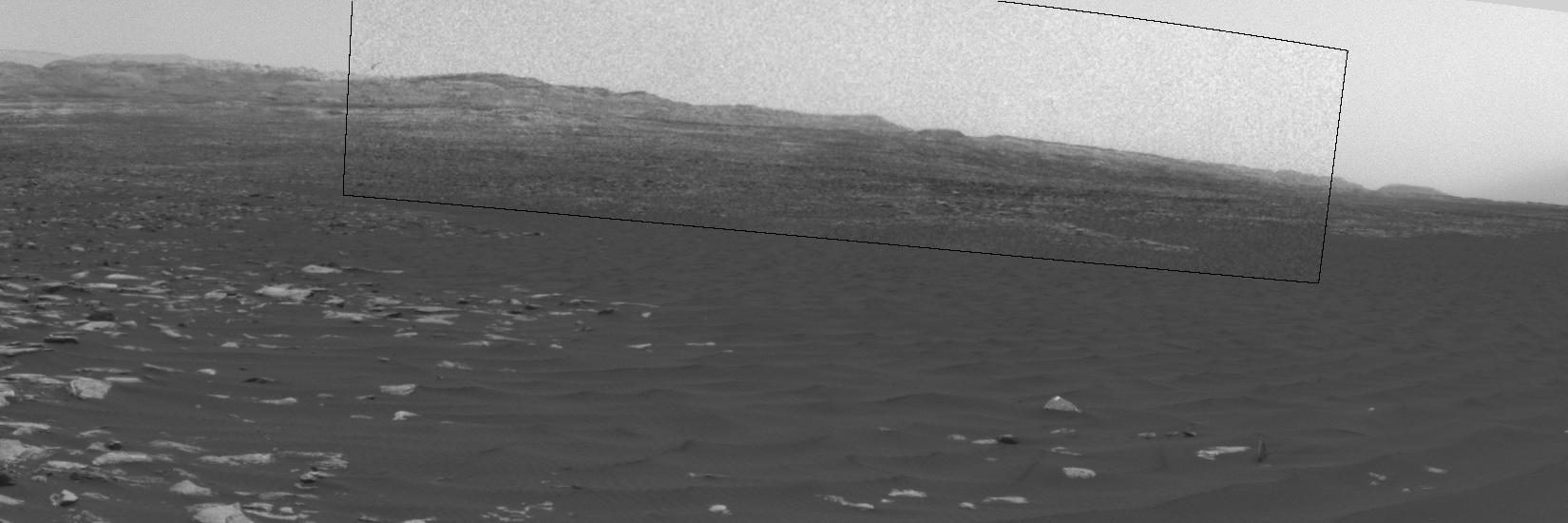
This frame from a sequence of images shows a dust-carrying whirlwind, called a dust devil, on lower Mount Sharp inside Gale Crater, as viewed by NASA's Curiosity Mars Rover during the summer afternoon of the rover's 1,613rd Martian day, or…
Swirling Dust in Gale Crater, Mars, Sol 1613
The mesa in the center of this scene from the "Murray Buttes" area on Mars' lower Mount Sharp is longer than a football field. It extends more than 361 feet (110 meters) from the left-most outcrop low on the slope to the right side where ro…
Cluster of Martian Mesas on Lower Mount Sharp, Sols 1438 and 1439
The two prominent mesas in this view of Mars' "Murray Buttes" region from NASA's Curiosity Mars rover are about 260 feet (about 80 meters) apart.  The top of the one on the left is about 26 feet (about 8 meters) above the surrounding plain…
Martian Mesas in Murray Buttes Area, Sol 1434
The top of the butte in this scene from the Mast Camera (Mastcam) on NASA's Curiosity Mars rover stands about 16 feet (about 5 meters) above the rover and about 82 feet (about 25 meters) east-southeast of the rover.  Mastcam's right-eye (te…
Butte M9a in Murray Buttes on Mars
This view from the Mast Camera (Mastcam) on NASA's Curiosity Mars rover shows two scales of ripples, plus other textures, in an area where the mission examined a linear-shaped dune in the Bagnold dune field on lower Mount Sharp.  The scene…
Textures Where Curiosity Rover Studied a Martian Dune
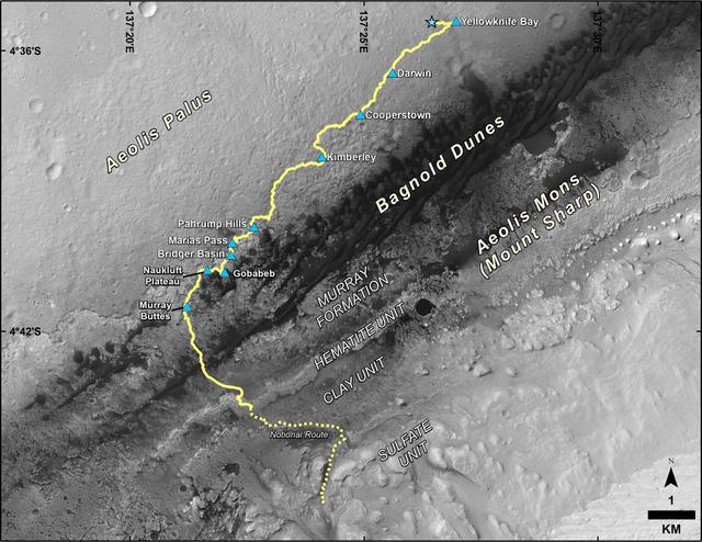
This map shows the route driven by NASA's Curiosity Mars rover from the location where it landed in August 2012 to its location in December 2016, which is in the upper half of a geological unit called the Murray formation, on lower Mount Sh…
Late 2016 Map of NASA Curiosity Mars Rover Mission
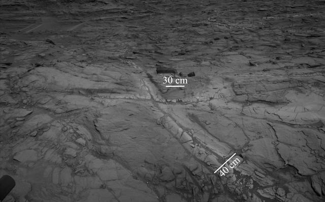
Pale zones called "halos" border bedrock fractures visible in this 2015 image from NASA's Curiosity Mars rover which has been darkened (a previously released image can be seen at PIA20268). Measurements overlaid on the image offer a sense o…
Halos in Martian Sandstone
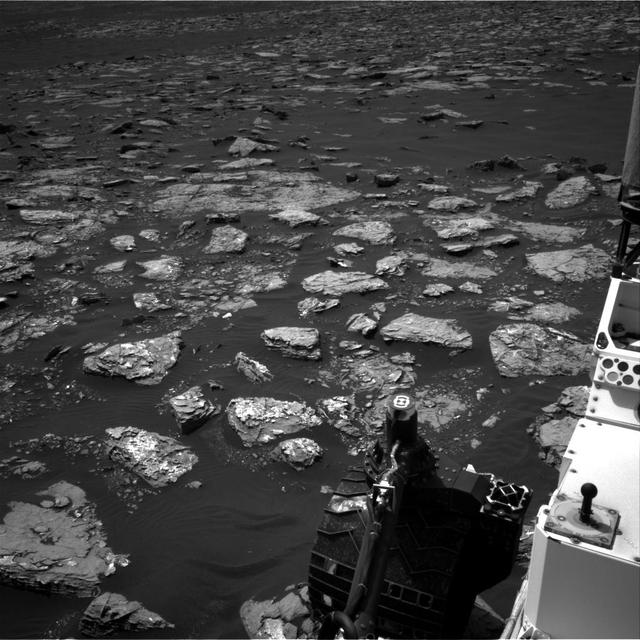
This view from the Navigation Camera (Navcam) on the mast of NASA's Curiosity Mars rover shows rocky ground within view while the rover was working at an intended drilling site called "Precipice" on lower Mount Sharp.  The right-eye camera…
Martian Terrain Near Curiosity Precipice Target
This self-portrait of NASA's Curiosity Mars rover shows the vehicle at the "Quela" drilling location in the "Murray Buttes" area on lower Mount Sharp.  Key features on the skyline of this panorama are the dark mesa called "M12" to the left…
Curiosity Self-Portrait at Murray Buttes.
The Mast Camera (Mastcam) on NASA's Curiosity Mars rover captured this view of "Vera Rubin Ridge" about two weeks before the rover started ascending this steep ridge on lower Mount Sharp.  The view combines 13 images taken with the Mastcam'…
Looking Up at Layers of 'Vera Rubin Ridge' on Sol 1790
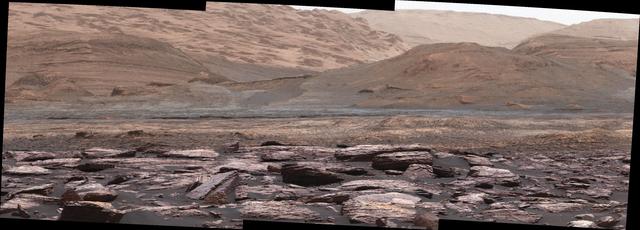
The foreground of this scene from the Mast Camera (Mastcam) on NASA's Curiosity Mars rover shows purple-hued rocks near the rover's late-2016 location on lower Mount Sharp. The scene's middle distance includes higher layers that are future…
Color Variations on Mount Sharp, Mars White Balanced
This panorama from the Mast Camera (Mastcam) of NASA's Curiosity Mars rover shows details of "Vera Rubin Ridge," which stretches about 4 miles (6.5 kilometers), end-to-end, on the northwestern flank of lower Mount Sharp.  The view combines…
Wide 'Vera Rubin Ridge' Ahead of Curiosity Mars Rover
This look ahead from NASA's Curiosity Mars rover includes four geological layers to be examined by the mission, and higher reaches of Mount Sharp beyond the planned study area.  The redder rocks of the foreground are part of the Murray form…
View Toward 'Vera Rubin Ridge' on Mount Sharp, Mars
This map shows the route driven by NASA's Curiosity Mars rover from the location where it landed in August 2012 to its location in September 2016 at "Murray Buttes," and the path planned for reaching destinations at "Hematite Unit" and "Cla…
Curiosity Destinations for Second Extended Mission
Original Caption Released with Image:      This 360-degree panorama was acquired by the Mast Camera (Mastcam) on NASA's Curiosity Mars rover while the rover was in an area called "Murray Buttes" on lower Mount Sharp, one of the most scenic…
Rover Panorama Taken Amid Murray Buttes on Mars
This 360-degree panorama was acquired by the Mast Camera (Mastcam) on NASA's Curiosity Mars rover as the rover neared features called "Murray Buttes" on lower Mount Sharp.  The view combines more than 130 images taken on Aug. 5, 2016, durin…
Rover Panorama of Entrance to Murray Buttes on Mars
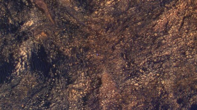
The feature that appears bright blue at the center of this scene is NASA's Curiosity Mars rover on the northwestern flank of Mount Sharp, viewed by NASA's Mars Reconnaissance Orbiter. Curiosity is approximately 10 feet long and 9 feet wide…
Curiosity Rover on Mount Sharp, Seen from Mars Orbit
No more images