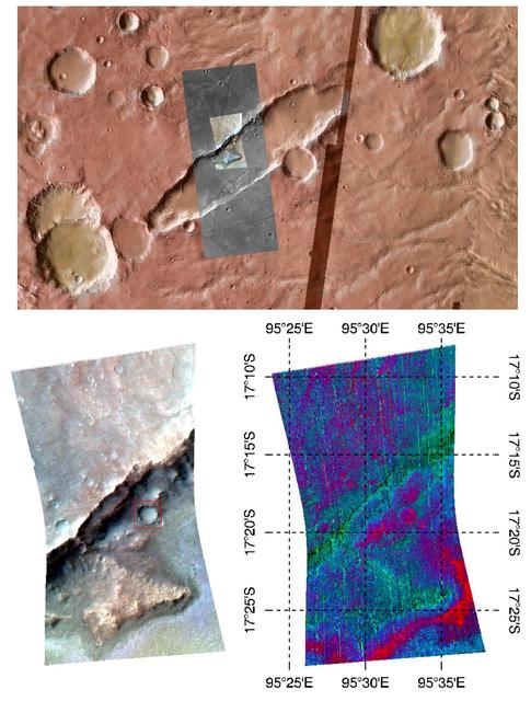
Oxia Planum is broad clay-bearing surface between Mawrth and Ares Vallis that has been proposed as a future landing site on Mars. This image is from NASA Mars Reconnaissance Orbiter.
This image shows black gold, that is: organic material, which could be a biomarker sign of past life, the holy grail of Mars exploration. This image is from NASA Mars Reconnaissance Orbiter.
Mars and the Earth run into debris in space regularly, and on our planet, meteors usually vaporize in the atmosphere. On Mars however, with a surface pressure 1/100th that of the Earth, the impactors generally make it to the surface. This…
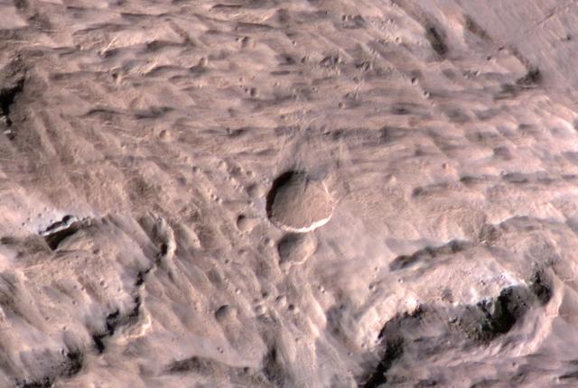
Sometimes a central pit forms inside some Martian craters, especially when there substantial ground ice. Such is the case in this observation from NASA Mars Reconnaissance Orbiter spacecraft. Sometimes what we call "mass wasting" processes…
Eridania Basin, located at the head of Maadim Vallis, has mounting geomorphic and spectral evidence that it may have been the site of an ancient inland sea. This image is from NASA Mars Reconnaissance Orbiter.
A dramatic, fresh impact crater dominates this image taken by the HiRISE camera onboard NASA Mars Reconnaissance Orbiter on Nov. 19, 2013. The crater is surrounded by a large, rayed blast zone.
This image comes from observations of Newton crater by the HiRISE camera onboard NASA Mars Reconnaissance Orbiter; warm-season features might be evidence of salty liquid water active on Mars today.
Ravines or very large gullies are actively forming on Mars during the coldest times of year, when carbon dioxide frost aids mass wasting as seen by NASA Mars Reconnaissance Orbiter. However, some of these ravines also show activity in the…
Olympia Undae is a large field of sand dunes surrounding Mars North Polar ice cap. High latitude covers them with water and carbon dioxide frost in the winter so they are illuminated. NASA Mars Reconnaissance Orbiter views these best in sum…
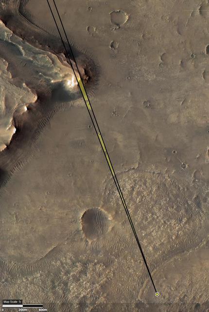
Provided by the High Resolution Imaging Experiment (HiRISE) aboard NASA's Mars Reconnaissance orbiter, this overhead image captures a portion of Mars' Jezero Crater. The yellow dot on lower right indicates the location of NASA's Perseveranc…
Shown here is an exceptionally long sinuous ridge, possibly an inverted fluvial feature, that cuts across newly mapped geologic units of the Medusae Fossae Formation, from NASA Mars Reconnaissance Orbiter.
Sand dunes cover much of this terrain, which has large boulders lying on flat areas between the dunes in this image captured by NASA Mars Reconnaissance Orbiter spacecraft.
Many of the Valles Marineris canyons, called chasmata, have kilometer-high, light-toned layered mounds made up of sulfate materials. Ius Chasma, near the western end of Valles Marineris, is an exception. The light-toned deposits here are t…
The objective of this observation by NASA Mars Reconnaissance Orbiter was to examine the edge of impact ejecta from a crater to the north-west of this area north is up, west is to the left.
Dust devils on Mars often create long, dark markings where they pull a thin coat of dust off the surface. This image shows a cluster of these tracks on the flat ground below the south polar layered deposits, but none on the layers themselve…
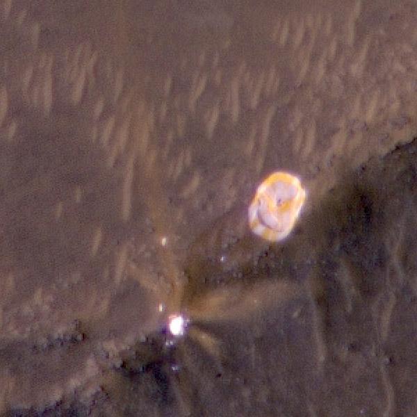
The High Resolution Imaging Experiment (HiRISE) camera aboard NASA's Mars Reconnaissance Orbiter (MRO) was able to capture this image of the final location of the parachute that helped slow down NASA's Perseverance rover during its landing…
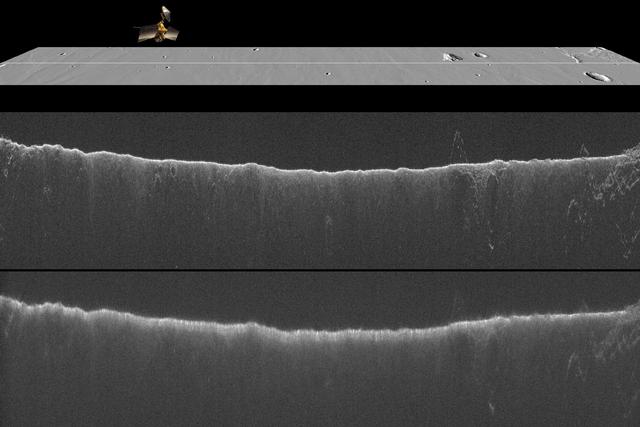
A comparison of two radargrams from the SHARAD instrument on NASA Mars Reconnaissance Orbiter shows effects on the Martian ionosphere from the close passage of a comet.
Mars has a small South Polar cap of carbon dioxide ice. Although this cap persists year round, it is always changing: it has pits and mesas that in some places resemble a slice of Swiss cheese. The pits are expanding because the carbon diox…
Yardangs are streamlined hills that are carved by wind erosion from bedrock. NASA Mars Reconnaissance Orbiter viewed these yardangs which can look like the hull of a boat.
This image shows two types of sand dunes on Mars. The small dots are called barchan dunes, and from their shape we can tell that they are upwind. The downwind dunes are long and linear. These two types of dune each show the wind direction…
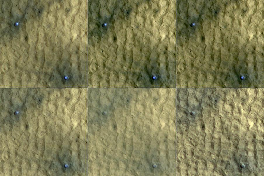
This series of images spanning a period of 15 weeks shows a pair of fresh craters taken by NASA Mars Reconnaissance Orbiter. Bright, bluish material apparent in the earliest images disappears by the later ones.
The North Polar layered deposits provide a record of recent climate changes on Mars as seen by NASA Mars Reconnaissance Orbiter spacecraft. Color variations between layers are due to differences in composition of the dust.
The suggested area in this observation from NASA Mars Reconnaissance Orbiter is characterized by a group of cones, shield-like features, and round mounds. They are a few hundred meters to kilometers in diameter but their heights are unknown…
This observation from NASA Mars Reconnaissance Orbiter shows a set of landforms that appears to form a nested chevron pattern on a slope in Coloe Fossae. Interestingly, nearby surfaces on the same slope are all parallel.
NASA's Mars Reconnaissance Rover (MRO) has observed two types of wind (aeolian) features in Proctor Crater: large, dark features that are sand dunes, made up of basaltic particles, and smaller, light-toned ripples that we call "TAR," or "tr…
Schiaparelli Crater is a 460 kilometer 286 mile wide multi-ring structure. However, it is a very shallow crater, apparently filled by younger materials such as lava and/or fluvial and aeolian sediments as seen by NASA Mars Reconnaissance Or…
This observation from NASA Mars Reconnaissance Orbiter Polygons form by the intersecting ridges of sand dunes. The illumination is coming from the upper left, so the bluish ridges are high-standing.
This image from NASA Mars Reconnaissance Orbiter spacecraft is of a morphologically fresh and simple impact crater in the Hellespontus region. At 1.3 kilometers in diameter, this unnamed crater is only slightly larger than Arizona's Barring…
Meteorites hit Mars and create small craters like the one we've imaged here. Usually we spot these new craters in lower-resolution images from the Context Camera because the impact disturbs dust on the surface and creates a dark mark that's…
Sunlight was just starting to reach the high Northern latitudes in late winter when NASA Mars Reconnaissance Orbiter HiRISE camera captured this image of part of the steep scarps around portions of the North Polar layered deposits.
This image shows two cross-cutting depressions that may have been formed by the collapse of weak terrain along pre-existing faults. These faults are associated with the release of volcanic material and/or liquid water. Sinuous channels are…
An impressionist painting? No, it's a new impact crater that has appeared on the surface of Mars, formed at most between September 2016 and February 2019. What makes this stand out is the darker material exposed beneath the reddish dust. I…
The largest crater associated with a March 2012 impact on Mars has many smaller craters around it, revealed in this image from the High Resolution Imaging Science Experiment HiRISE camera on NASA Mars Reconnaissance Orbiter.