
Crater Deformation

This image from NASA 2001 Mars Odyssey spacecraft shows a small crater near Phlegra Montes.

Today's VIS image shows a small section of Shalbatana Vallis. Located in Xanthe Terra, Shalbatana Vallis is an outflow channel carved by massive floods of escaping groundwater whose source lies far to the south of this image. This channel,…

The channel at the very top of this image captured by NASA 2001 Mars Odyssey spacecraft is Olympica Fossae. That and the rest of the channels in this image are likely lava channels.

This image from NASA 2001 Mars Odyssey spacecraft shows a portion of the floor of Antoniadi Crater. The faint, dark marks may be dust devil tracks.

Today's VIS image shows a portion of an unnamed channel in northern Arabia Terra. Numerous channels dissect this region of Arabia Terra where it borders the northern lowlands. Orbit Number: 81196 Latitude: 36.607 Longitude: 35.816 Instrume…
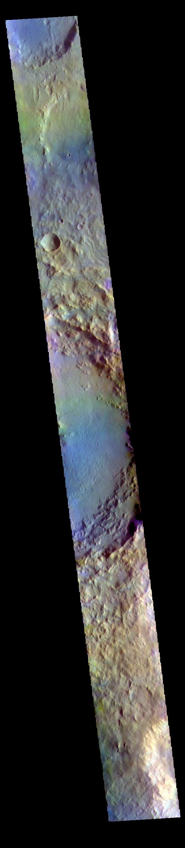
The THEMIS VIS camera contains 5 filters. The data from different filters can be combined in multiple ways to create a false color image. These false color images may reveal subtle variations of the surface not easily identified in a single…

This VIS image is located on the South Polar Cap. A trough crosses the center of the image, showing the layered nature of the cap ice. This image was collected in early spring, and highlights the icy surface textures. Orbit Number: 81750 L…
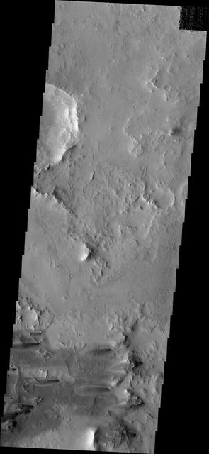
Windstreaks

The wide channel in this image captured by NASA Mars Odyssey is Tinto Vallis.
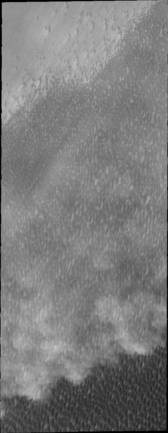
Spring storms are common near the north pole. This image captured by NASA 2001 Mars Odyssey spacecraft shows a storm front over the extensive dune field which surrounds part of the polar cap.

There appear to be layers in the rim of this northern crater

Arsia Mons Flows

Dust Devil Tracks

This image from NASA 2001 Mars Odyssey shows a complex tributary channel and its entry to the main channel of Shalbatana Vallis.

The three large aligned Tharsis volcanoes are Arsia Mons, Pavonis Mons and Ascreaus Mons (from south to north). There are collapse features on all three volcanoes, on the southwestern and northeastern flanks. This alignment may indicate a l…
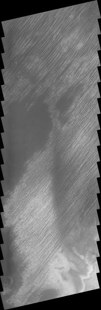
This linear features near the South Polar Cap appeared during the height of southern summer

Today's VIS image shows a small portion of the immense lava flows that originated from Arsia Mons. Arsia Mons is the southernmost of the three large aligned volcanoes in the Tharsis region. The different surface textures are created by diff…

The THEMIS VIS camera contains 5 filters. The data from different filters can be combined in multiple ways to create a false color image. These false color images may reveal subtle variations of the surface not easily identified in a single…

Channel/Crater Interaction

The THEMIS camera contains 5 filters. The data from different filters can be combined in multiple ways to create a false color image. This image from NASA 2001 Mars Odyssey spacecraft shows a trough in the south polar cap. Layering in the i…

Hooke Crater Dunes

This false color image shows part of the interior of Crommelin Crater. This crater contains a large mound of layered materials on the crater floor. This material was deposited after the crater formed. Crommelin Crater is one a several crate…

Do you see what I see? Poor Mickey Mouse, only his head remains at the bottom of this image captured by NASA 2001 Mars Odyssey spacecraft.

The THEMIS VIS camera contains 5 filters. The data from different filters can be combined in multiple ways to create a false color image. These false color images may reveal subtle variations of the surface not easily identified in a single…

The dunes in this image captured by NASA 2001 Mars Odyssey spacecraft are located in an unnamed crater on the eastern margin of Tempe Terra.

Do you see what I see in this image captured by NASA 2001 Mars Odyssey spacecraft? The dark dune deposit resembles a howling animal.

The bottom half of this image of central Candor Chasma shows a surface topography called chaos. Chaos is a region of small to medium sized mesas surrounded by valleys that are usually the same elevation. In this image sand and sand dunes ar…

Dune Types

Today's VIS image shows western parts of Ophir Chasma (top of image) and Candor Chasma (bottom of image). Both are part of Valles Marineris. Candor Chasma is approximately 810 km long (503 miles) and is divided into two regions – eastern an…

This image captured by NASA 2001 Mars Odyssey spacecraft shows a portion of Cerberus Fossae, a set of linear graben located south of Tartarus Montes.

This image is located in the Tyrrhena Terra region. The cause of the bright markings/material is unknown. It is possible that the formation of the channels are exposing a series of bright layered material
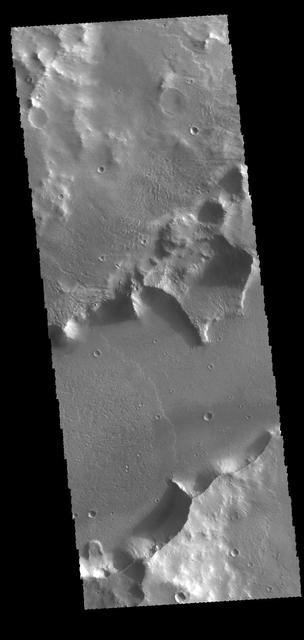
The channel feature in this image from NASA 2001 Mars Odyssey spacecraft is called Mangala Fossa. This feature was formed by tectonic activity, with the walls being faults that allowed the central portion to slide downward forming a graben.

Today's VIS image is located on the upper flank of Olympus Mons. Olympus Mons is the largest volcano in the solar system, reaching heights over 25 km (16 miles) tall from base to summit, with the base covering an area as large as the state…

This type of feature is termed an inverted channel. One theory of how these features form is that rocky debris accumulates in channels of flowing water beneath glaciers

Dunes on Ice

Summer in Mars North Polar Region
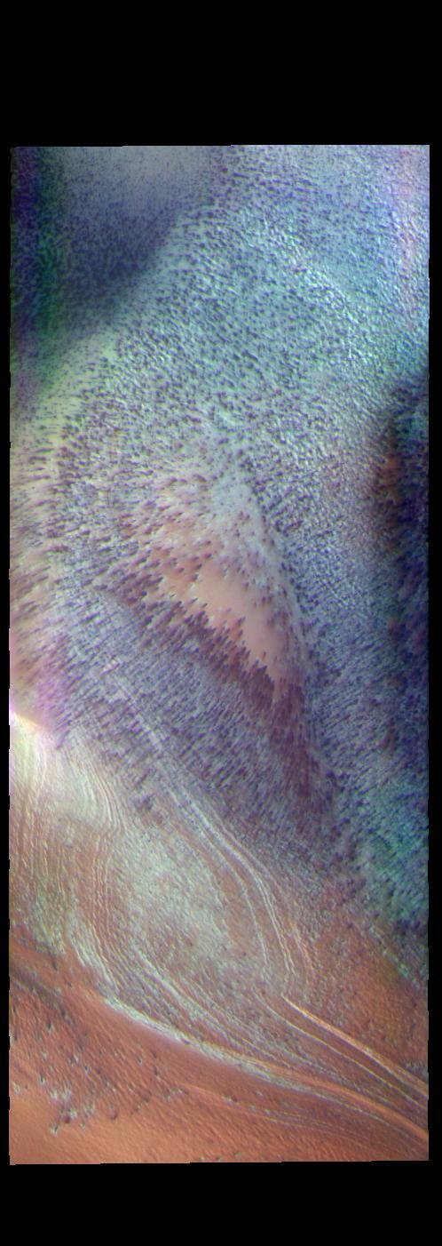
This false color image shows part of the south polar cap. The cap was created over millions of years with deposition of ice and dust during different seasons. This image was collected during spring time. In addition to the layers of ice/dus…

Overlapping Flows
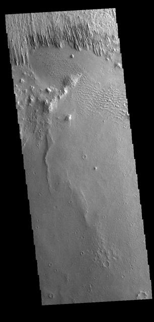
Yardangs are present at the top of this VIS image. These features are created by long term winds scouring a poor cemented surface material into linear ridges and valleys. These yardangs are part of the Medusa Fossae Formation. It has been s…

Tempe Terra
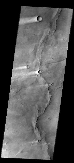
This image shows several wind streaks in Syrtis Major Planum as seen by NASA 2001 Mars Odyssey spacecraft.

Central Gusev
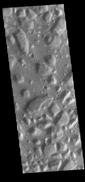
Today's VIS image shows part of Ariadnes Colles. The term colles means hills or knobs. Some hills appear brighter than the surrounding lowlands, likely due to relatively less dust cover. Ariadnes Colles is located in Terra Cimmeria. Orbit…

This image shows part of the southern flank of Pavonis Mons. The linear and sinuous features mark the locations of lava tubes and graben that occur on both sides of the volcano along a regional trend that passes thru Pavonis Mons, Ascreaus…
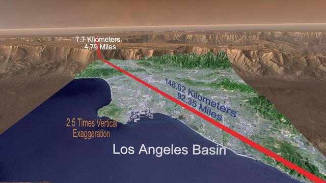
A Grand Canyon of Mars slices across the Red Planet near its equator. This canyon -- Valles Marineris, or the Mariner Valley -- is 10 times longer and deeper than Arizona Grand Canyon, and 20 times wider
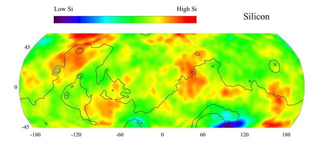
This gamma ray spectrometer map of the mid-latitude region of Mars is based on gamma-rays from the element silicon. Silicon is one of the most abundant elements on the surface of both Mars and Earth (second only to oxygen). The most extensi…

This unnamed channel complex in nothern Arabia Terra contains several different surface textures on the channel floor. The parallel ridges are unusally indicative of materials which contain volatiles