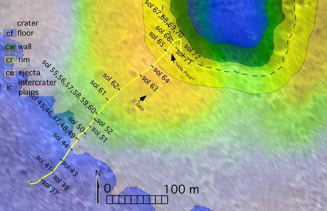
The route of NASA's Mars Exploration Rover Spirit, from its landing site to its location on sol 72 (March 16, 2004) near the rim of the large crater dubbed "Bonneville" is pictured here on this traverse map. The map consists of data from NA…

This video combines two perspectives of the 59th flight of NASA's Ingenuity Mars Helicopter. The frame on the left shows video from NASA's Perseverance Mars rover; the frame on the right is footage taken by Ingenuity's downward-pointing bla…

An alien themed cup cake is seen during the Mars celebration Saturday, June 1, 2019, in Mars, Pennsylvania. NASA is in the small town to celebrate Mars exploration and share the agency’s excitement about landing astronauts on the Moon in fi…

Crater Deformation

The THEMIS VIS camera contains 5 filters. The data from different filters can be combined in multiple ways to create a false color image. These false color images may reveal subtle variations of the surface not easily identified in a single…
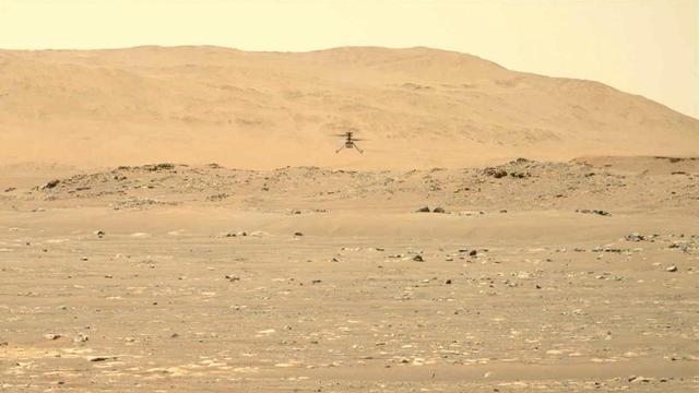
NASA's Ingenuity Mars Helicopter hovers and rotates over Jezero Crater during its second experimental flight test on April 22, 2021. The footage was captured by the Mastcam-Z imager, a pair of zoomable cameras aboard NASA's Perseverance Mar…

Channel/Crater Interaction

The THEMIS camera contains 5 filters. The data from different filters can be combined in multiple ways to create a false color image. This image from NASA 2001 Mars Odyssey spacecraft shows a trough in the south polar cap. Layering in the i…

Hooke Crater Dunes

This false color image shows part of the interior of Crommelin Crater. This crater contains a large mound of layered materials on the crater floor. This material was deposited after the crater formed. Crommelin Crater is one a several crate…

Overlapping Flows
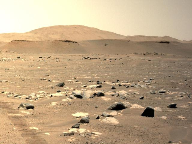
NASA's Ingenuity Mars Helicopter can be seen hovering during its third flight on April 25, 2021, as seen by the left Navigation Camera aboard NASA's Perseverance Mars rover. https://photojournal.jpl.nasa.gov/catalog/PIA24624

Do you see what I see in this image captured by NASA 2001 Mars Odyssey spacecraft? The dark dune deposit resembles a howling animal.

The bottom half of this image of central Candor Chasma shows a surface topography called chaos. Chaos is a region of small to medium sized mesas surrounded by valleys that are usually the same elevation. In this image sand and sand dunes ar…

There appear to be layers in the rim of this northern crater

This Mars map shows variations in thickness of the planet crust, the relatively thin surface layer over the interior mantle of the planet. It shows unprecedented detail derived from new mapping of variations in Mars gravitational pull on or…
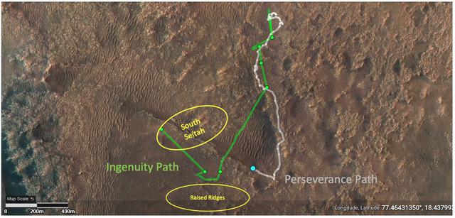
This annotated image depicts the ground tracks of NASA's Perseverance rover (white) and Ingenuity Mars Helicopter (green) since arriving on Mars on February 18, 2021. The green dots represent the locations of the helicopter's airfields duri…

A mural inside the Mars Brew House is seen during the Mars celebration Saturday, June 1, 2019, in Mars, Pennsylvania. NASA is in the small town to celebrate Mars exploration and share the agency’s excitement about landing astronauts on the…

Today's VIS image shows a small portion of the immense lava flows that originated from Arsia Mons. Arsia Mons is the southernmost of the three large aligned volcanoes in the Tharsis region. The different surface textures are created by diff…

Today's VIS image is located on the upper flank of Olympus Mons. Olympus Mons is the largest volcano in the solar system, reaching heights over 25 km (16 miles) tall from base to summit, with the base covering an area as large as the state…

This type of feature is termed an inverted channel. One theory of how these features form is that rocky debris accumulates in channels of flowing water beneath glaciers

The channel at the very top of this image captured by NASA 2001 Mars Odyssey spacecraft is Olympica Fossae. That and the rest of the channels in this image are likely lava channels.

This image from NASA 2001 Mars Odyssey spacecraft shows a portion of the floor of Antoniadi Crater. The faint, dark marks may be dust devil tracks.
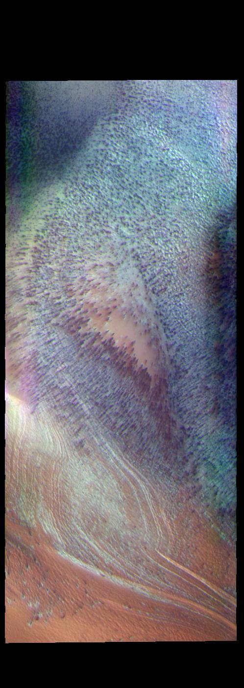
This false color image shows part of the south polar cap. The cap was created over millions of years with deposition of ice and dust during different seasons. This image was collected during spring time. In addition to the layers of ice/dus…
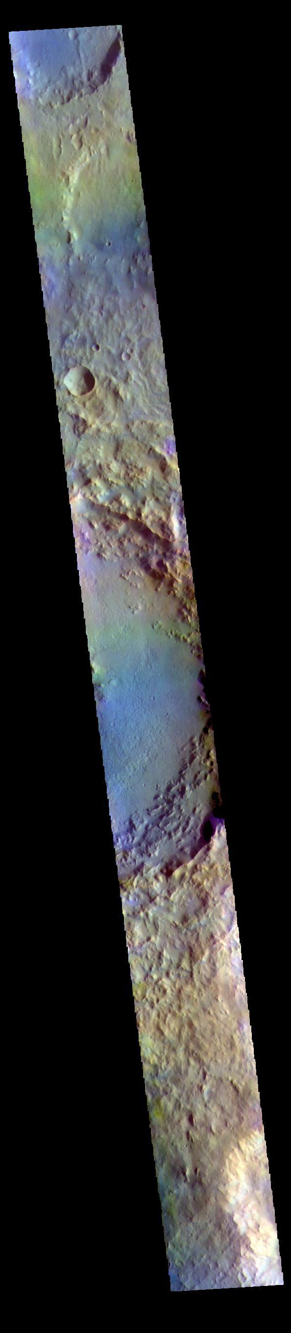
The THEMIS VIS camera contains 5 filters. The data from different filters can be combined in multiple ways to create a false color image. These false color images may reveal subtle variations of the surface not easily identified in a single…

This VIS image is located on the South Polar Cap. A trough crosses the center of the image, showing the layered nature of the cap ice. This image was collected in early spring, and highlights the icy surface textures. Orbit Number: 81750 L…

The dunes in this image captured by NASA 2001 Mars Odyssey spacecraft are located in an unnamed crater on the eastern margin of Tempe Terra.
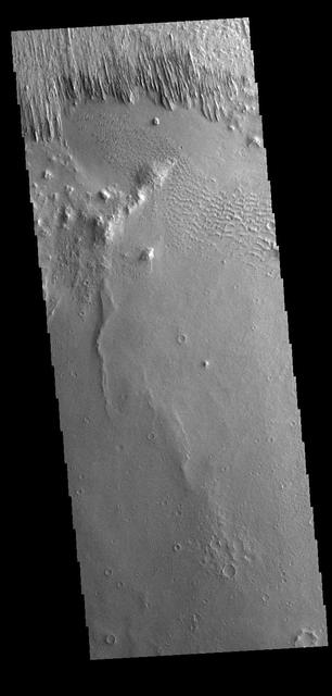
Yardangs are present at the top of this VIS image. These features are created by long term winds scouring a poor cemented surface material into linear ridges and valleys. These yardangs are part of the Medusa Fossae Formation. It has been s…

Tempe Terra
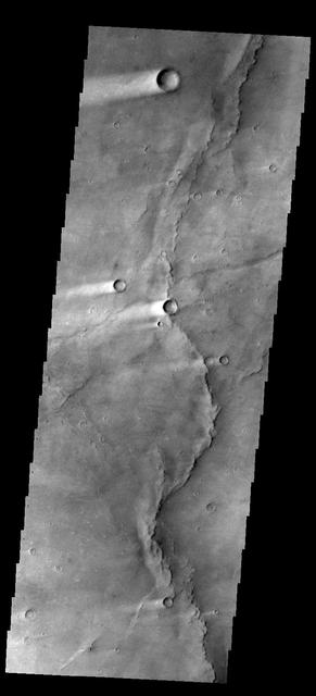
This image shows several wind streaks in Syrtis Major Planum as seen by NASA 2001 Mars Odyssey spacecraft.
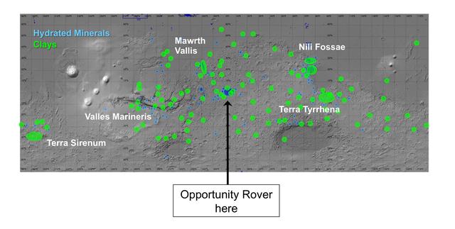
On this map of Mars, spectrometers on spacecraft orbiting Mars have detected clay minerals green and hydrated minerals-- clays, sulfates and others blue.
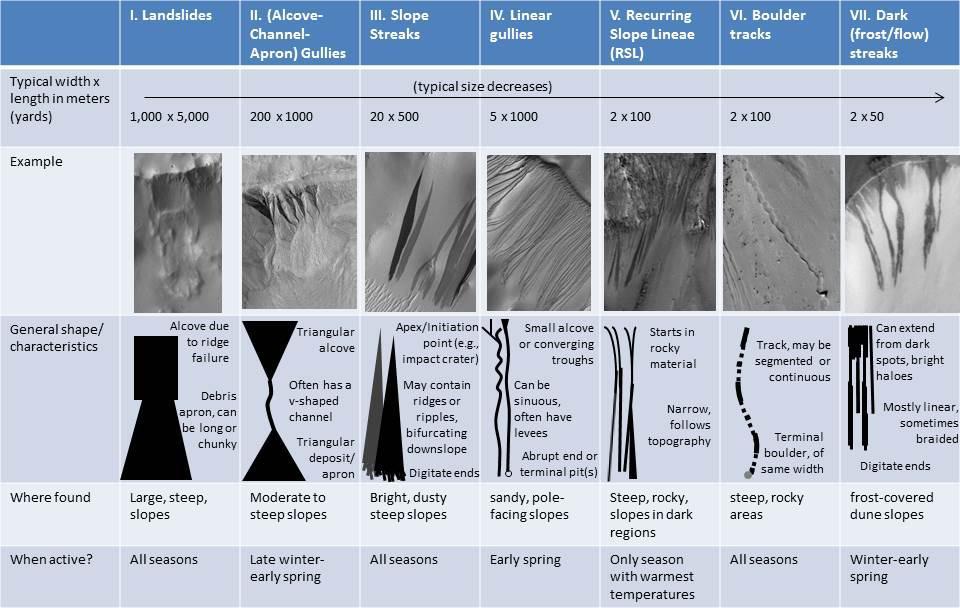
As on the Earth, many processes can move material down a Martian slope. This graphic compares seven different types of features observed on Mars that appear to result from material flowing or sliding or rolling down slopes.

On December 3, 1999) Mars Polar Lander (MPL) was set to touchdown on the enigmatic layered terrain located near the South Pole. Unfortunately, communications with the spacecraft were lost and never regained. The Mars Program Independent Ass…
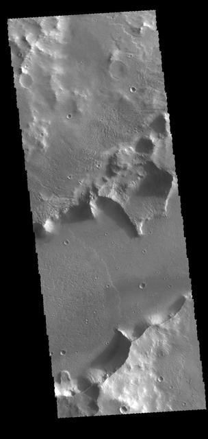
The channel feature in this image from NASA 2001 Mars Odyssey spacecraft is called Mangala Fossa. This feature was formed by tectonic activity, with the walls being faults that allowed the central portion to slide downward forming a graben.

This image from NASA 2001 Mars Odyssey spacecraft shows a small crater near Phlegra Montes.

Today's VIS image shows a small section of Shalbatana Vallis. Located in Xanthe Terra, Shalbatana Vallis is an outflow channel carved by massive floods of escaping groundwater whose source lies far to the south of this image. This channel,…

Dunes on Ice

Summer in Mars North Polar Region

Today's VIS image shows a portion of an unnamed channel in northern Arabia Terra. Numerous channels dissect this region of Arabia Terra where it borders the northern lowlands. Orbit Number: 81196 Latitude: 36.607 Longitude: 35.816 Instrume…
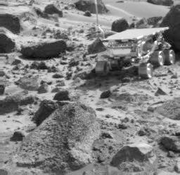
Sojourner, Wedge, & Shark

Do you see what I see? Poor Mickey Mouse, only his head remains at the bottom of this image captured by NASA 2001 Mars Odyssey spacecraft.

The THEMIS VIS camera contains 5 filters. The data from different filters can be combined in multiple ways to create a false color image. These false color images may reveal subtle variations of the surface not easily identified in a single…
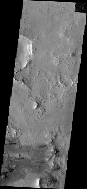
Windstreaks

The wide channel in this image captured by NASA Mars Odyssey is Tinto Vallis.
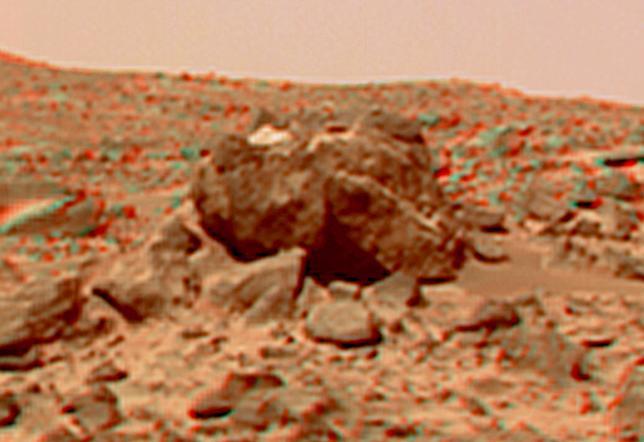
This view of the "Hippo," 25 meters to the west of the lander, was produced by combining the "Super Panorama" frames from the IMP camera. Super resolution was applied to help to address questions about the texture of this rock and what it m…
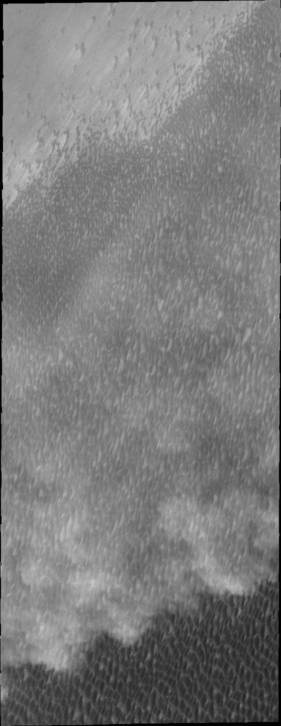
Spring storms are common near the north pole. This image captured by NASA 2001 Mars Odyssey spacecraft shows a storm front over the extensive dune field which surrounds part of the polar cap.

The Mars celebration Friday, May 31, 2019, in Mars, Pennsylvania. NASA is in the small town to celebrate Mars exploration and share the agency’s excitement about landing astronauts on the Moon in five years. The celebration includes a weeke…

Dune Types