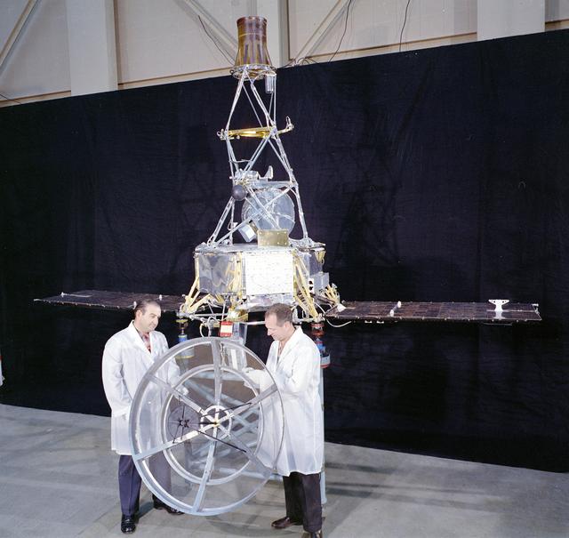
JPL's Spacecraft Assembly Facility looks more like a hangar in this photo of two engineers standing with Mariner 1 on May 2, 1962. However, the gowning procedures were far less rigorous than they are today. Mariner 1 was destroyed during it…
Mariner 1 in JPL's Spacecraft Assembly Facility
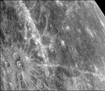
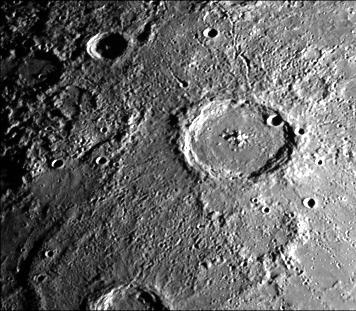
This photograph of Mercury, taken by NASA Mariner 10, shows two prominent rayed craters. Bright halos extend as far as 2 crater diameters beyond crater rims. Individual rays extend from halo.
Prominent Rayed Craters
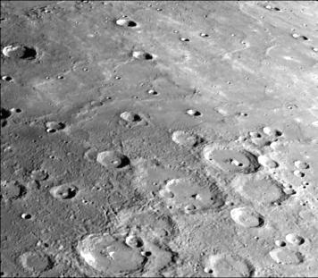
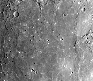
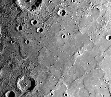
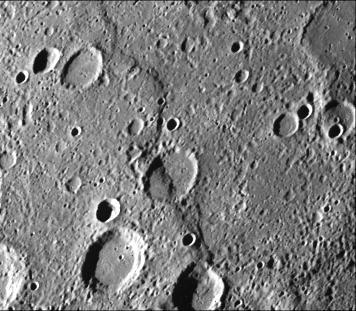
This photograph of Mercury was taken by NASA Mariner 10 spacecraft shows smooth plains areas on Mercury that are thought to be volcanic in origin with lava flows filling in heavily cratered areas.
Heavily Cratered Terrain and Smooth Plain
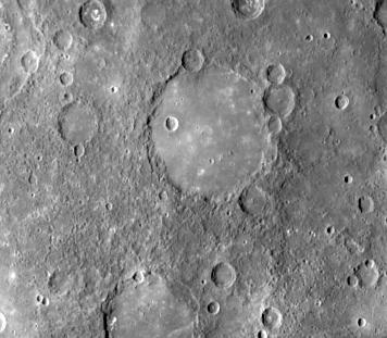
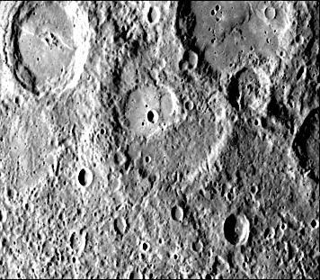
This image, from NASA Mariner 10 spacecraft which launched in 1974, shows an old basin hummocky rim is partly degraded and cratered by later events.
Old Basin Filled by Smooth Plains
Caloris Basin on Mercury, is one of the largest basins in the solar system, its diameter exceeds 1300 kilometers and is in many ways similar to the great Imbrium basin on the Moon. This image is from NASA Mariner 10 spacecraft which launche…
Caloris Basin
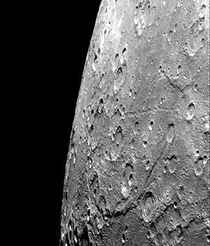
After passing Mercury the first time and making a trip around the Sun, NASA Mariner 10 again flew by Mercury on Sept. 21, 1974. This encounter brought the spacecraft in front of Mercury in the southern hemisphere.
Hero Rupes Scarp
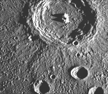
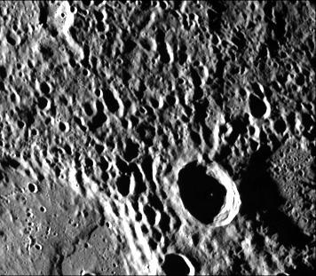
This crater illustrates the narrow hummocky rim facies, radial ridges, and surrounding extensive field of secondary craters. This image of Mercury was taken by NASA Mariner 10.
Terraced Craters
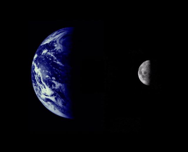
NASA Mariner 10 was launched on November 3, 1973, 12:45 am PST, from Cape Canaveral on an Atlas/Centaur rocket a reconditioned Intercontinental Ballistic Missile - ICBM.
Earth and Moon as Viewed by Mariner 10
A faint double ring crater is seen at upper right in this picture of Mercury taken one hour and 40 minutes before NASA Mariner 10 second rendezvous with the planet Sept. 21, 1975
Double Ring Craters
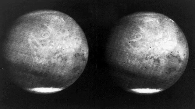
South Polar Cap of Mars as seen by Mariners 9 & 7
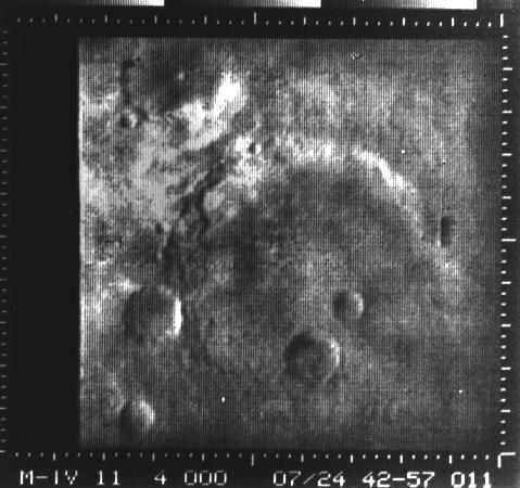
Mariner Crater
Mariner Crater
This image, from NASA Mariner 10 spacecraft which launched in 1974, is of the H-7 Beethoven Quadrangle, and lies in Mercury Equatorial Mercator. NASA Mariner 10 spacecraft imaged the region during its initial flyby of the planet.
Mercury: Beethoven Quadrangle, H-7
This image, from NASA Mariner 10 spacecraft which launched in 1974, shows hilly and lineated terrain and a patch of smooth plains in a large degraded crater.
Hilly and Lineated Terrain
Antoniadi Ridge, over 450 kilometers long, runs along the right side of this acquired image during NASA Mariner 10 first encounter with Mercury after its launch in 1974.
Antoniadi Ridge
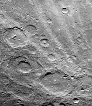
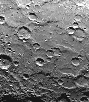
The craters in this image NASA Mariner 10 spacecraft, which launched in 1974, have interior rings of mountains and ejecta deposits which are scarred by deep secondary crater chain groves.
Crater Chain Groves Inside Larger Craters
This image, from NASA Mariner 10 spacecraft which launched in 1974, is of the northeastern quadrant of the Caloris basin and shows the smooth hills and domes between the inner and outer scarps and the well-developed radial system east of th…
Northeastern Quadrant of the Caloris Basin
Mariner #9 Mars Craters and Riverbeds
ARC-1985-AC85-0760-4
Nix Olympica Identified by Mariner 9 on Mars Approach
Mariner 9 views of shield volcano
After passing Mercury the first time and making a trip around the Sun, NASA Mariner 10 again flew by Mercury on Sept. 21, 1974. The south pole is located on the right hand edge of Chao Meng Fu crater that has only its rim sticking up into t…
Mercury South Pole
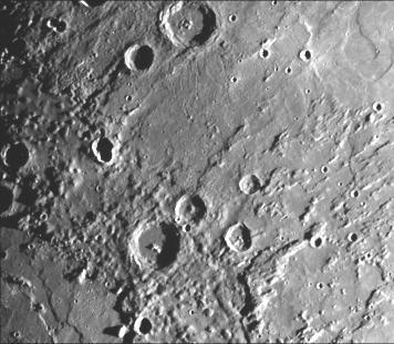
This image, from NASA Mariner 10 spacecraft which launched in 1974, shows that several west-facing lobate scarps occur in the hummocky plains interpreted as Caloris ejecta.
Lobate Scarps within the Hummocky Plains East of Caloris Basin
This computer generated photomosaic from NASA Mariner 10 is of the southern half of Mercury Shakespeare Quadrangle, named for the ancient Shakespeare crater located on the upper edge to the left of center.
Photomosaic of Mercury - Inbound View
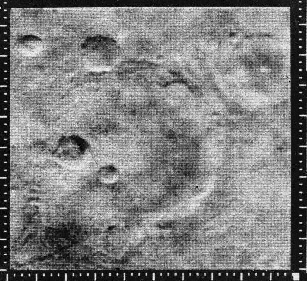
Atlantis Region on Mars - Mariner 4
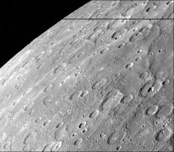
After passing Mercury the first time and making a trip around the Sun, NASA Mariner 10 again flew by Mercury on Sept. 21, 1974. This encounter brought the spacecraft in front of Mercury in the southern hemisphere.
Similarities to Lunar Highlands
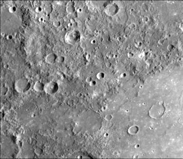
This image, from NASA Mariner 10 spacecraft which launched in 1974, is located about 500 km east of the Caloris basin and shows hummocky plains interpreted as Caloris ejecta in the upper half of the picture and smooth plains in the lower ha…
Hummocky and Smooth Plains
A field of bright rays, created by ejecta from a crater, radiating to the north top from off camera lower right is seen in this view of Mercury taken Sept. 21, 1974 by NASA Mariner 10.
Field of Bright Rays
This image, from NASA Mariner 10 spacecraft which launched in 1974, shows plains filling this basin are uniformly brighter and slightly redder than the surrounding cratered terrain.
Smooth Volcanic Plains
This image, from NASA Mariner 10 spacecraft which launched in 1974, is of the northern half of Mercury Shakespeare Quadrangle.  http://photojournal.jpl.nasa.gov/catalog/PIA00066
Mercury: Photomosaic of the Shakespeare Quadrangle Northern Half H-3
After passing on the darkside of the planet, NASA Mariner 10 photographed the other, somewhat more illuminated hemisphere of Mercury. The north pole is at the top, two-thirds down from which is the equator.
Photomosaic of Mercury - Outbound View
This picture, taken only minutes after NASA Mariner 10 made its closest approach to Mercury, is one of the highest resolution pictures obtained. Abundant craters in various stages of degradation dot the surface.
Mercury at First Encounter Closest Approach
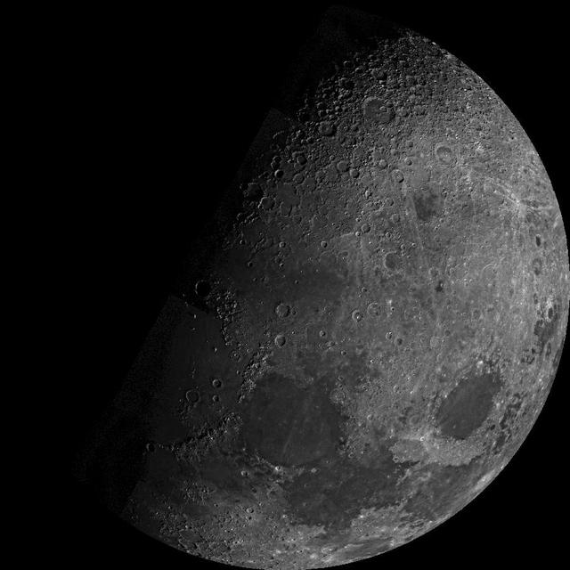
Moon North Pole
Moon North Pole
Mercury south pole was photographed by one of NASA Mariner 10 TV cameras; the pole is located inside the large crater on Mercury limb lower center.
Mercury South Pole
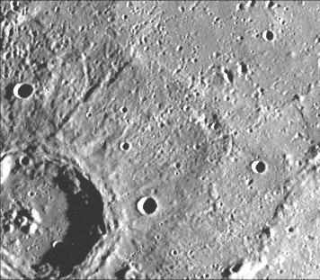
This image, from NASA Mariner 10 spacecraft which launched in 1974, shows young craters superposed on smooth plains. Larger young craters have central peaks, flat floors, terraced walls, and radial ejecta deposits.
Young Craters on Smooth Plains
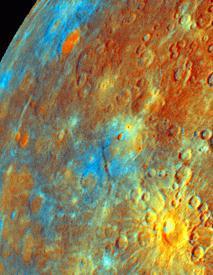
Updated calibration and subsequent mosaicing led to substantial improvements in NASA Mariner 10 color image data; the spacecraft launched in 1974.
Incoming Hemisphere - Enhanced Color
NASA Mariner 10 spacecraft was coaxed into a third and final encounter with Mercury in March of 1975. This is one of the highest resolution images of Mercury acquired by the spacecraft.
High Resolution View of Mercury
NASA Mariner 10 took this picture of the densely cratered surface of Mercury when the spacecraft was 18,200 kilometers 8085 miles from the planet on March 29, 1974.
Mercury Densely Cratered Surface
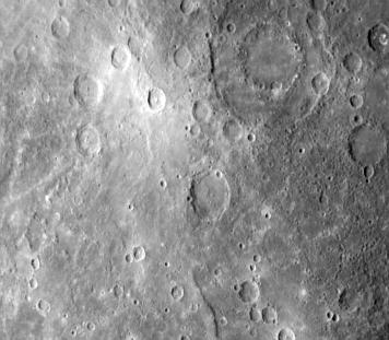
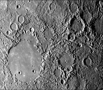
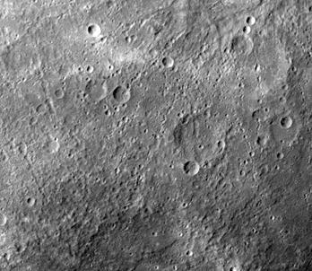
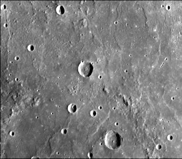
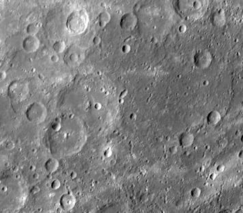
This image, from NASA Mariner 10 spacecraft which launched in 1974, shows intercrater plains and heavily cratered terrain typical of much of Mercury outside the area affected by the formation of the Caloris basin.
Intercrater Plains and Heavily Cratered Terrain
Mars full disk approach view from Mariner 7
This image, from NASA Mariner 10 spacecraft which launched in 1974, is of the southern hemisphere of Mercury.
Mercury Southern Hemisphere
This image, from NASA Mariner 10 spacecraft which launched in 1974, features a 140 kilometer diameter crater and its surrounding zone of secondary craters. T
Large Mercurian Crater
Intercrater plains and heavily cratered terrain typical of much of Mercury outside the area affected by the formation of the Caloris basin are shown in this image taken during the NASA Mariner 10 first encounter with Mercury in 1974.
Intercrater Plains and Heavily Cratered Terrain - First Encounter
Mariner 9 View of Arsia Silva
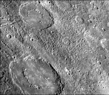
This image, from NASA Mariner 10 spacecraft which launched in 1974, shows several scarps, which appear to be confined to crater floors. The scarp in the crater at the upper left of the image has been diverted by the central peaks.
Scarps Confined to Crater Floors
This image, from NASA Mariner 10 spacecraft which launched in 1974, is of the Michelangelo Quadrangle, which lies in Mercury southern polar region. The Mercurian surface is heavily marred by numerous impact craters.
Mercury: Photomosaic of the Michelangelo Quadrangle H-12
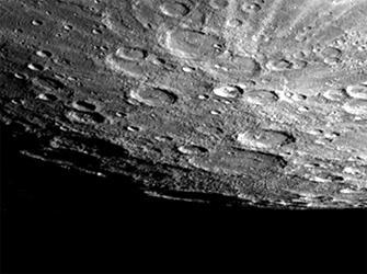
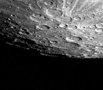
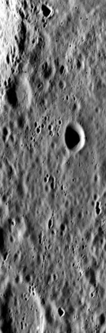
A cratered area near Mercury South Pole was photographed by NASA Mariner 10 during its second flyby of the planet of Sept. 21, 1974 the spacecraft made its first encounter with Mercury on March 19, 1974.
South Pole - Ridges, Scarps, Craters
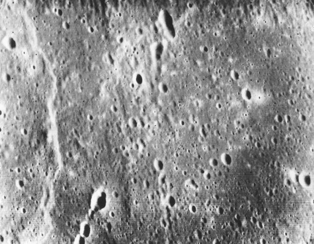
As NASA Mariner 10 approached Mercury at nearly seven miles per second on March 29, 1974, its TV camera took this picture from an altitude of 35,000 kilometers 21,700 miles The picture shows a heavily-cratered surface with many low hills
Mercury Heavily Cratered Surface
This computer generated photomosaic from NASA Mariner 10 is of the southern half of Mercury Shakespeare Quadrangle, named for the ancient Shakespeare crater located on the upper edge to the left of center.  http://photojournal.jpl.nasa.gov/…
Mercury: Photomosaic of the Shakespeare Quadrangle of Mercury Southern Half H-3
This image, from NASA Mariner 10 spacecraft which launched in 1974, shows a crater just north of the Caloris Planitia displays interior and central peaks rising up from a hilly floor.
Interior Peaks and Hilly Floored Crater