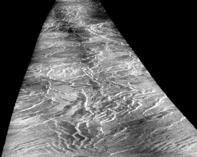
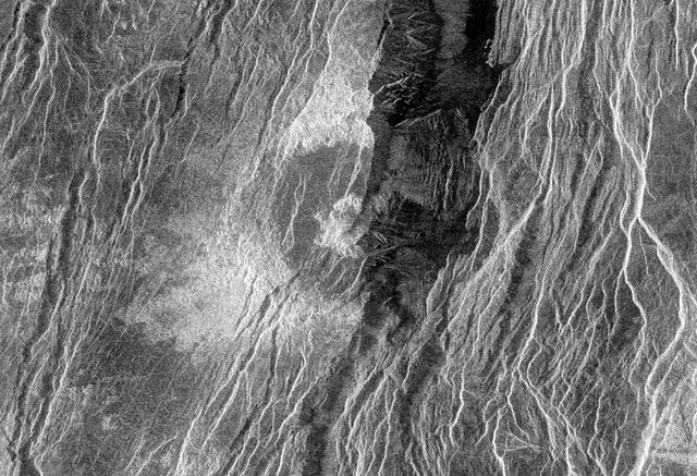
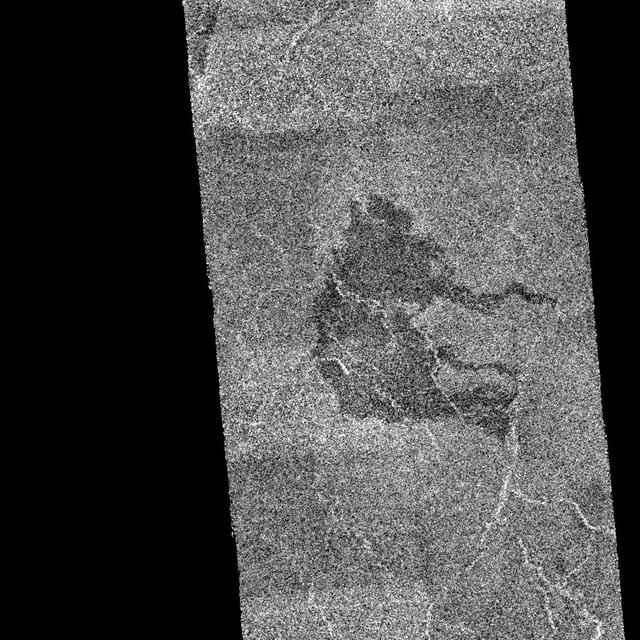
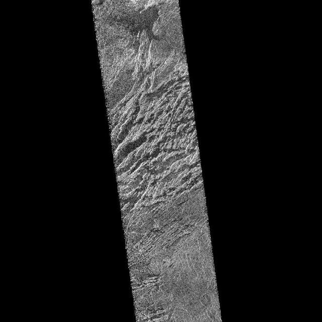
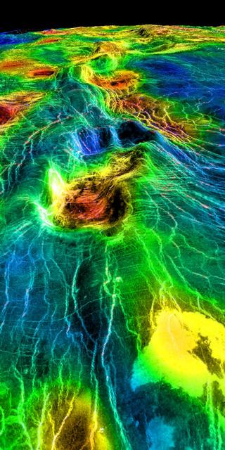
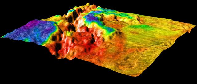
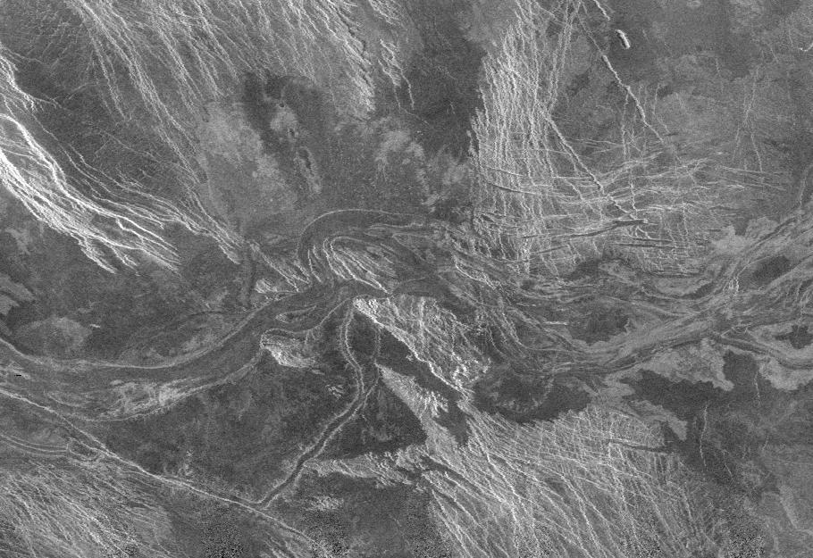
The eastern edge of Alpha Regio is shown in this image from NASA Magellan spacecraft.  http://photojournal.jpl.nasa.gov/catalog/PIA00215
Venus - Alpha Regio
This image is a mosaic of 24 orbits of the Navka region of Venus. The image is centered at about 10 degrees south latitude and 335 degrees east longitude. The image is about 400 km (240 miles) across. 'Behepa 8' marks the approximate landin…
Venus - Venera 8 Landing Site in Navka Region
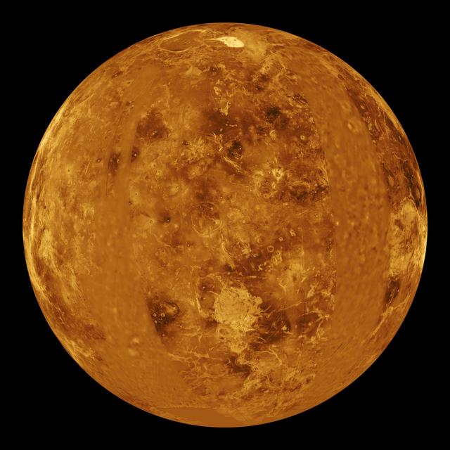
The images used for the base of this globe show the northern and southern hemispheres of Venus as revealed by more than a decade of radar investigations culminating in the 1990-1994 NASA Magellan mission.
Venus Hemispherical Globes
This full resolution radar image from NASA Magellan spacecraft is centered along the eastern edge of Lakshmi Planum and the western edge of Maxwell Montes.  http://photojournal.jpl.nasa.gov/catalog/PIA00241
Venus - Lakshmi Planum and Maxwell Montes
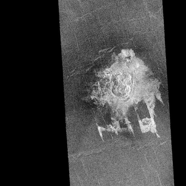
NASA Magellan spacecraft observed remnant landslide deposits apparently resulting from the collapse of volcanic structures. This radar image is centered in the southwestern Navka Region of Venus.  http://photojournal.jpl.nasa.gov/catalog/PI…
Venus - Landslide in Navka Region
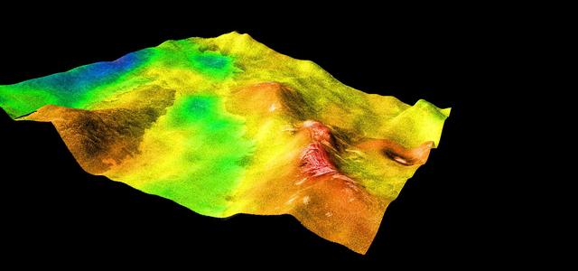
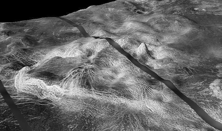
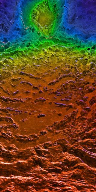
A portion of the eastern edge of Alpha Regio is displayed in this three-dimensional perspective view of the surface of Venus from NASA Magellan spacecraft.  http://photojournal.jpl.nasa.gov/catalog/PIA00246
Venus - 3-D Perspective View of Eastern Edge of Alpha Regio
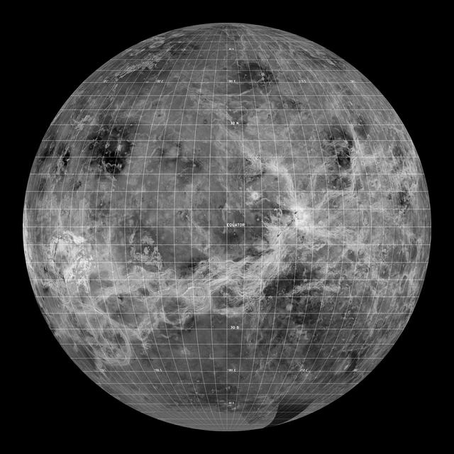
This global view of the surface of Venus is centered at 0 degrees east longitude. NASA Magellan synthetic aperture radar mosaics from the first cycle of Magellan mapping were mapped onto a computer-simulated globe to create this image.   ht…
Venus - Computer Simulated Global View Centered at 0 Degrees East Longitude
Maat Mons is displayed in this 3-dimensional perspective view of the surface of Venus taken by NASA Magellan. The viewpoint is located north of Maat Mons.  http://photojournal.jpl.nasa.gov/catalog/PIA00254
Venus - 3-D Perspective View of Maat Mons
This perspective view of Venus, generated by computer from NASA Magellan data and color-coded with emissivity, shows part of Sedna Planitia and illustrates a common phenomenon of the lowland plains of Venus.  http://photojournal.jpl.nasa.go…
Magellan Perspective View of Sedna Planitia, 45° N, 350° E
A portion of Alpha Regio is displayed in this three-dimensional perspective view of the surface of Venus from NASA Magellan spacecraft. In 1963, Alpha Regio was the first feature on Venus to be identified from Earth-based radar.
Venus - Three-Dimensional Perspective View of Alpha Region
This is a full resolution radar mosaic of the Lavinia region of Venus as seen by NASA Magellan spacecraft. This area shows a diverse set of geologic features.  http://photojournal.jpl.nasa.gov/catalog/PIA00087
Lavinia Region Ridge Belts, Plains and Lava Flows
The view of Venus, after more than a decade of radar investigations culminating in the 1990-1994 NASA's Magellan mission, is centered at 180 degrees east longitude.  http://photojournal.jpl.nasa.gov/catalog/PIA00159
Hemispheric View of Venus Centered at 180° East Longitude
This radar image from NASA Magellan spacecraft shows a region located in a vast plain to the south of Aphrodite Terra. The data for this image was obtained in January 1991.  http://photojournal.jpl.nasa.gov/catalog/PIA00202
Venus - Aine Corona F-MIDR 59S164
This view of the surface of Venus acquired by NASA Magellan spacecraft shows a geographically young region of lowland plains. The location is near the equator between two highland areas known as Asteria Regio and Phoebe Regio.  http://photo…
Venus - Asteria Regio and Phoebe Regio
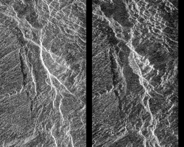
Landslides on Venus! The image on the left was taken in late November of 1990 during Magellan first trip around Venus. The image on the right was taken July 23, as the Magellan spacecraft passed over the region for the second time.  http://…
Venus - Aphrodite Terra
During orbits 404 through 414 on 19-20 September 1990, NASA's Magellan imaged a peak-ring crater that is 50 kilometers in diameter located at latitude 27.4 degrees north and longitude 337.5 degrees east. The name Barton has been proposed by…
Venus - Barton Crater
This perspective view of Venus, generated by computer from NASA Magellan data and color-coded with emissivity, shows the boundary between the lowland plains and characteristic Venusian highland terrain in Ovda Regio.  http://photojournal.jp…
Magellan Perspective View of Ovda Regio, 0° N, 77° E
This computer-generated perspective view of Latona Corona and Dali Chasma on Venus shows NASA Magellan radar data superimposed on topography.  http://photojournal.jpl.nasa.gov/catalog/PIA00268
Venus - 3-D Perspective View of Latona Corona and Dali Chasma
This image from NASA Magellan spacecraft shows a relatively flat plains region composed of many lava flows.  http://photojournal.jpl.nasa.gov/catalog/PIA00082
Venus - Lakshmi Region
This image covers much of Ovda Regio, which forms the western part of Aphrodite Terra. It covers an area about 2,250 kilometers (1,386 miles) wide by 1,300 kilometers (800 miles) north to south, and ranges in latitude from 8 degrees north t…
Venus - Ovda Regio
The view from NASA's Magellan spacecraft shows Yavine Corona, looking northeast. Coronae are roughly circular, volcanic features believed to form over hot upwellings of magma within the Venusian mantle.  http://photojournal.jpl.nasa.gov/cat…
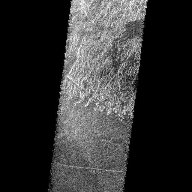
Close-up View of Yavine Corona
This radar image from NASA Magellan is of part of the Phoebe region of Venus. It is a mosaic of parts of revolutions 146 and 147 acquired in the first radar test on Aug. 16, 1990.   http://photojournal.jpl.nasa.gov/catalog/PIA00212
Venus Phoebe Regio
The eastern half of the planet is displayed in this simple cylindrical map of the surface of Venus obtained by NASA Magellan spacecraft.  http://photojournal.jpl.nasa.gov/catalog/PIA00256
Venus - Simple Cylindrical Map of Surface Eastern Half
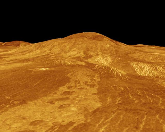
Sif Mons is displayed in this computer-simulated view obtained by NASA's Magellan spacecraft of the surface of Venus.  http://photojournal.jpl.nasa.gov/catalog/PIA00108
Venus - 3-D Perspective View of Sif Mons
This set of three images from NASA Magellan spacecraft, shows a small volcano, lava plains distorted into wrinkle ridges, and some unusual wispy-appearing surface deposits.  http://photojournal.jpl.nasa.gov/catalog/PIA00267
Venus - Cycle 1, 2, and 3 Images of Imdr Region
These radar images show an identical area on Venus (centered at 110 degrees longitude and 64 degrees north latitude) as imaged by the U.S. NASA Magellan spacecraft in 1991 (left) and the U.S.S.R. Venera 15/16 spacecraft in the early 1980's…
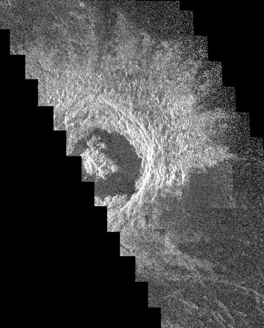
Venus - Comparison of Venera and Magellan Resolutions
This full-resolution image from NASA Magellan spacecraft shows the northern part of the Akna Montes mountains of Venus.   http://photojournal.jpl.nasa.gov/catalog/PIA00250
Venus - Wanda Crater in Akna Montes
This image of the Venusian crater Golubkina, a 340 kilometer 20.4 miles diameter impact crater located at about 60.5 degrees north latitude, 287.2 degrees east longitude, contains NASA Magellan data mosaiced with a Soviet Venera radar image…
Venus - Golubkina Crater
This is full-resolution mosaic from NASA Magellan spacecraft. The bright feature, slightly south of center is interpreted to be a volcano with a large apron of blocky debris to its right and some smaller aprons to its left.  http://photojou…
Venus - Volcano With Massive Landslides
This is a stereo image pair of crater Goeppert-Mayer obtained by NASA Magellan radar mapping mission.   http://photojournal.jpl.nasa.gov/catalog/PIA00269
Venus - Stereo Image Pair of Crater Goeppert-Mayer
This hemispheric view of Venus, as revealed by more than a decade of radar investigations culminating in the 1990-1994 Magellan mission, is centered on the North Pole. NASA Magellan spacecraft imaged more than 98% of Venus.  http://photojou…
Hemispheric View of Venus Centered at the South Pole
Two mosaiced pieces of NASA Magellan image strips display the area east of the Rhea Mons volcano on Venus.  http://photojournal.jpl.nasa.gov/catalog/PIA00208
Venus - Rhea Mons Volcano
This global view of the surface of Venus is centered at 180 degrees east longitude. Magellan synthetic aperture radar mosaics from the first cycle of Magellan mapping, and a 5 degree latitude-longitude grid, are mapped onto a computer-simul…
Venus - Global View Centered at 180 degrees
This mosaic from NASA Magellan data is in the Lavinia region of Venus. Three large impact craters can be seen located in a region of fractured plains.  http://photojournal.jpl.nasa.gov/catalog/PIA00086
Mosaic of Large Impact Craters
This area of Venus northeast of Ushas Mons measures 40 by 112 kilometers 25 by 70 miles and shows evidence of possible explosive volcanism as seen by NASA Magellan spacecraft.  http://photojournal.jpl.nasa.gov/catalog/PIA00213
Venus - Ushas Mons
This perspective view of Venus, generated by computer from NASA Magellan data and color-coded with emissivity, is a look westward across the Fortuna Tessera toward the slopes of Maxwell Montes.  http://photojournal.jpl.nasa.gov/catalog/PIA0…
Looking Westward Across the Fortuna Tessera Right Member of a Synthetic Stereo Pair
This radar image from NASA's Magellan spacecraft is of a half crater located in the rift between Rhea and Theia Montes in Beta Regio on Venus and has been cut by many fractures or faults since it was formed by the impact of a large asteroid…
Venus - Fractured Somerville Crater in Beta Regio
This radar image from NASA Magellan is of part of the Phoebe region of Venus. It is a mosaic of parts of revolutions 146 and 147 acquired in the first radar test on Aug. 16, 1990.  http://photojournal.jpl.nasa.gov/catalog/PIA00211
Venus - Phoebe Region
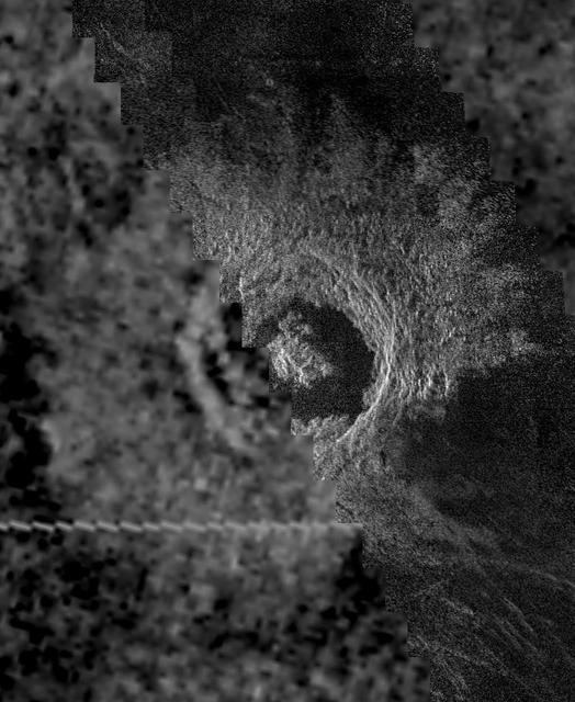
This image mosaic from NASA Magellan spacecraft shows the impact crater Golubkina.  http://photojournal.jpl.nasa.gov/catalog/PIA00236
Venus - Crater Golubkina
NASA' sMagellan imaged this multiple-floored, irregular impact crater at latitude 16.4 degrees north, longitude 352.1 degrees east, during orbits 481 and 482 on 27 September 1990. This crater, about 9.2 kilometers in maximum diameter, was f…
Venus - Multiple-Floored, Irregular Impact Crater
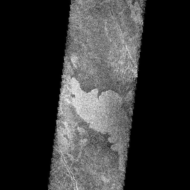
This image from NASA Magellan spacecraft shows an area of dark volcanic lava flows overlying the brighter surrounding plains which are thought to have been formed from older flows.
Venus - Dark Volcanic Lava Flows
This portion of NASA Magellan radar image strip shows a small region on Venus 20 kilometers 12.4 miles wide and 75 km 50 miles long on the east flank of a major volcanic upland called Beta Regio.  http://photojournal.jpl.nasa.gov/catalog/PI…
Venus - Beta Regio
This full-resolution mosaic of Venus, obtained by NASA Magellan spacecraft, shows an area replete with diverse volcanic features.  http://photojournal.jpl.nasa.gov/catalog/PIA00265
Venus - False Color of Volcanic Plains
This false color image from NASA Magellan spacecraft shows a portion of Bereghinya Planitia plains in the northern hemisphere of Venus.  http://photojournal.jpl.nasa.gov/catalog/PIA00259
Venus - False Color of Bereghinya Planitia
This perspective view of Venus, generated by computer from NASA Magellan data and color-coded with emissivity, shows part of the lowland plains in Sedna Planitia. Circular depressions with associated fracture patterns, called coronae.  http…
Sedna Planitia Left Member of a Synthetic Stereo Pair
This perspective view of Venus, generated by computer from NASA Magellan data and color-coded with emissivity, shows the boundary between the lowland plains and characteristic Venusian highland terrain in Ovda Region.  http://photojournal.j…
Magellan Perspective View of Ovda Regio, 0° S, 129° E
This image from the Atla region of Venus obtained by NASA Magellan spacecraft shows several types of volcanic features and superimposed surface fractures.  http://photojournal.jpl.nasa.gov/catalog/PIA00201
Venus - Volcanic features in Atla Region
This NASA Magellan radar image mosaic is of part of Venus, centered at 51 degrees south latitude, 21 degrees east longitude. Running from west to east across the center of the image is part of a wide lava channel in the Lada Terra region of…
Venus - Lada Terra Region