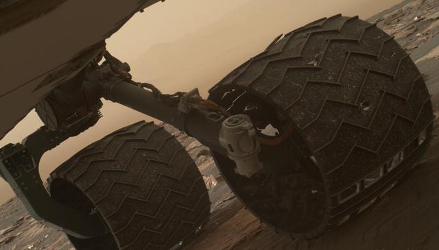
Two of the raised treads, called grousers, on the left middle wheel of NASA's Curiosity Mars rover broke during the first quarter of 2017, including the one seen partially detached at the top of the wheel in this image from the Mars Hand Le…
Break in Raised Tread on Curiosity Wheel
This self-portrait of NASA's Curiosity Mars rover shows the vehicle at the "Big Sky" site, where its drill collected the mission's fifth taste of Mount Sharp.  The scene combines dozens of images taken during the 1,126th Martian day, or sol…
Curiosity Self-Portrait at Big Sky Drilling Site
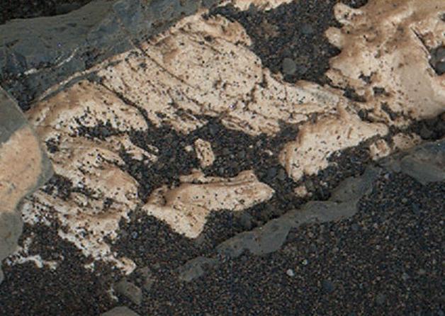
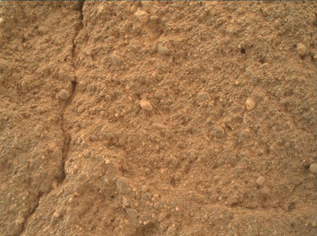
This view from the Mars Hand Lens Imager (MAHLI) on the arm of NASA's Curiosity Mars rover shows texture within a light-toned vein at a site called "Garden City" on lower Mount Sharp.  The area shown is roughly 0.9 inch (2.2 centimeters) wi…
Crystal Growth Texture in Light Vein at Garden City
nal Caption Released with Image:      This graphic maps locations of the sites where NASA's Curiosity Mars rover collected its first 19 rock or soil samples for analysis by laboratory instruments inside the vehicle. It also presents images…
Curiosity Rock or Soil Sampling Sites on Mars, Through November 2016
The network of cracks in this Martian rock slab called "Old Soaker" may have formed from the drying of a mud layer more than 3 billion years ago. The view spans about 4 feet (1.2 meters) left-to-right and combines three images taken by the…
Possible Mud Cracks Preserved in Martian Rock
This view of a sandstone target called "Big Arm" covers an area about 1.3 inches (33 millimeters) wide in detail that shows differing shapes and colors of sand grains in the stone.  Three separate images taken by the Mars Hand Lens Imager (…
Diverse Grains in Mars Sandstone Target Big Arm
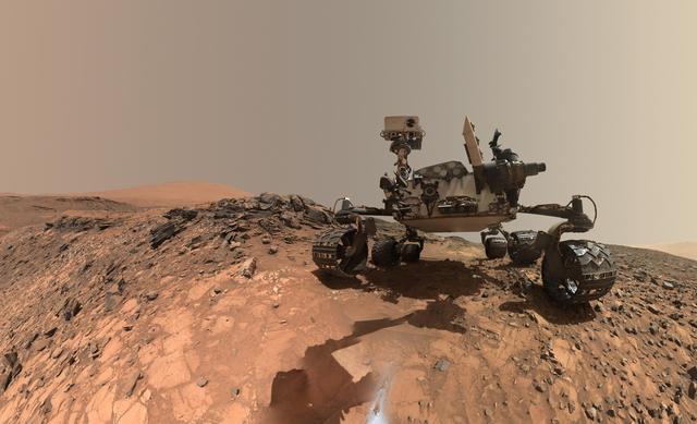
This low-angle self-portrait of NASA's Curiosity Mars rover shows the vehicle above the "Buckskin" rock target, where the mission collected its seventh drilled sample. The site is in the "Marias Pass" area of lower Mount Sharp.  The scene c…
Curiosity Low-Angle Self-Portrait at Buckskin Drilling Site on Mount Sharp
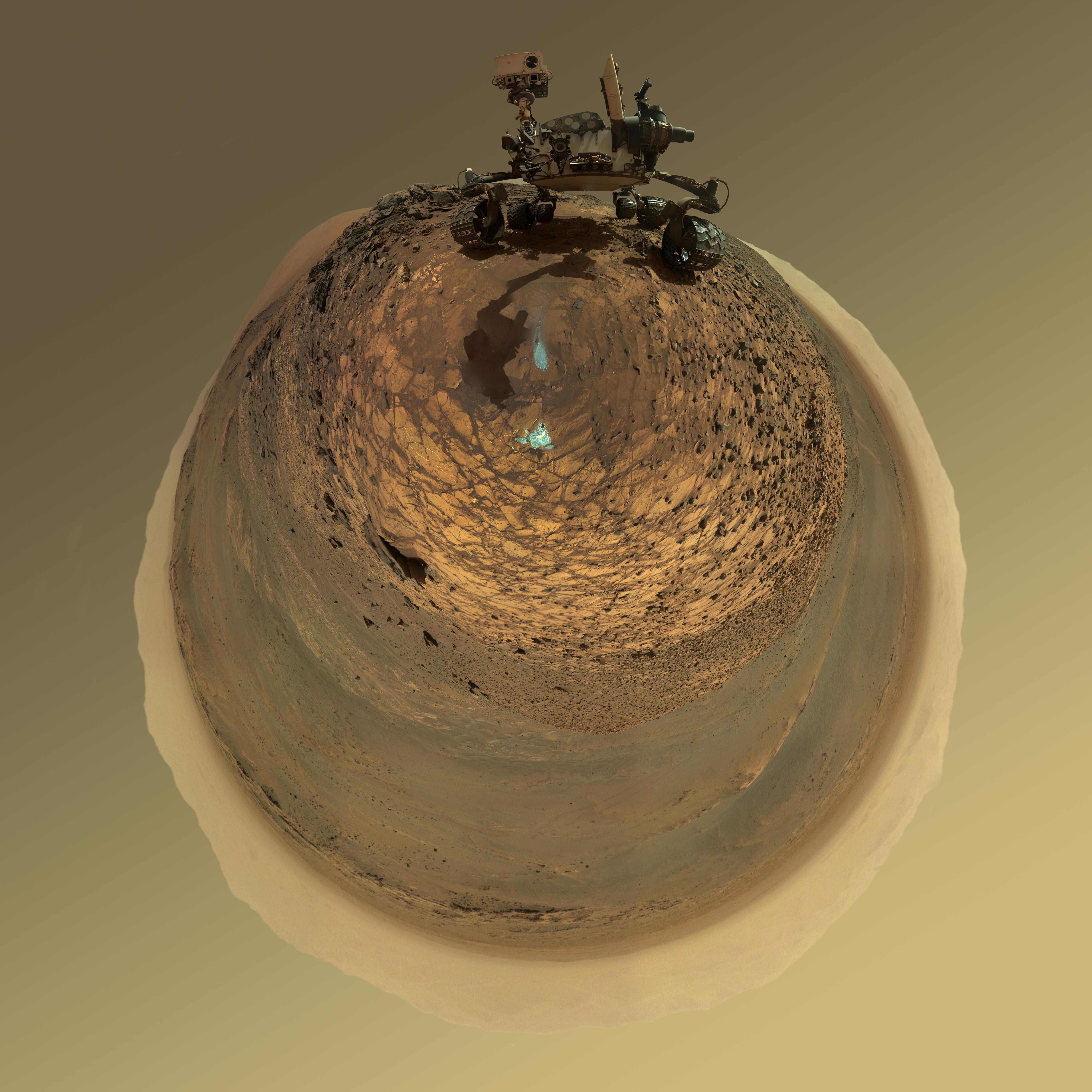
This version of a self-portrait of NASA's Curiosity Mars rover at a drilling site called "Buckskin" on lower Mount Sharp is presented as a stereographic projection, which shows the horizon as a circle.  It is a mosaic assembled from the sam…
Round-Horizon Version of Curiosity Low-Angle Selfie at Buckskin
This graphic maps locations of the sites where NASA's Curiosity Mars rover collected its first 18 rock or soil samples for analysis by laboratory instruments inside the vehicle. It also presents images of the drilled holes where 14 rock-pow…
Curiosity First 16 Rock or Soil Sampling Sites on Mars
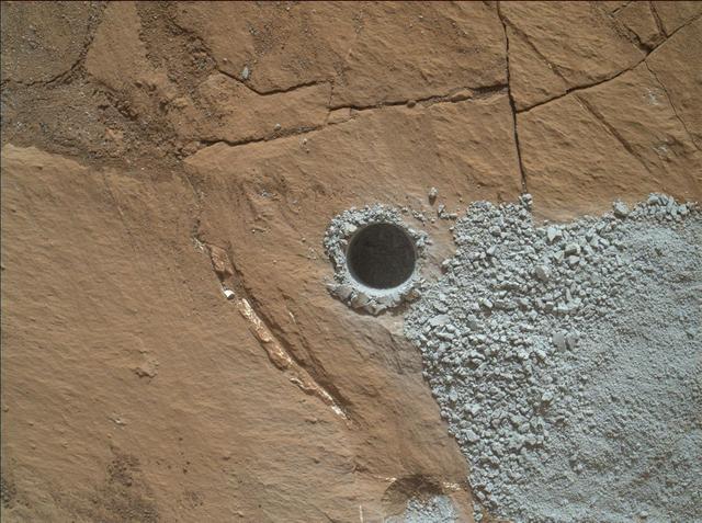
NASA's Curiosity Mars Rover drilled this hole to collect sample material from a rock target called "Buckskin" on July 30, 2015, during the 1060th Martian day, or sol, of the rover's work on Mars. The diameter is slightly smaller than a U.S.…
Hole at Buckskin Drilled Days Before Landing Anniversary
A rock outcrop dubbed "Missoula," near Marias Pass on Mars, is seen in this image mosaic taken by the Mars Hand Lens Imager on NASA's Curiosity rover. Pale mudstone (bottom of outcrop) meets coarser sandstone (top) in this geological contac…
Contact Zone: Missoula
This low-angle self-portrait of NASA's Curiosity Mars rover shows the vehicle at the site from which it reached down to drill into a rock target called "Buckskin" on lower Mount Sharp.  The selfie combines several component images taken by…
Looking Up at Mars Rover Curiosity in Buckskin Selfie
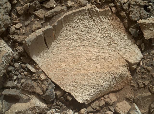
A rock fragment dubbed "Lamoose" is shown in this picture taken by the Mars Hand Lens Imager (MAHLI) on NASA's Curiosity rover. Like other nearby rocks in a portion of the "Marias Pass" area of Mt. Sharp, Mars, it has unusually high concent…
High-Silica Lamoose Rock
No more images