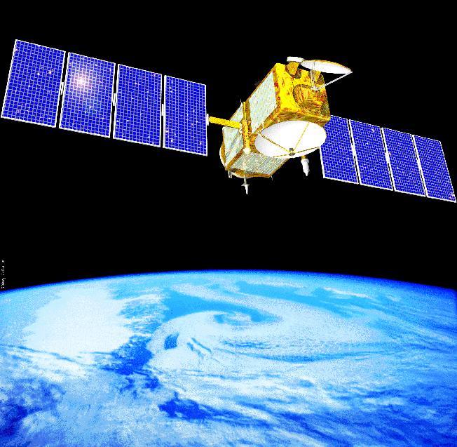
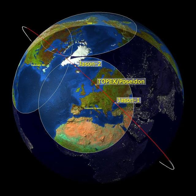
This image is a family portrait of Topex/Poseidon, Jason-1 and Ocean Surface Topography Mission/Jason-2 OSTM/Jason-2, NASA satellites that have measured global sea surface heights since 1992.
Altimeter Family Portrait: Topex/Poseidon, Jason-1 and OSTM/Jason-2
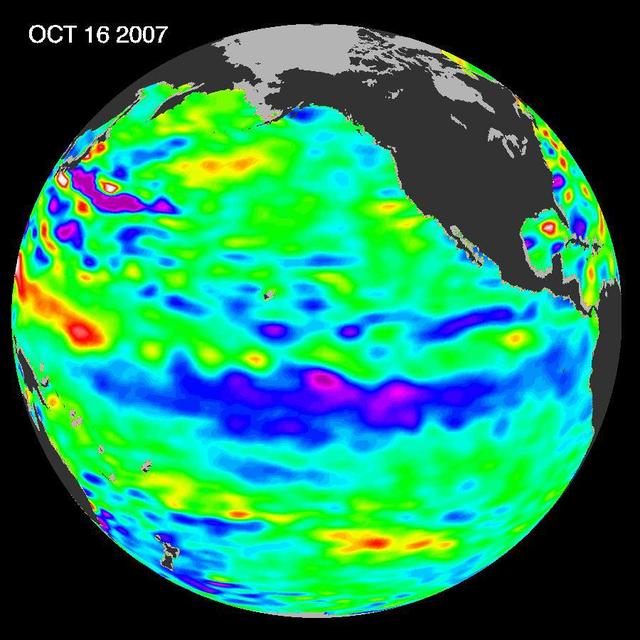
The tropical Pacific Ocean remains in the grips of a cool La Niña, as shown by new data of sea-level heights from mid-October of 2007, collected by NASA U.S-French Jason altimetric satellite.
La Niña Persists
The tropical Pacific Ocean is beginning to exhibit the characteristics of a developing La Niña condition.
She Back? La Niña Developing?
This sea surface height map of the Gulf of Mexico, with the Florida peninsula on the right and the Texas-Mexico Gulf Coast on the left, is based on altimeter data from four satellites including NASA’s Topex/Poseidon and Jason. Red indicates…
Rita Roars Through a Warm Gulf September 22, 2005
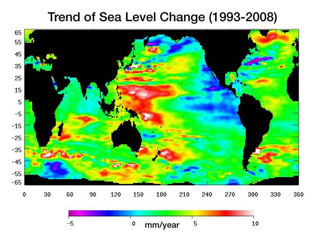
Warming water and melting land ice have raised global mean sea level 4.5 centimeters 1.7 inches from 1993 to 2008. But the rise is by no means uniform.
Portrait of a Warming Ocean and Rising Sea Levels:<br />Trend of Sea Level Change 1993-2008
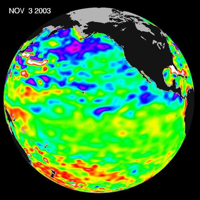
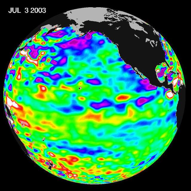
Some climate forecast models indicate there is an above average chance that there could be a weak to borderline El Niño by the end of November 2003. However, the trade winds, blowing from east to west across the equatorial Pacific Ocean, re…
A Mostly Quiet Pacific
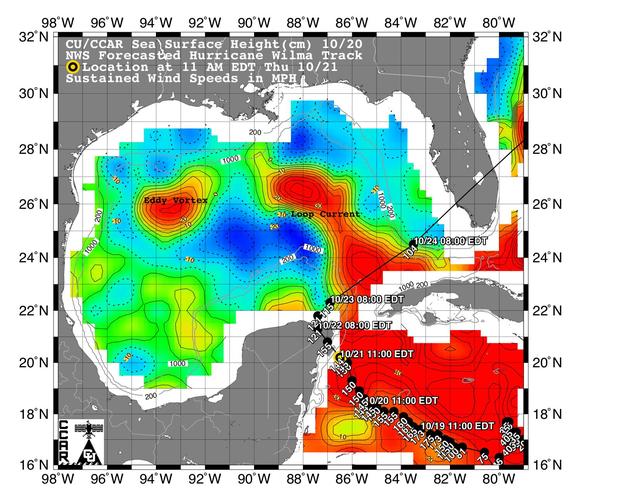
This sea surface height map of the Gulf of Mexico and the northwestern Caribbean Sea, with the Florida peninsula on the upper right, is based on altimeter data from three satellites including NASA Jason-1.
Wilma Trek Through Warm Caribbean/Gulf Waters
Artist concept of NASA's Jason 1 spacecraft from December, 2002.  http://photojournal.jpl.nasa.gov/catalog/PIA04237
Artist Concept of Jason 1
Recent sea-level height data from NASA Jason-1 altimetric satellite show that continuing weaker-than-normal trade winds in the western and central equatorial Pacific have triggered another strong, eastward moving, warm Kelvin wave.
Jason Celebrates 5th Anniversary as El Niño Builds, Warm Kelvin Wave Surges Toward South America
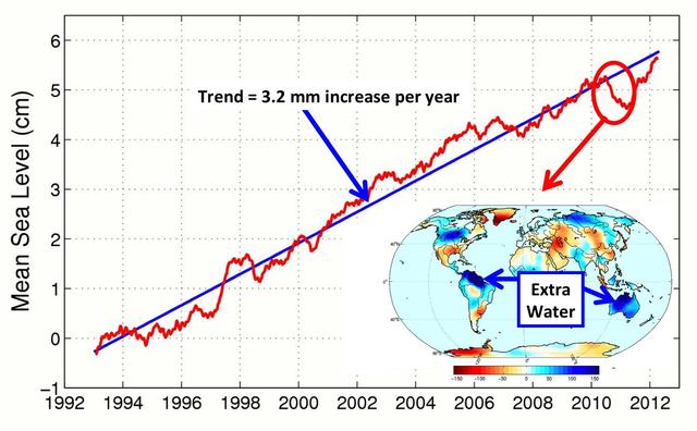
This figure shows changes in global mean sea level as measured by satellite altimetry NASA/CNES Topex/Poseidon and Jason-1; and NASA/CNES/NOAA/EUMETSAT Jason-2 between 1992 to 2012.
After Brief Dip, Global Mean Sea Level Resumes Climb
SpaceX Crew-1 NASA astronauts, from left to right, Shannon Walker, Victor Glover, Mike Hopkins, and Japan Aerospace Exploration Agency (JAXA) astronaut Soichi Noguchi, right, presents a montage from their mission to Capitol Police officer J…
SpaceX Crew-1 Postflight
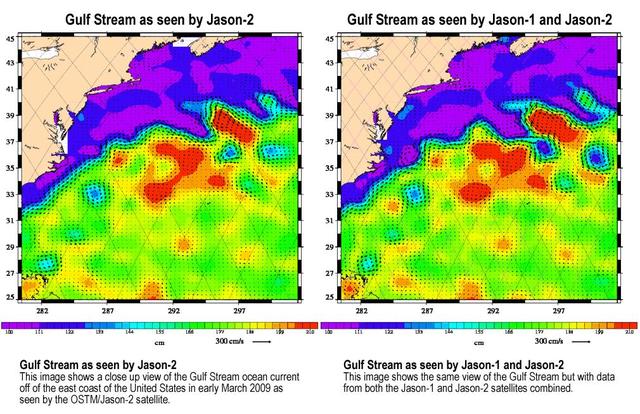
Created with altimeter data from NASA's Ocean Surface Topography Mission (OSTM)/Jason-2 satellite and the Jason-1 satellite, this image shows a portion of the Gulf Stream off the east coast of the United States. It demonstrates how much mor…
OSTM/Jason-2 and Jason-1 Tandem Mission View of the Gulf Stream
The latest remote sensing data from NASA's Jason satellite show that the equatorial Pacific sea surface levels are higher, indicating warmer sea surface temperatures in the central and west Pacific Ocean. This pattern has the appearance of…
Pacific Dictates Droughts and Drenchings
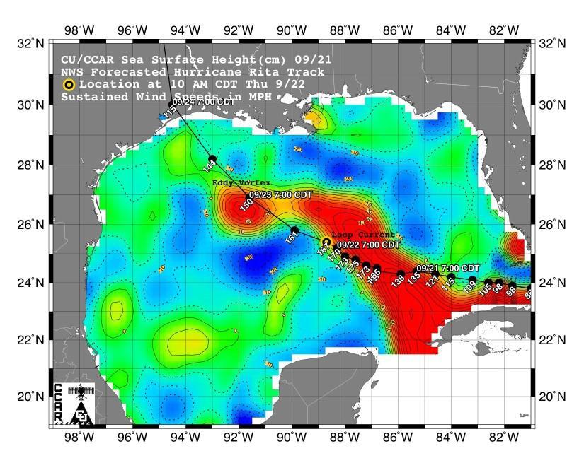
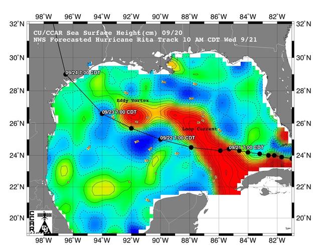
This sea surface height map of the Gulf of Mexico, with the Florida peninsula on the right and the Texas-Mexico Gulf Coast on the left, is based on altimeter data from four satellites including NASA’s Topex/Poseidon and Jason.
Rita Roars Through a Warm Gulf September 21, 2005
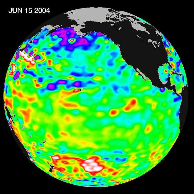
Recent sea level height data from NASA U.S./France Jason altimetric satellite during a 10-day cycle ending June 15, 2004.
Pacific Decadal Oscillation Influences Drought June 15, 2004
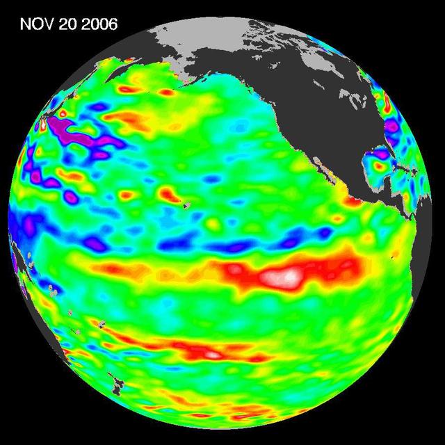
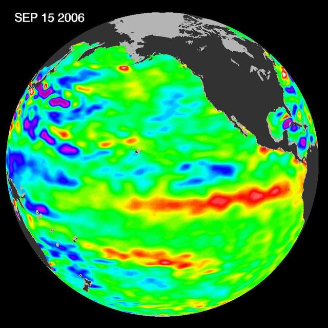
In September 2006, NASA satellite data indicated that El Niño had returned to the tropical Pacific Ocean, although it was relatively weak.
Jason Satellite Observes Mild El Nino in 2006
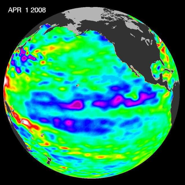
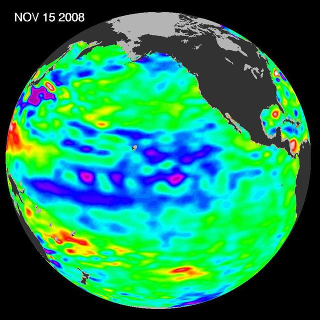
One of the strongest La Niñas in many years is slowly weakening but continues to blanket the Pacific Ocean near the equator, as shown by new sea-level height data collected by NASA U.S.-French Jason oceanographic satellite.
Larger Pacific Climate Event Helps Current La Niña Linger
Displayed in blue color is the height of sea surface (shown in blue) measured by the Jason satellite two hours after the initial magnitude 9 earthquake hit the region (shown in red) southwest of Sumatra on December 26, 2004. The data were t…
NASA/French Satellite Data Reveal New Details of Tsunami
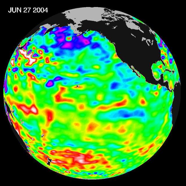
Recent sea level height data from NASA U.S./France Jason altimetric satellite during a 10-day cycle ending June 27, 2004.
Pacific Decadal Oscillation Influences Drought June 27, 2004
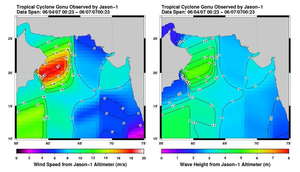
This pair of images from the radar altimeter instrument on NASA U.S./France Jason mission reveals information on wind speeds and wave heights of Tropical Cyclone Gonu, which reached Category 5 strength in the Arabian Sea prior to landfall i…
Jason Tracks Powerful Tropical Cyclone Gonu High Winds, Waves
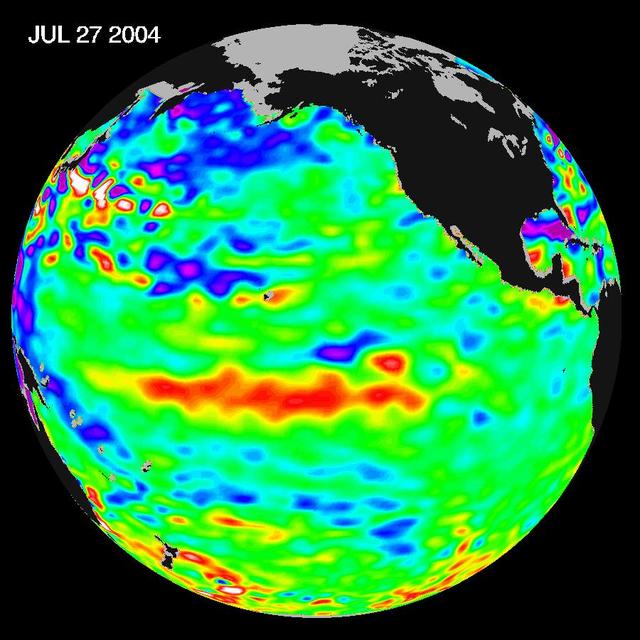
Sea-level height data from NASA U.S./France Jason altimetric satellite during a 10-day cycle ending July 27, 2004, show weaker than normal trade winds in the western and central equatorial Pacific have triggered an eastward moving, warm Kel…
Warm Pacific Water Wave Heads East, But No El Niño Yet
Visit to GRC by the Deputy Administrator, James Morhard
This is the first global map of ocean surface topography produced with data from the new interleaved tandem mission of NASA Jason-1 and Ocean Surface Topography Mission OSTM/Jason-2 satellites.
First Jason-1 and OSTM/Jason-2 Tandem Global View
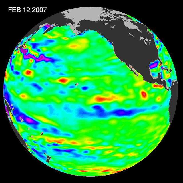
New data of sea-level heights from early February, 2007, by the Jason altimetric satellite show that the tropical Pacific Ocean has transitioned from a warm El Niño to a cool La Niña condition during the prior two months
Pacific Shows Signs of Morphing From Warm El Nino To Cool La Nina
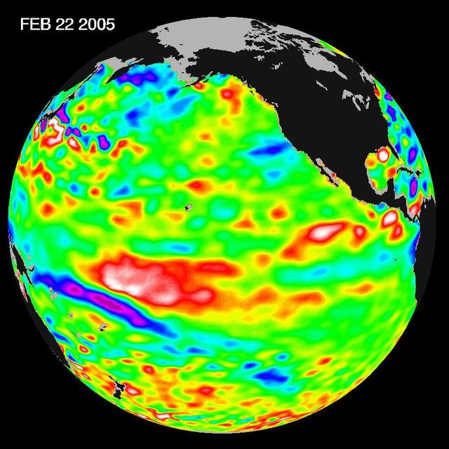
Recent sea-level height data from NASA U.S./France Jason altimetric satellite during a 10-day cycle ending February 22, 2005, show that the central equatorial Pacific continues to exhibit an area of higher-than-normal sea surface heights.
El Niño: The Weak, Getting Weaker
Since the weak El Niño event of last winter, the equatorial Pacific has cooled and oceanographers have been on a La Niña watch. Thus far, equatorial waters have seesawed between cooling and the present slight warming.
Where is La Niña?
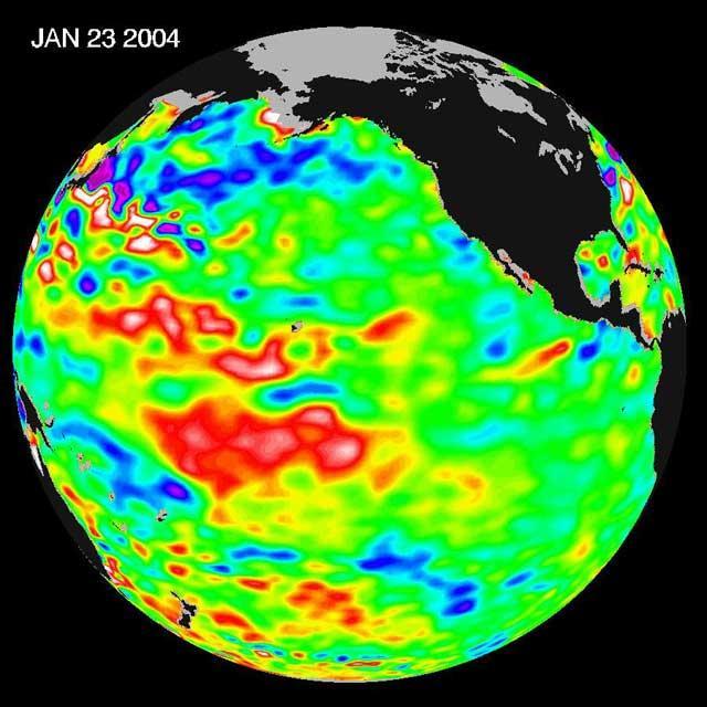
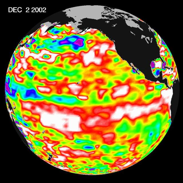
The latest image from NASA Jason oceanography satellite, taken during a 10-day collection cycle ending December 2, 2002, shows the Pacific dominated by two significant areas of higher-than-normal sealevel warmer ocean temperatures.
El Niño Continues to Grow
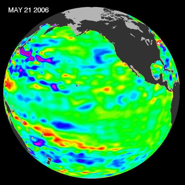
In early 2006, a weak La Niña event kept the temperatures in the Pacific Ocean along the equator a little cooler than normal.
Pacific Climate Calm
The latest image of sea-surface height measurements from NASA U.S./French Jason-1 oceanography satellite shows the Pacific Ocean remains locked in a strong, cool phase of the Pacific Decadal Oscillation.
Oscillation Rules as the Pacific Cools
Tropical Cyclone Heat Potential TCHP field in the Gulf of Mexico during September 22, 2005. The path of Hurricane Rita is indicated with circles spaced every 3 hours with their size and color representing intensity see legend.
NASA Data Helps Track Heat Potential Fueling Rita
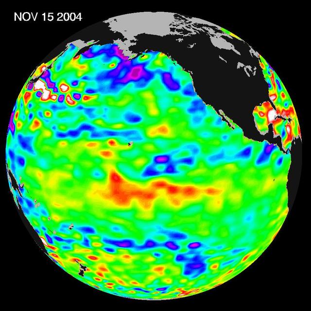
Recent sea-level height data from NASA U.S./France Jason altimetric satellite during a 10-day cycle ending November 15, 2004.
El Nino: Pumping Up or Fizzling Out?
JASON ELDRIDGE, AN ERC INCORPORATED EMPLOYEE SUPPORTING THE MATERIALS & PROCESSES LABORATORY AT NASA'S MARSHALL SPACE FLIGHT CENTER, SIGNS HIS NAME ON THE INTERIOR OF THE ADAPTER THAT WILL CONNECT THE ORION SPACECRAFT TO A UNITED LAUNCH ALL…
1301253
No more images