On Sunday, Nov. 12, 2017, a magnitude 7.3 earthquake struck along the Iran-Iraq border near Halabjah, Iraq. The earthquake was felt as far away as Kuwait, Qatar, Turkey, Lebanon and Israel. Extensive damage and numerous casualties were repo…
Iran-Iraq Border Quake Region Imaged by NASA Satellite
AS7-05-1615 (12 Oct. 1968) --- Persian Gulf coastal area of Iran, Qeshm Island, as seen from the Apollo 7 spacecraft during its 24th revolution of Earth. Photographed from an altitude of approximately 130 nautical miles, at ground elapsed t…
Persian Gulf are of Iran, Qeshm Island, as seen from the Apollo 7 spacecraft
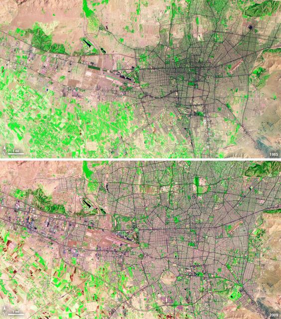
Between 1985 and 2009, the population of Tehran, Iran, grew from six million to just over seven million. The city's growth was spurred largely by migration from other parts of the country. In addition to being the hub of government and asso…
Landsat View: Tehran, Iran
STS058-95-028 (18 Oct-1Nov 1993) --- Lake Urmia (Orumiyeh) in the high desert plateau of northwest Iran dominates the center of this northeast-looking view.  The left edge of the view cuts Lake Van in eastern Turkey.  The Caucasus Mountains…
Kurdistan Region, Asia as seen from STS-58
STS-35 Earth observation taken aboard Columbia, Orbiter Vehicle (OV) 102, is of the Persian Gulf area. Major cities and oilfields of the countries of Saudi Arabia (foreground), Iraq (top left), Iran (top center and top right), Kuwait, Bahra…
STS-35 Earth observation of the Persian Gulf area
No more images