On Aug. 27, 2017, the Multi-angle Imaging SpectroRadiometer (MISR) instrument on NASA's Terra satellite passed over then-Tropical Storm Harvey about noon local time, the day after the storm first made landfall in Texas as a Category 4 hurri…
Tropical Storm Harvey Spotted by NASA's MISR
Data from NASA's Soil Moisture Active Passive (SMAP) satellite have been used to create new surface flooding maps of Southeast Texas and the Tennessee Valley following Hurricane Harvey. The SMAP observations detect the proportional cover of…
New NASA Maps Show Flooding Changes In Aftermath of Hurricane Harvey
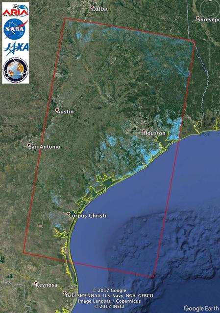
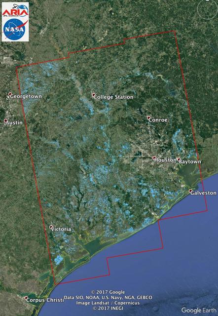
The Advanced Rapid Imaging and Analysis (ARIA) team at NASA's Jet Propulsion Laboratory in Pasadena, California, used synthetic aperture radar imagery from the Japan Aerospace Exploration Agency's (JAXA) ALOS-2 satellite to create this Floo…
Updated NASA Satellite Flood Map of Southeastern Texas (ALOS-2 Data)
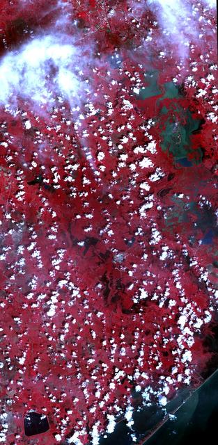
On Sept. 5, 2017, the Advanced Spaceborne Thermal Emission and Reflection Radiometer (ASTER) instrument on NASA's Terra spacecraft captured this image of the area around Bay City, Texas, about 50 miles (80 kilometers) southwest of Houston.…
Hurricane Harvey Flooding Seen in New NASA Satellite Image
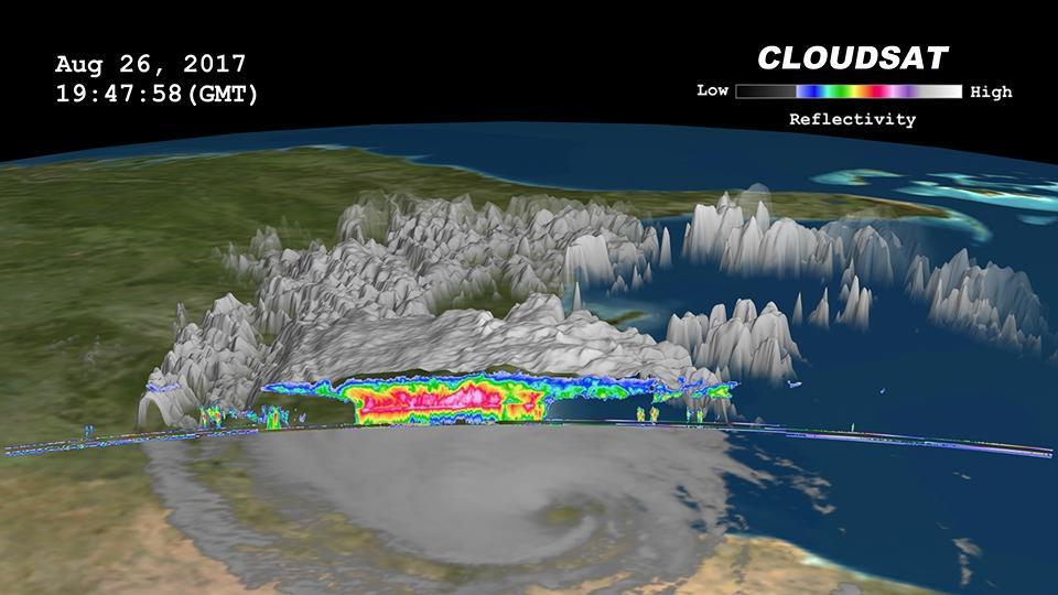
Click on the image for larger animation  NASA's CloudSat satellite flew over then-Tropical Storm Harvey on Aug. 26, 2017, at 2:45 p.m. CDT (19:45 UTC) as the storm was nearly stationary over south Texas. At that time, Harvey contained estim…
NASA's CloudSat Sees Tropical Storm Harvey in 3D
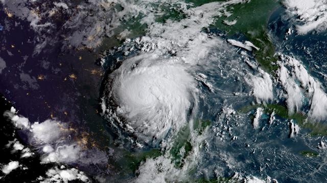
On Aug. 24, the National Hurricane Center noted that Hurricane Harvey was quickly strengthening and is forecast to be a category 3 Hurricane when it approaches the middle Texas coast. In addition, life-threatening storm surge and freshwater…
As expected Harvey has intensified into a Hurricane
Images of soil moisture conditions in Texas near Houston, generated by NASA's Soil Moisture Active Passive (SMAP) satellite before and after the landfall of Hurricane Harvey can be used to monitor changing ground conditions due to Harvey's…
NASA SMAP Images Show Texas Soil Moisture Conditions Before/After Hurricane Harvey's Landfall
The Advanced Rapid Imaging and Analysis (ARIA) team at NASA's Jet Propulsion Laboratory in Pasadena, California, used synthetic aperture radar imagery from the European Space Agency's (ESA) Sentinel-1 satellite to create this Flood Proxy Ma…
New NASA Satellite Flood Map of Southeastern Texas (Sentinel-1 Data)
No more images