Frozen meltwater lake along the northeast Greenland coast, as seen from NASA's P-3B aircraft on May 7, 2012.   Credit: NASA/Jim Yungel  ===========  IceBridge, a six-year NASA mission, is the largest airborne survey of Earth's polar ice eve…
Frozen Greenland Meltpond
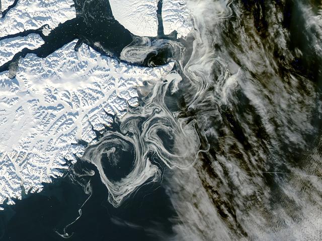
NASA's Aqua satellite observed swirls of sea ice along the coast of Greenland on December 30, 2012.  Credit: NASA/GSFC/Jeff Schmaltz/MODIS Land Rapid Response Team  <b><a href="http://www.nasa.gov/audience/formedia/features/MP_Photo_Guideli…
Southern Greenland
At 1 p.m. EDT (10 a.m. PDT) on Friday, Aug. 28, NASA's Goddard Space Flight Center in Greenbelt, Maryland, will host a live TV program about agency research into how and why the massive Greenland ice sheet is changing. The event features sc…
Greenland ice sheet is changing
Scientists and crew with NASA’s Operation IceBridge, which makes annual aerial surveys of polar ice, are wrapping up their seventh campaign over the Arctic. In spring 2015, the team began using a different research aircraft—an adapted C-130…
Chutes and Fissures in Greenland
On June 15, 2016, the Advanced Land Imager (ALI) on NASA’s Earth Observing-1 satellite acquired a natural-color image of an area just inland from the coast of southwestern Greenland (120 kilometers southeast of Ilulisat and 500 kilometers n…
Early Melt on the Greenland Ice Sheet
NASA's Oceans Melting Greenland airborne mission found that most of Greenland's glaciers that empty into the ocean are at greater risk of rapid ice loss than previously understood. OMG's six-year field campaign studied the ocean's role in g…
Apusiaajik Glacier, Greenland
NASA image acquired October 16, 2012  The MODIS instrument on NASA's Aqua satellite captured this visible image of Sea Ice off eastern Greenland on October 16, 2012.    NASA/GSFC/Jeff Schmaltz/MODIS Land Rapid Response Team  <b><a href="htt…
Sea Ice off eastern Greenland
A wider view of mountains showing the distinctive geology of the Geikie Plateau region in eastern Greenland, as seen from NASA's P-3B aircraft on April 16, 2012.  Credit: NASA/GSFC/Jefferson Beck  ===========  IceBridge, a six-year NASA mis…
Geikie Plateau Peak
James Jacobson, a Data Analyst based out of Ames Research Center, explains his Digital Mapping System instrument to two teachers flying with Operation IceBridge, (top to bottom) Tom Koch Svennesen, of Greenland, and Peter Gross, of Denmark,…
teachers DMS 4 14 1156
On March 31, the P-3 departed Thule, Greenland. IceBridge teams flew a science transit flight to Kangerlussaq, Greenland, where missions will be based for the next several weeks before returning to Thule. Along the route, instruments survey…
Bye to Thule, For Now
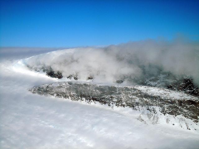
On April 11, 2011, IceBridge finally got the clear weather necessary to fly over glaciers in southeast Greenland, but with clear skies came winds of up to 70 knots. What looks like clouds is actually wind-blown snow. The data could help sci…
Windblown Snow
This spectacular north looking view of south Greenland (62.0N, 46.0W) shows numerous indentations along the coastline, many of which contain small settlements. These indentations are fiords carved by glaciers of the last ice age. Even today…
South Greenland, North Atlantic Ocean
Climate researchers from the National Center for Atmospheric Research (NCAR) and several universities install and perform functional checkouts of a variety of sensitive atmospheric instruments on NASA's DC-8 airborne laboratory prior to beg…
Eric Apel and Alan Hills of the National Center for Atmospheric Research install the Trace Organic Gas Analyzer's sensor probe on the exterior of NASA's DC-8
Climate researchers from the National Center for Atmospheric Research (NCAR) and several universities install and perform functional checkouts of a variety of sensitive atmospheric instruments on NASA's DC-8 airborne laboratory prior to beg…
Eric Scheuer of the University of New Hampshire installs the Soluble Acidic Gases and Aerosol instrument in NASA's DC-8 for the ARCTAS mission
Climate researchers from the National Center for Atmospheric Research (NCAR) and several universities install and perform functional checkouts of a variety of sensitive atmospheric instruments on NASA's DC-8 airborne laboratory prior to beg…
Deedee Montzka of the National Center for Atmospheric Research checks out the NOxyO3 instrument on NASA's DC-8 flying laboratory before the ARCTAS mission
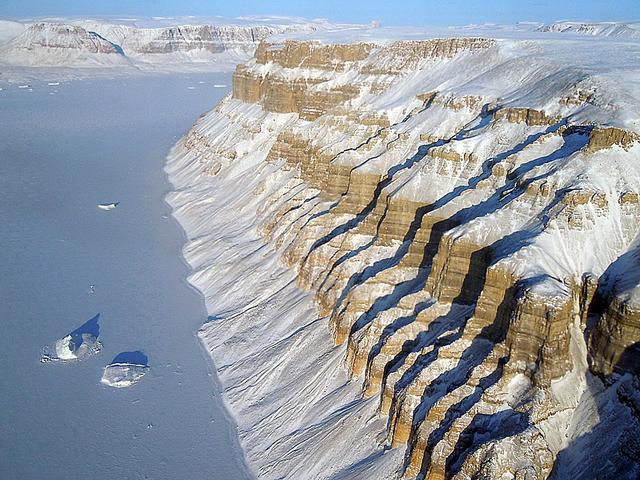
A northern Greenland glacier as seen by NASA's P-3B aircraft on May 3, 2012.    Credit: Michael Studinger/NASA  ===========  IceBridge, a six-year NASA mission, is the largest airborne survey of Earth's polar ice ever flown. It will yield a…
Unnamed Glacial Canyon, Northern Greenland
As the northern hemisphere experiences the heat of summer, ice moves and melts in the Arctic waters and the far northern lands surrounding it. The Moderate Resolution Imaging Spectroradiometer (MODIS) aboard NASA’s Aqua satellite captured t…
Sea ice in the Greenland Sea
NASA's Gulfstream III was one of several research aircraft that NASA's Oceans Melting Greenland mission used during its six-year field campaign to record the temperature, salinity, and depth of the ocean around the entire island. OMG used a…
NASA's OMG at Thule Air Base, Greenland
This image shows a region of the sea floor off the coast of northwest Greenland mapped as part of NASA Oceans Melting Greenland OMG mission. The data shown here will be used to understand the pathways by which warm water can reach glacier e…
NASA OMG Mission Maps Sea Floor Depth off Greenland Coast
In this aerial view, a glacier along Greenland's craggy coastline is actively undergoing undercutting, a process in which meltwater flowing out from the bottom of the glacier enters the fjord. The brown water in front of the glacier is caus…
Glacier Undercutting in Action
On April 8, 2011, IceBridge flew a mission to coastal areas in southwest Greenland. Mountains and an open-water fjord surround one of the mission's targets, a small ice cap called Sukkertoppen Isflade.   Operation IceBridge, now in its thir…
SW Greenland Fjord and Mountain
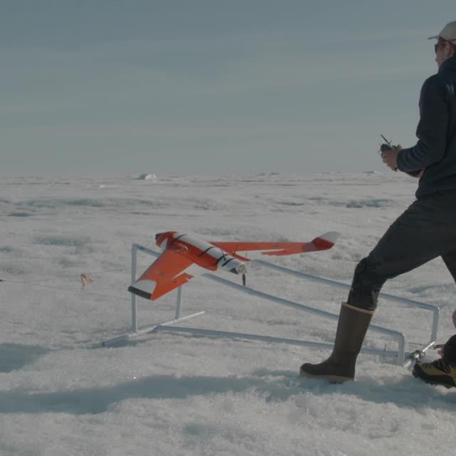
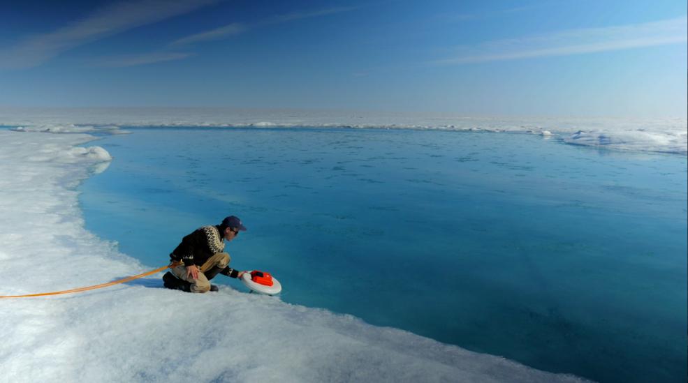
Laurence Smith, chair of geography at University of California, Los Angeles, deploys an autonomous drift boat equipped with several sensors in a meltwater river on the surface of the Greenland ice sheet on July 19, 2015.  “Surface melting i…
greenland_summer_campaign_1
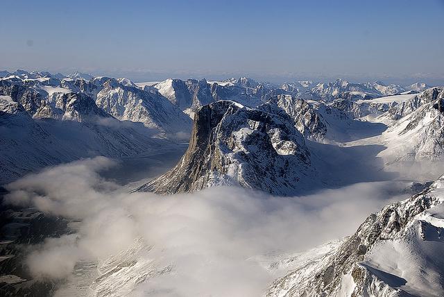
Mountain ridges showing the distinctive geology of the Geikie Plateau region in eastern Greenland, as seen from NASA's P-3B aircraft on April 16, 2012.  Credit: NASA/GSFC/Jefferson Beck  ===========  IceBridge, a six-year NASA mission, is t…
Geikie Plateau Peak
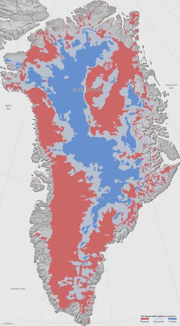
NASA researchers have helped produce the first map showing what parts of the bottom of the massive Greenland Ice Sheet are thawed – key information in better predicting how the ice sheet will react to a warming climate.  Greenland’s thick i…
NASA: First Map Of Thawed Areas Under Greenland Ice Sheet
On April 11, 2011, IceBridge finally got the clear weather necessary to fly over glaciers in southeast Greenland. But with clear skies came winds of up to 70 knots, which made for a bumpy ride over the calving front of glaciers like Gyldenl…
Gyldenlove Glacier
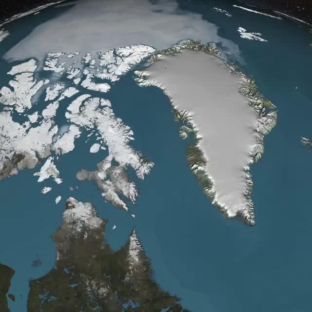
All was well at the North Pole this summer, when Santa and his elves were busily making toys and taking orders for this Christmas. NASA's Terra satellite was able to piece together a number of images it took to give us a complete look at th…
NASA Satellites See Santa's North Pole
Climate researchers from the National Center for Atmospheric Research (NCAR) and several universities install and perform functional checkouts of a variety of sensitive atmospheric instruments on NASA's DC-8 airborne laboratory prior to beg…
Jingqiu Moa and Xinrong Ren check out Pennsylvania State University's Airborne Tropospheric Hydrogen Oxides Sensor instrument during the ARCTAS mission upload
Climate researchers from the National Center for Atmospheric Research (NCAR) and several universities install and perform functional checkouts of a variety of sensitive atmospheric instruments on NASA's DC-8 airborne laboratory prior to beg…
Chris Cantrell and Becky Anderson of the National Center for Atmospheric Research assess the CIMS instrument's operation during ARCTAS mission preparations
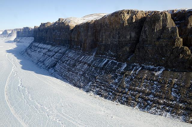
A glacial canyon in northern Greenland as seen by NASA's P-3B aircraft on May 3, 2012.    Credit: Michael Studinger/NASA   ===========  IceBridge, a six-year NASA mission, is the largest airborne survey of Earth's polar ice ever flown. It w…
Unnamed Glacial Canyon, Northern Greenland
Scientists and crew with NASA’s Operation IceBridge, which makes annual aerial surveys of polar ice, are wrapping up their seventh campaign over the Arctic. In spring 2015, the team began using a different research aircraft—an adapted C-130…
Chutes and Fissures in Greenland
The first Norse settlement of Greenland was at Brattahlid (now Qassiarsuk), which yielded a radiocarbon date of about 1000. According to the sagas, it was also in the year 1000 that Leif Erikson left the settlement to explore the regions ar…
Qassiarsuk, Greenland
These images show the mass Greenland's Jakobshavn Glacier has gained from 2016-17, 2017-18 and 2018-19. Areas with the most growth — about 33 yards (30 meters) — are shown in dark blue. Red areas represent thinning. The images were produced…
Jakobshavn Glacier Grows for Third Year in a Row
For five years, Jeremy Harbeck has worked as a support scientist for NASA’s Operation IceBridge, an airborne mission to study polar ice. The data processing that he does typically takes place in an office at NASA’s Goddard Space Flight Cent…
Iceberg in North Star Bay, Greenland
Peering into the thousands of frozen layers inside Greenland’s ice sheet is like looking back in time. Each layer provides a record of what Earth’s climate was like at the dawn of civilization, or during the last ice age, or during an ancie…
Greenland Ice Sheet in 3D Cutaway
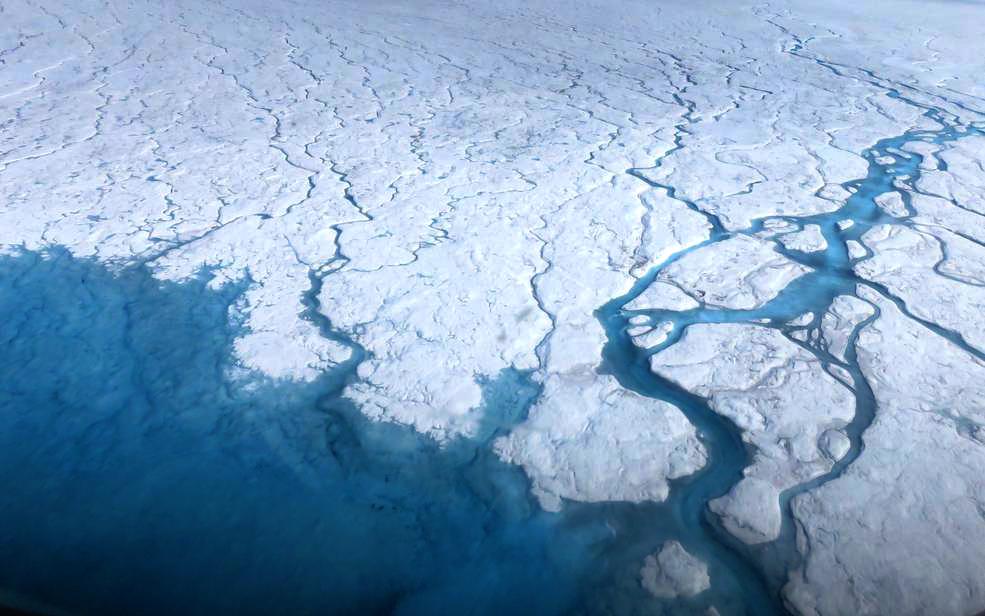
Streams and rivers that form on top of the Greenland ice sheet during spring and summer are the main agent transporting melt runoff from the ice sheet to the ocean.  “Surface melting in Greenland has increased recently, and we lacked a rigo…
greenland_summer_campaign_3
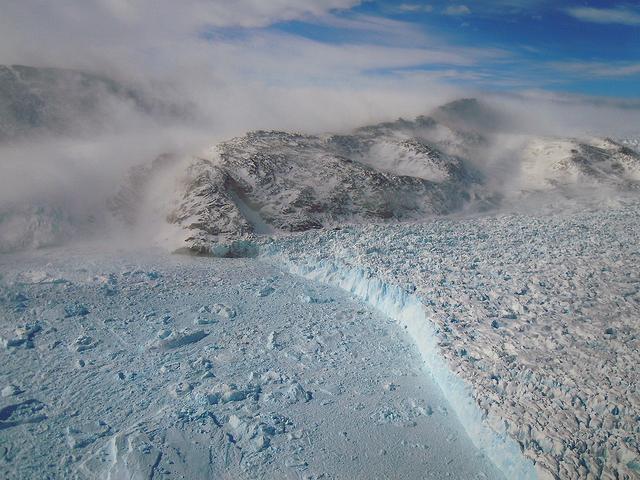
The calving front of the Jakobshavn Glacier in western Greenland, as seen from NASA's P-3B aircraft on April 21, 2012.   Credit: NASA/GSFC/Jefferson Beck  ===========  IceBridge, a six-year NASA mission, is the largest airborne survey of Ea…
Jakobshavn Calving Front
NASA's IceBridge, an airborne survey of polar ice, flew over the Helheim/Kangerdlugssuaq region of Greenland on Sept. 11, 2016. This photograph from the flight captures Greenland's Steenstrup Glacier, with the midmorning sun glinting off of…
NASA's Observes Effects of Summer Melt on Greenland Ice Sheet
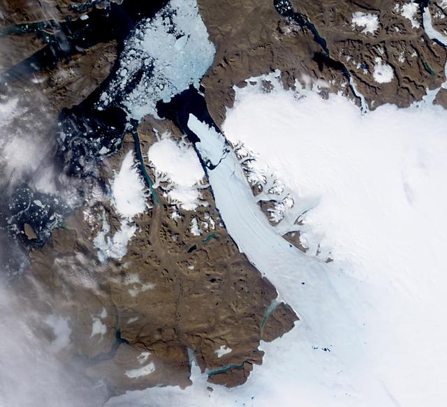
NASA image acquired August 5, 2010  On August 5, 2010, an enormous chunk of ice, roughly 97 square miles (251 square kilometers) in size, broke off the Petermann Glacier, along the northwestern coast of Greenland. The Canadian Ice Service d…
Ice Island calves off Petermann Glacier
This north-looking view of southwestern Greenland was taken in November, 1994, and shows numerous indentations, many of which contain small settlements. These fjords were carved by the glaciers of the last ice age 10,000 years ago. Even tod…
Greenland as seen by the STS-66 shuttle Atlantis
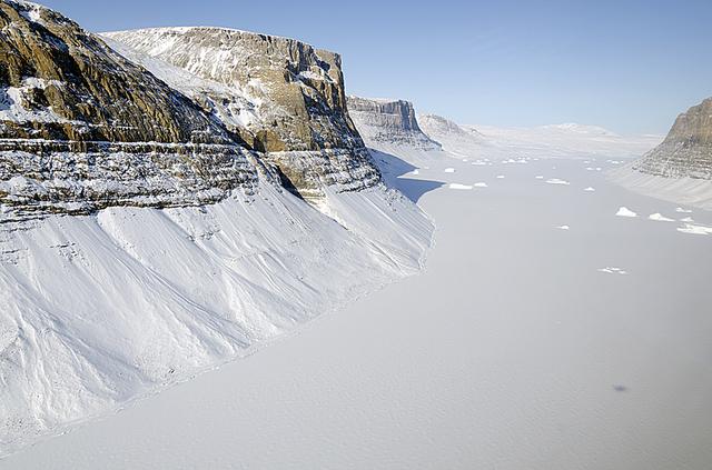
This image of Saunders Island and Wolstenholme Fjord with Kap Atholl in the background was taken during an Operation IceBridge survey flight in April, 2013. Sea ice coverage in the fjord ranges from thicker, white ice seen in the background…
IceBridge Survey Flight Over Saunders Island and Wolstenholme Fjord
NASA's DC-8 flying laboratory lifts off the runway at Air Force Plant 42 in Palmdale, Calif., on its first flight in the ARCTAS atmospheric science mission.
NASA's DC-8 flying laboratory lifts off the runway at Air Force Plant 42 in Palmdale, Calif., on its first flight in the ARCTAS atmospheric science mission
Climate researchers from the National Center for Atmospheric Research (NCAR) and several universities install and perform functional checkouts of a variety of sensitive atmospheric instruments on NASA's DC-8 airborne laboratory prior to beg…
Lee Mauldin inspects the National Center for Atmospheric Research CIMS instrument probe on the exterior of NASA's DC-8 flying lab prior to the ARCTAS mission
No more images