Atmospheric methane is a potent greenhouse gas, but the percentage of it produced through human activities is still poorly understood. Future instruments on orbiting satellites can help address this issue by surveying human-produced methane…
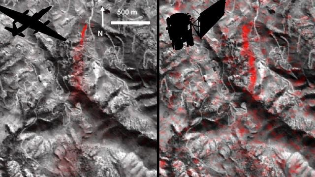
A First: NASA Spots Single Methane Leak from Space
NASA's Airborne Visible Infrared Imaging Spectrometer instrument (AVIRIS), flying aboard a NASA Armstrong Flight Research Center high-altitude ER-2 aircraft, flew over the wildfires burning in Southern California on Dec. 5, 2017 and acquire…
NASA's AVIRIS Instrument Sheds New Light on Southern California Wildfires
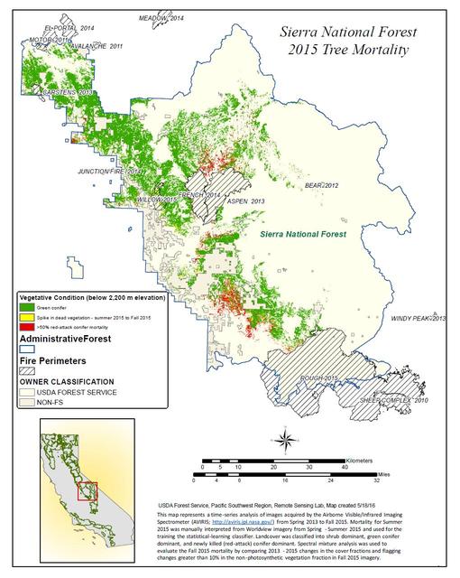
California, reveals the devastating effect of California's ongoing drought on Sierra Nevada conifer forests.  The map will be used to help the U.S. Forest Service assess and respond to the impacts of increased tree mortality caused by the d…
California Drought Effects on Sierra Trees Mapped by NASA
NASA's Airborne Visible Infrared Imaging Spectrometer instrument (AVIRIS), flying aboard a NASA Armstrong Flight Research Center high-altitude ER-2 aircraft, observed wildfires burning in Southern California on Dec. 5-7, 2017. AVIRIS is an…
Multiple Aspects of the Southern California Wildfires as Seen by NASA's AVIRIS
No more images