
Frame of color news-released stills. This was a Tail Cone Off Mission. Crew was made up of Astronauts Engle and Truly. Astronauts Engle, Truly egress Orbiter following flt. DFRC, CA

Frame of color news-released stills. This was a Tail Cone Off Mission. Stack Enterprise and 747 in flight.

Africa's Lake Chad where the borders of Chad, Niger, Nigeria and Cameroon merge (13.0N, 14.0E) has been undergoing change for the past 25 to 30 years when it was first noticed that the lake is drying up. Since then, astronauts have been pho…

At first glance a dry lake bed in the southern California desert seems like the last place to prepare to study ice. But on Oct. 2, 2014, NASA’s Operation IceBridge carried out a ground-based GPS survey of the El Mirage lake bed in Californi…

Evidence of a recent flash flood can be seen in the form of light brown sediment that flowed down gullies and mountain sides forming ponds of debris over agricultural areas in the broad valley near the town of Parras (26.5N, 102.5W). This p…
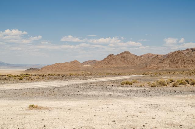
A view of Crater Island from the VADIX Basecamp, Crater Island, Utah June 24, 2026. This area was the site of a series of tests (June 23-25, 2026) of the camera system that will one day fly aboard NASA’s DAVINCI mission to Venus. NASA/Mike…
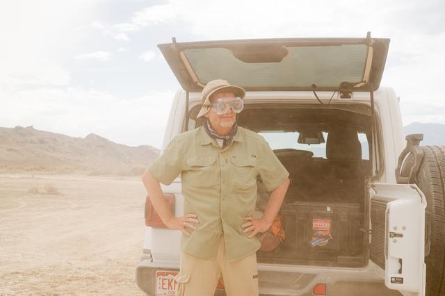
Bob Podgurski wears goggles during a dust event at the DAVINCI VADIX basecamp, Crater Island, Utah, June 24, 2026. This area was the site of a series of tests (June 23-25, 2026) of the camera system that will one day fly aboard NASA’s DAVIN…

SpaceX performed its fourteenth overall parachute test supporting Crew Dragon development. This most recent exercise was the first of several planned parachute system qualification tests ahead of the spacecraft’s first crewed flight and res…

SpaceX performed its fourteenth overall parachute test supporting Crew Dragon development. This most recent exercise was the first of several planned parachute system qualification tests ahead of the spacecraft’s first crewed flight and res…

This view shows the west coast of the United States and Mexico (32.5N, 118.0W) and gives an indication of the range of view from orbital altitude. The visual range of this particular scene is from Skammon's Lagoon on Baja to the northern ti…

SL2-04-018 (June 1973) --- A vertical view of the Arizona-Utah border area showing the Colorado River and Grand Canyon photographed from the Skylab 1/2 space station in Earth orbit. This picture was taken by one of the six lenses of the Ite…

STS003-10-613 (22-30 March 1982) --- A truly remarkable view of White Sands and the nearby Carrizozo Lava Beds in southeast NM (33.5N, 106.5W). White Sands, site of the WW II atomic bomb development and testing facility and later post war n…

The arculate fronts of these apparently converging internal waves off the northeast coast of Somalia (11.5N, 51.5E) probably were produced by interaction with two parallel submarine canyons off the Horn of Africa. Internal waves are packets…

Fog is the only source of moisture for desert dwelling animals and plants living in the Namib Desert sand dune field, Namibia (23.5N, 15.0E). Coastal stratus clouds provide most of the life supporting moisture as fog droplets in this arid l…

PHOTO DATE: 10-20-21 LOCATION: Flagstaff, Arizona - Field Location SUBJECT: Photographic support and coverage of night field evaluation. EVA Test #1 PHOTOGRAPHER: BILL STAFFORD

STS062-108-058 (4-18 March 1994) --- Cairo lies at the apex of the great delta of the Nile: the delta is marked by the strong greens of cultivated lands, Cairo by the gray sprawl along the river and the eastern delta apex as it develops in…

Chuquicamata, in Chile's Atacama Desert, is the largest open pit copper mine in the world, by excavated volume. The copper deposits were first exploited in pre-Hispanic times. Open pit mining began in the early 20th century when a method wa…
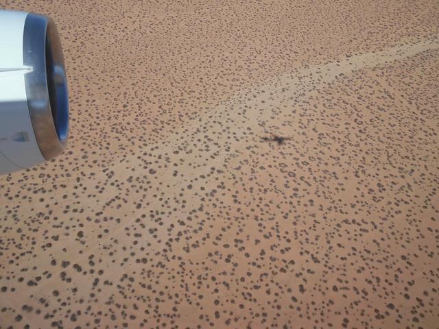
The DC-8 research aircraft casting its shadow on the ground in California's Mojave Desert during an IceBridge instrument check flight. Prior to field campaigns, IceBridge instrument and aircraft teams run the aircraft through a series of te…

STS058-92-064 (18 Oct-1 Nov 1993) --- This oblique view, looking northeast from central Egypt, shows great expanses of the sand covered and rocky Western Desert in the foreground (bottom). The dark patches bottom right are the Dakhla Oases…
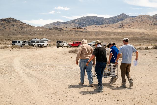
DAVINCI VADIX team carries the VADIX payload from the helicopter back to basecamp so they can retrieve flight data and get the payload back onto the helicopter for the next test flight at Crater Island, Utah, June 24, 2026. NASA/Mike Guinto
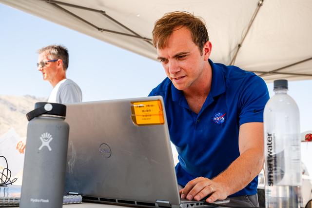
DAVINCI's Matthew Mullin, space laser engineer, reviews data in between test flights at Crater Island, Utah June 24, 2026. NASA/Mike Guinto

SpaceX performed its fourteenth overall parachute test supporting Crew Dragon development. This most recent exercise was the first of several planned parachute system qualification tests ahead of the spacecraft’s first crewed flight and res…
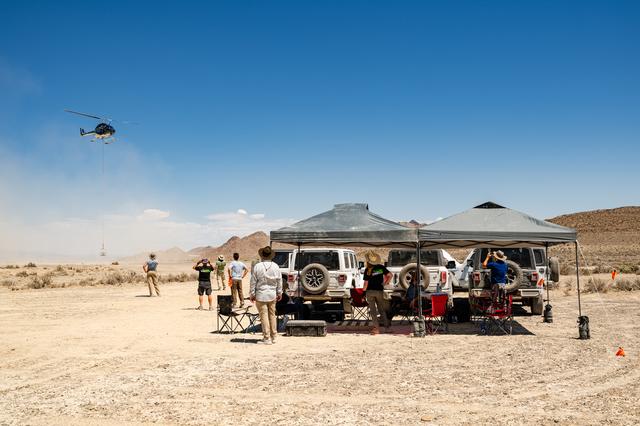
Helicopter carrying the VADIX payload flies past the DAVINCI VADIX base camp in crater island, Utah on June 24, 2026. NASA/Mike Guinto

A front view of the Lunar Electric Rover (LER) during the Desert Research and Technology Studies (RATS) remote field test at Black Point Lava Flow, Arizona in 2008.

STS035-501-007 (2-10 Dec. 1990) --- The STS-35 crewmembers aboard the Earth-orbiting Space Shuttle Columbia photographed this view of the Arid Simpson Desert of Australia with a handheld Rolleiflex camera. Lake Eyre is normally dry; however…
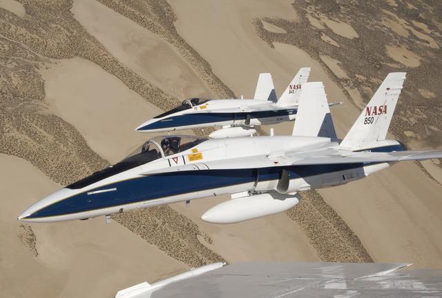
Two NASA Dryden F/A-18s flown by research pilots Frank Batteas and Nils Larson were captured by photographer Lori Losey from a third F/A-18 flown by Dick Ewers as they flew in tight formation over the desert at Edwards Air Force Base.

STS040-151-123 (5-14 June 1991) --- This large format view shows parts of northern Arizona and southern Utah. San Juan River, Lake Powell and Monument Valley are visible. Water of Lake Powell can be seen filling the valleys of the Colorad…

STS054-151-009 (13-19 Jan 1993) --- This large format camera's view shows the circular volcanic structure of the Brandberg mountain, which at 2630 meters (8,550 feet) is the highest point in the new nation of Namibia. The Brandberg is a ma…

SL2-03-192 (22 June 1973) --- Lake Mead, Nevada, (36.0N, 114.5E) where the water from the Colorado River empties after it's 273 mile journey through the Grand Canyon of Arizona is the subject of this photo. Other features of interest are Ho…

Portions of Oman, The United Arab Emirates and Iran are seen at the Strait of Hormuz (26.0N, 56.0E) in this view. A number of ship wakes can be seen in the area of the strait. Sunglint in the Persian Gulf to the northwest, accentuates the c…

One of the driest regions on Earth, the Namib Desert, Namibia, Africa (23.0N, 15.0E) lies adjacent to the Atlantic coast but the upwelling oceanic water causes a very stable rainless atmosphere. The few local inland rivers do not reach the…

Mike Miller demonstrates one of the backpacks his team designed and built for the Desert Research and Technology Studies project's upcoming field test in Arizona. Miller led the team that developed the backpacks. The backpacks are equipped…
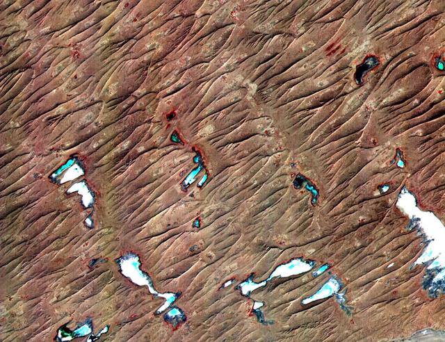
This ASTER sub-scene covers an area of 12 x 15 km in NW India in the Thar Desert. The sand dunes of the Thar Desert constantly shift and take on new shapes. Located in northwestern India and eastern Pakistan, the desert is bounded on the so…

STS049-92-071 (13 May 1992) --- The STS-49 crew aboard the Earth-orbiting Space Shuttle Endeavour captured this Saharan dust storm on the Algeria-Niger border. The south-looking, late-afternoon view shows one of the best examples in the Sh…

A back view of the Lunar Electric Rover (LER) during the Desert Research and Technology Studies (RATS) remote field test at Black Point Lava Flow, Arizona in 2008. Two Mark III spacesuits are visibly mounted on the LER suit port.
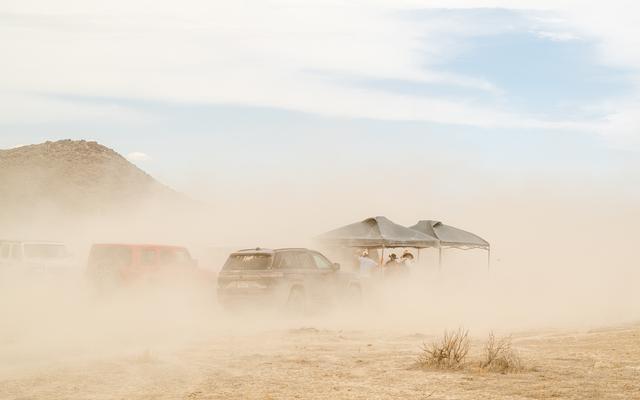
A strong wind kicks up a lot of dirt around the DAVINCI VADIX basecamp at Crater Island, Utah, June 24, 2026. This area was the site of a series of tests (June 23-25, 2026) of the camera system that will one day fly aboard NASA’s DAVINCI mi…
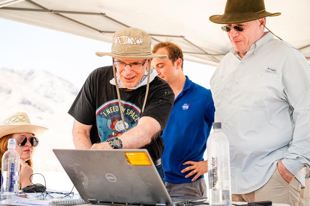
Dr. Jim Garvin, left, and Mike Ravine review flight data inbetween test flights over Crater Island, Utah as part of the DAVINCI VADIX experiment, June 24, 2026. NASA/Mike Guinto

SpaceX performed its fourteenth overall parachute test supporting Crew Dragon development. This most recent exercise was the first of several planned parachute system qualification tests ahead of the spacecraft’s first crewed flight and res…
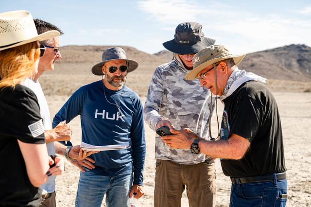
Dr. Jim Garvin, right, discusses flight plans with the pilots in between test flights at Crater Island, Utah, June 24, 2026. NASA/Mike Guinto

Desert Patterns - April 13th, 2003 Description: Seen through the "eyes" of a satellite sensor, ribbons of Saharan sand dunes seem to glow in sunset colors. These patterned stripes are part of Erg Chech, a desolate sand sea in sou…
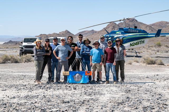
The DAVINCI VADIX dress rehearsal team poses for a group photo at Crater Island, June 4, 2026. From left to right, Erika Kohler, Terra Hardwick, Mike Vitulio, Brent Bos, Will Rivera, Christian Tate, Ben Schumacher, Phil Coulter, Joe Turner,…

STS031-79-015 (24-29 April 1990) --- The 330-plus nautical mile orbital altitude of the Space Shuttle Discovery allowed for this unique high oblique 70mm Hasselblad frame. Egypt is in the foreground, with the Nile River and Lake Nasser re…

STS062-151-182Z (4-18 March 1994) --- This east-looking view shows most of the east-west extent of the country of Sudan. The foreground shows a vegetation-less and almost uninhabited region of northwest Sudan. The rich earth colors are an…

STS001-12-308 (12-14 April 1981) --- Space shuttle Columbia approached Edwards Air Force Base from the left to land at the dry lake at the center. The view is to the southwest. The edge of the light "vee" is the intersection of the San Andr…

STS059-306-034 (9-20 April 1994) --- The radiating transportation pattern of this 20th-Century urban plan is nicely displayed in this high-resolution photograph. Light-toned spots in the desert mark oil well sites; along the south edge of…
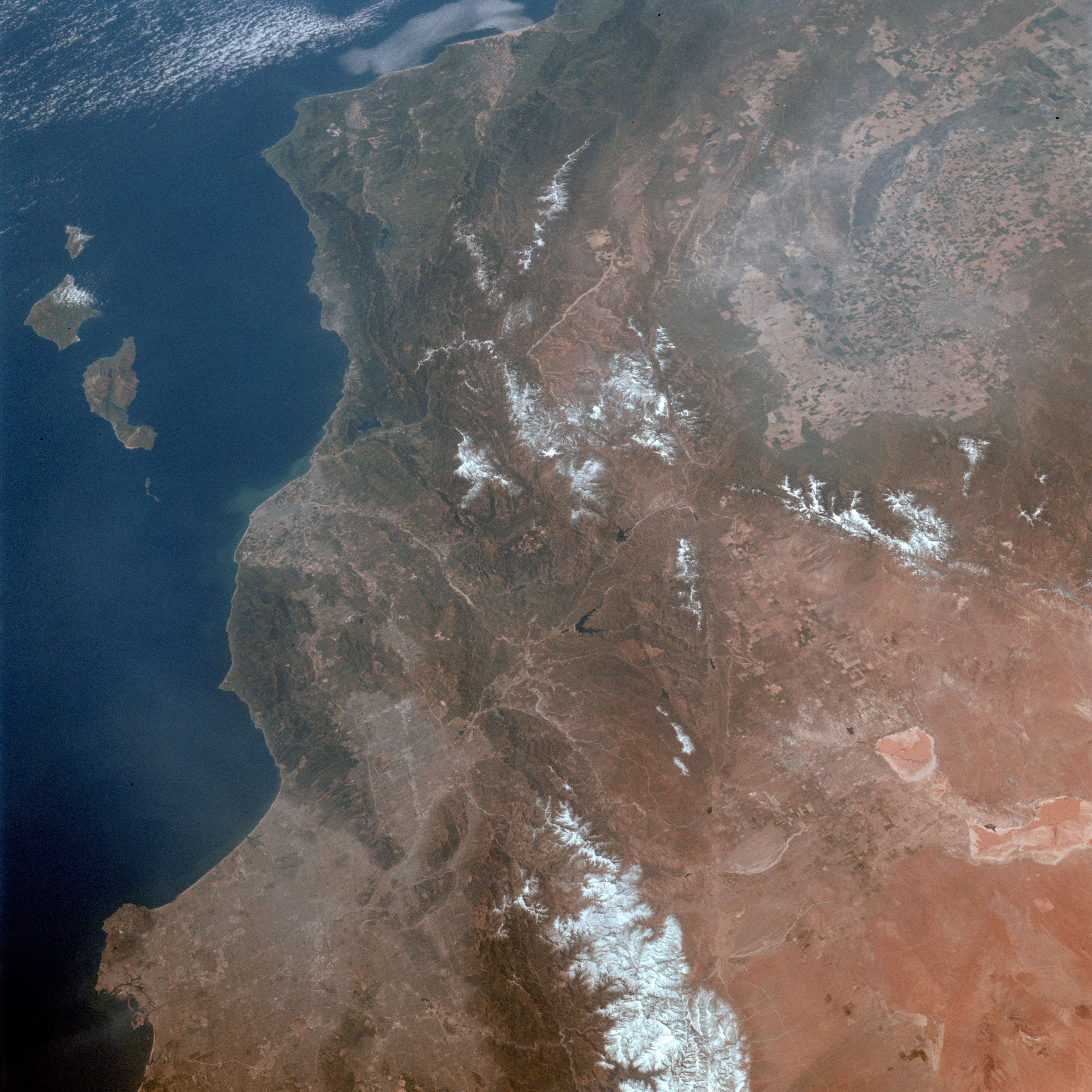
STS003-010-593 (30 March 1982) --- A general view of the greater Los Angeles region of California (34,0N, 118.5W) showing the coastline, Vandenberg AFB, the south end of the Central Valley and the dry lake beds at Edwards AFB. A close look…

STS054-152-189 (13-19 Jan. 1993) --- This near-vertical color photograph shows the very diverse landscape that is part of the great Sahara Desert of north Africa. Specifically, the vast expanse of sand dunes, located in the extreme southwe…

This image of abstract shapes is comprised numerous subparallel, very long, orange colored linear dunes and patchy grey dry lakes (playas). The dunes are aligned north to south in the great central basin of Astralia (27.0S, 138.0E). The reg…