
High Reynolds Channel II and Laser Doppler Velocimeter System, N-231

High Reynolds Channel II and Laser Doppler Velocimeter System, N-231

General Atomics' uninhabited Altair flew a NOAA/NASA coastal mapping, mammal observation and marine monitoring mission off the California coast in late 2005.

Six iROSA solar arrays in the planned configuration will augment the power drawn from the existing arrays on the International Space Station. Power channels shown are 1A, 2B, 3A, 3B, 4A, and 4B.

A thick blanket of low clouds covered the English Channel, Celtic Sea and Irish Sea on March 13, 2014. The fog also crept over major cities in the United Kingdom and Ireland. While citizens living in parts of Ireland, England, Wales, Scotla…

51J-143-126 (5 Oct. 1985) --- The vertical stabilizer of the Earth-orbiting Space Shuttle Atlantis serves to partially frame this scene of Metropolitan Houston. Hold photo with vertical tail at top so that north will be at top. America's fo…

High Reynolds Channel II and Laser Doppler Velocimeter System, N-231
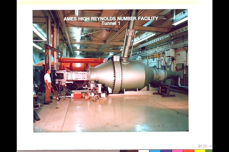
N-231 High Reynolds Number Channel Facility (An example of a Versatile Wind Tunnel) Tunnel 1 I is a blowdown Facility that utilizes interchangeable test sections and nozzles. The facility provides experimental support for the fluid mechanic…

N-231 High Reynolds Number Channel II Facility In this timeframe the test section was designed specifically to test two-dimensional airfoil models. It is equipped with 'through-the-wall' turntables that remotely position the airfoil, with…

iss071e361950 (July 15, 2024) --- The International Space Station's 57.7-foot-long Canadarm2 robotic arm crosses the foreground as the orbital outpost soared 265 miles above the Mozambique Channel south of the African island nation of Madag…

General Atomics' remotely-operated Altair soars over Rogers Dry Lake at Edwards Air Force Base during a NOAA/NASA earth science mission in November 2005.

STS060-103-055 (3-11 Feb 1994) --- This wintertime photograph shows the large city of St. Petersburg Russia at the head of the Gulf of Finland. The city, built by Peter the Great, is situated in the former swampy delta of the Neva River wh…

Long regarded as one of the best photo of Houston, Texas (29.5N, 95.0W), this view from space shows the entire greater Houston/Galveston region in remarkable detail and clarity. The dark north/south line in the water between Houston and Gal…

High Reynolds Channel II and Laser Doppler Velocimeter System, N-231

N-231 High Reynolds Number Channel Facility (4x6 Inch Channel - Atmospheric)
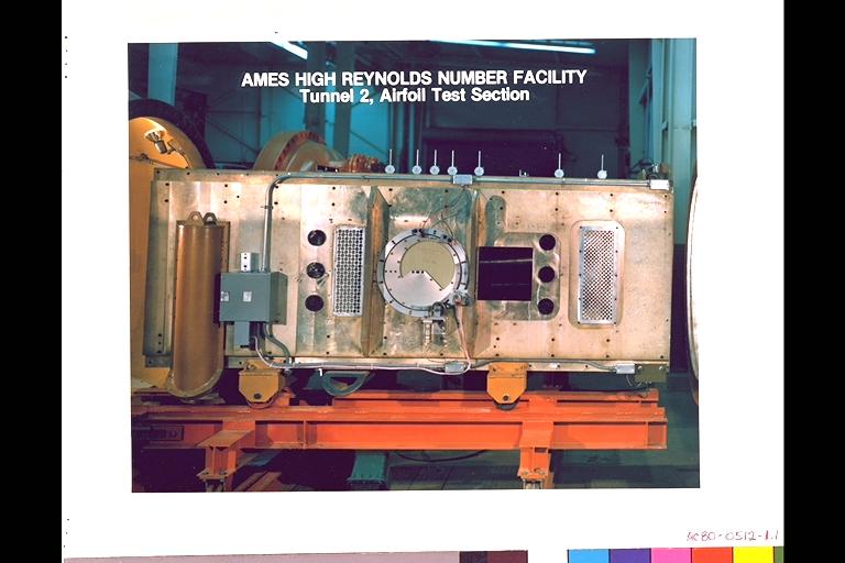
N-231 High Reynolds Number Channel Facility (Tunnel 2, Airfoil Test Section)

General Atomics' uninhabited Altair flew a NOAA/NASA coastal mapping, mammal observation and marine monitoring mission off the California coast in late 2005.

General Atomics' uninhabited Altair flew a NOAA/NASA coastal mapping, mammal observation and marine monitoring mission off the California coast in late 2005.

Assembling the Gossamer Albatross II in hangar