The Atmospheric Infrared Sounder (AIRS) instrument aboard NASA's Aqua satellite detected volcanic sulfur dioxide (SO₂) plumes emanating from Hawaii's Mauna Loa volcano, which started erupting late Sunday, Nov. 27, 2022, at 11:30 p.m. Hawaii…
This animation shows a nearly 20-year record of temperature anomalies for two layers in Earth's atmosphere: the lower troposphere, where most of the planet's weather occurs; and the upper stratosphere, which contains the ozone layer. NASA's…
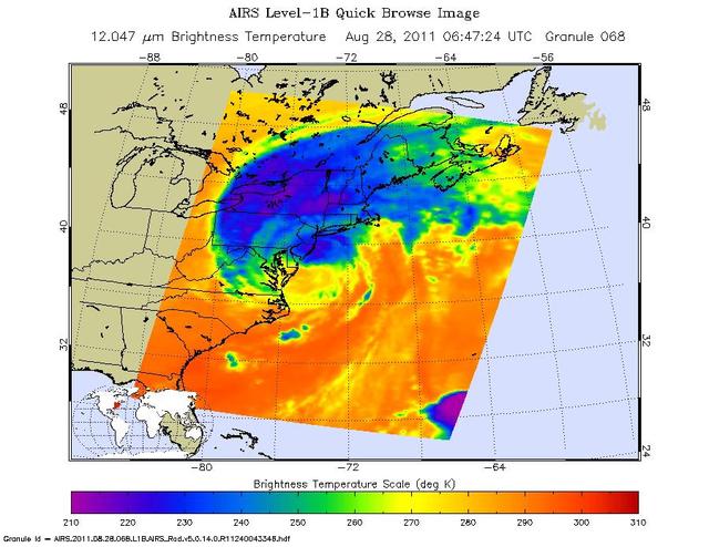
This infrared image of Hurricane Irene from the AIRS instrument on NASA Aqua spacecraft, was taken at 2:47 a.m. EDT on Aug. 28. The storm coldest cloud top temperatures and intense rains are shown in purples and blues.
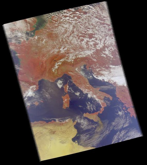
The quick dry-out of vegetation in Southern California this year is depicted in this pair of images from the Moderate Resolution Imaging Spectroradiometer MODIS sensor on NASA Aqua spacecraft.
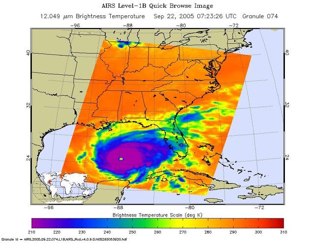
In September, 2005, Rita was a category 5 hurricane with sustained winds of 150 mph and a central pressure of 897 millibar when positioned approximately 470 southeast of Galveston, Texas.
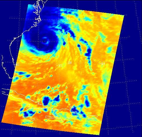
Hurricane Isabel isotherms as the storm moved across the Atlantic Ocean in September, 2003, from the Atmospheric Infrared Sounder AIRS on NASA Aqua satellite.
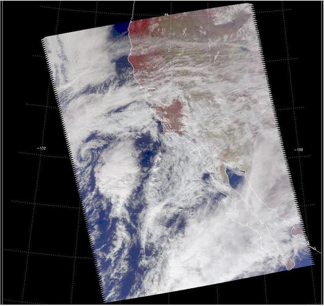
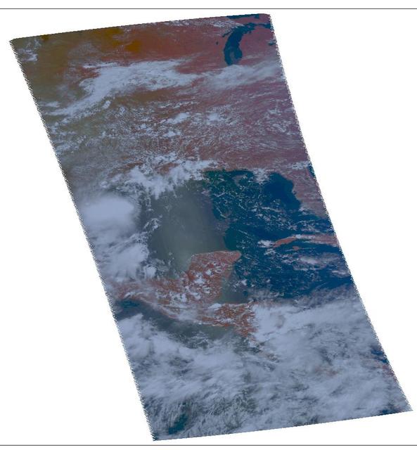
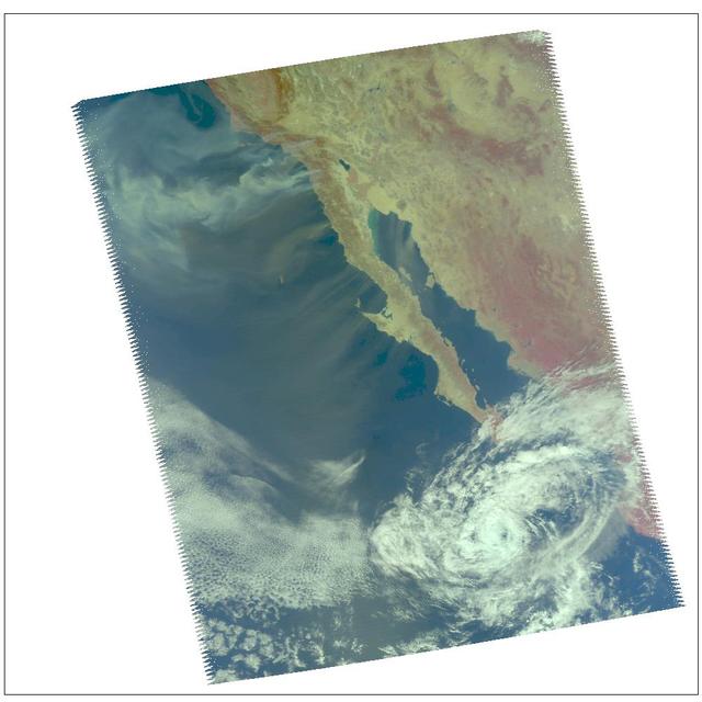
Visible image of a California storm in March, 2003, as seen by the Atmospheric Infrared Sounder AIRS on NASA Aqua satellite. http://photojournal.jpl.nasa.gov/catalog/PIA00402
NASA Aqua spacecraft continues to track the gradual organization of Tropical Storm Emily, as seen in this image taken Aug. 2, 2011 at 1:05 p.m. EDT. At that time, the storm was located about 270 miles southeast of San Juan, Puerto Rico.
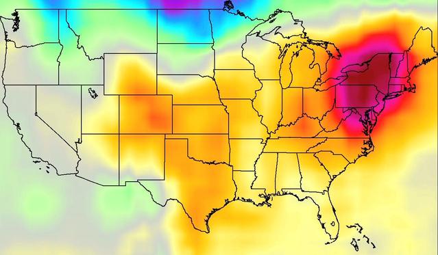
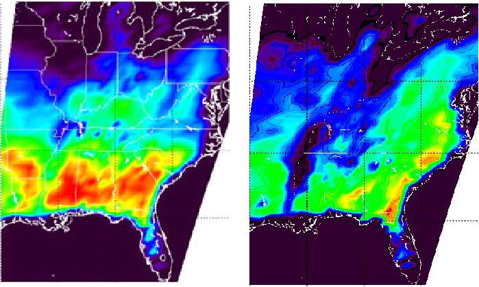
NASA Aqua spacecraft has illustrated surface air and skin temperature for the period from July 16-24, showing movement of a dome of heat across the eastern two-thirds of the country. See More Details for the movies.
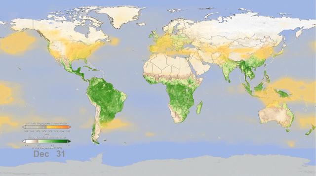
This graph made with data from the AIRS instrument on NASA Aqua satellite shows the concentration of carbon dioxide in Earth mid-troposphere, located roughly between 3 to 6 miles 5 to 9 kilometers in altitude.
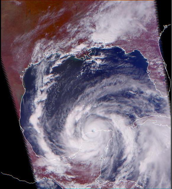
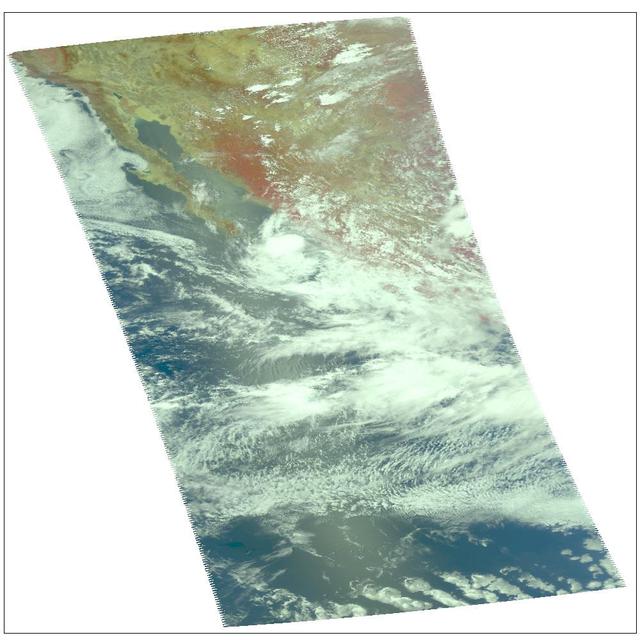
Visible image of Hurricane Dean, at the coast of Mexico from Manzanillo to Mazatlan in August, 2007, from Atmospheric Infrared Sounder AIRS on NASA Aqua satellite.
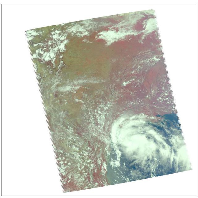
Visible image of Tropical Storm Erin, the Atlantic Ocean 210 miles south of Galveston, Texas, August, 2007, from the Atmospheric Infrared Sounder AIRS on NASA Aqua satellite.
This image was made from data acquired by the Atmospheric Infrared Sounding System AIRS instrument suite aboard NASA Aqua spacecraft in December, 2002, just as the eye of Supertyphoon Pongsona was about to pass over Guam. http://photojourn…
NASA Atmospheric Infrared Sounder instrument is able to peel back cloud cover to reveal 3-D structure of a storm water vapor content, information that can be used to improve weather forecast models.
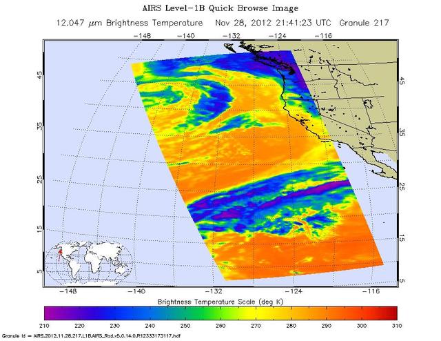
NASA Aqua spacecraft captured this infrared image of the first of a series of storms approaching the Pacific Northwest at 2141 UTC 1:41 p.m. PST on Nov. 28, 2012, marking the beginning of an atmospheric river event.
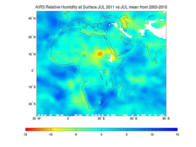
Surface relative humidity anomalies in percent, during July 2011 compared to the average surface relative humidity over the previous eight years, as measured by NASA Aqua instrument AIRS. The driest areas are shown in oranges and reds.
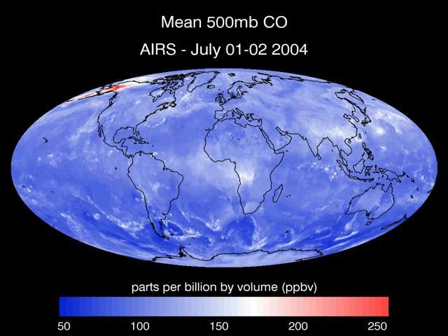
A series of maps of the transport of carbon monoxide generated by Alaska Fires, July 2004, created by data from the Atmospheric Infrared Sounder AIRS on NASA Aqua satellite.
NASA Aqua spacecraft passed over Tropical Storm Don at 8:17 UTC 1:17 a.m. EDT on July 29, 2011. Texas is experiencing exceptional drought conditions; Tropical Storm Don may bring relief.
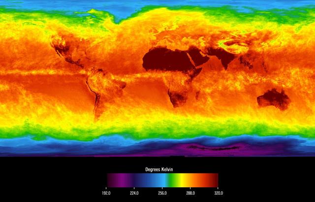
This image shows average temperatures in April, 2003, observed by AIRS at an infrared wavelength that senses either the Earth's surface or any intervening cloud. Similar to a photograph of the planet taken with the camera shutter held open…
Smoke from multiple wildfires burning in Southern California in October, 2007, can be seen in this false-color image from the Atmospheric Infrared Sounder AIRS on NASA Aqua satellite.
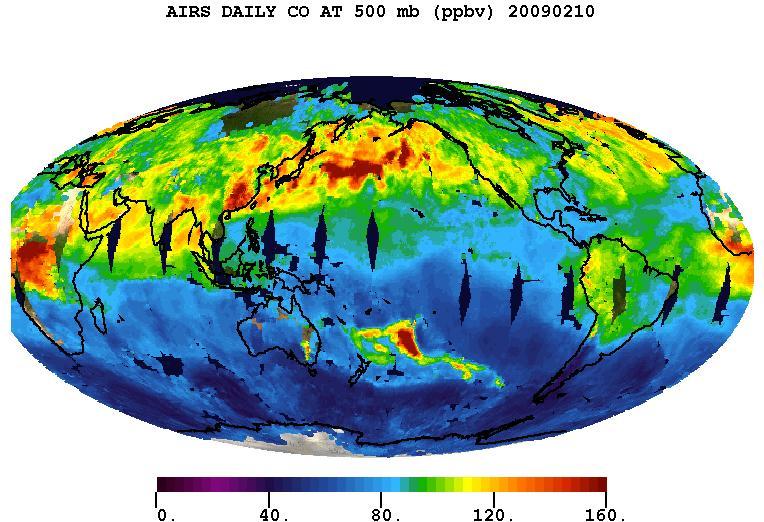
Carbon monoxide from California wildfire, a visualization created using data from the Atmospheric Infrared Sounder AIRS on NASA Aqua satellite, June-July, 2008.
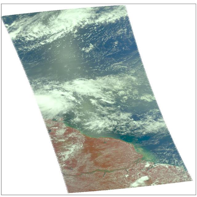
Tropical Storm Isidore was born in mid-September, 2000 north of Venezuela. This images is from Atmospheric Infrared Sounding System AIRS on NASA Aqua. http://photojournal.jpl.nasa.gov/catalog/PIA00365
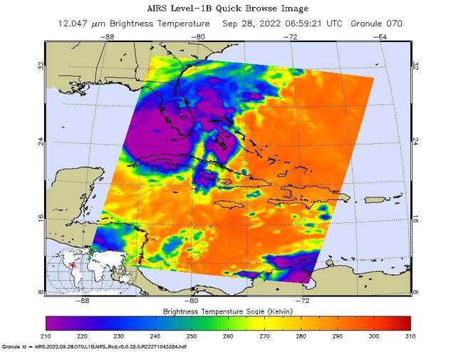
NASA's Atmospheric Infrared Sounder (AIRS) instrument aboard the Aqua satellite captured imagery of Hurricane Ian over the Gulf of Mexico between Cuba and Florida just before 2 a.m. local time Sept. 28, 2022. At that time, the Category 3 st…
This plot shows the concentration of carbon dioxide in Earth mid-troposphere at various latitudes as measured by NASA Aqua satellite. The colored lines represent different latitude bands that circle Earth, called zones.
This false-color image shows Hurricane Isabel viewed by the AIRS and AMSU-A instruments at 1:30 EDT in the morning of Thursday September 18, 2003. Isabel will be ashore within 12 hours, bringing widespread flooding and destructive winds. I…
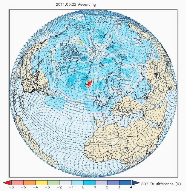
Images made with data from the Atmospheric Infrared Sounder on NASA Aqua satellite, show sulfur dioxide released from the volcanic eruption of Eyjafjallajökull.
Mt. Etna, a volcano on the island of Sicily, erupted on October 26, 2002, as seen by the Atmospheric Infrared Sounding System AIRS on NASA Aqua. http://photojournal.jpl.nasa.gov/catalog/PIA00355
This chart shows low-humidity thresholds that signal flu outbreaks in 48 U.S. states, calculated using water vapor data from NASA's Atmospheric Infrared Sounder (AIRS) instrument on the Aqua satellite with data on U.S. flu cases from 2003 t…
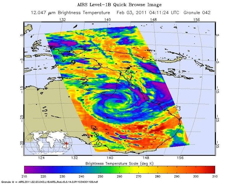
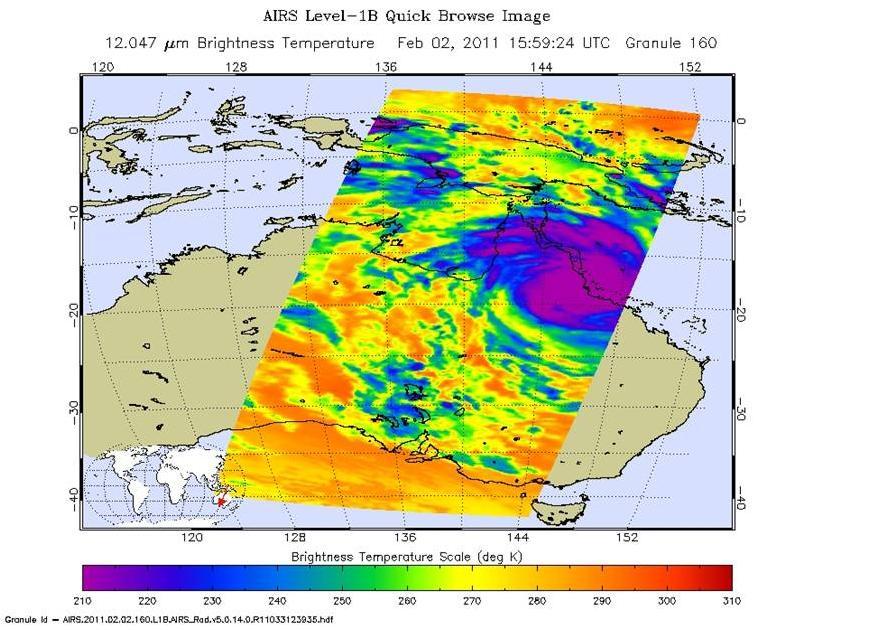
The Atmospheric Infrared Sounder AIRS instrument onboard NASA Aqua spacecraft captured this infrared image of Tropical Cyclone Yasi on Feb. 2, 2011 as the storm passed over Australia Great Dividing Range.
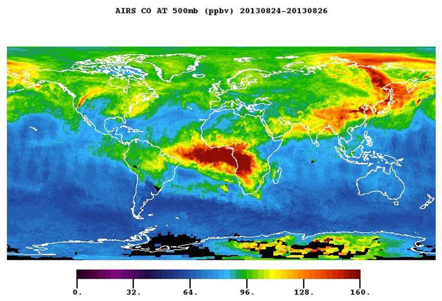
The plume of carbon monoxide pollution from the Rim Fire burning in and near Yosemite National Park, Calif., shows a three-day running average of daily measurements from NASA Aqua spacecraft.
This map created with data from the AIRS on NASA Aqua satellite shows the concentration of carbon dioxide in Earth mid-troposphere, located roughly between 3 to 6 miles 5 to 9 kilometers in altitude.
Powerful Tropical Cyclone Yasi fury rakes Northeastern Australia in February, 2011, as seen by the Atmospheric Infrared Sounder AIRS on NASA Aqua satellite.
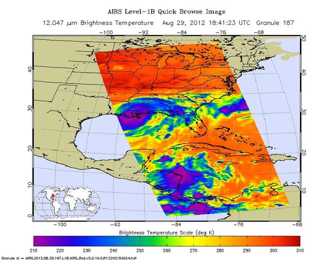
Strong tropical storm Isaac continues to create havoc across the Gulf Coast, from eastern Texas to Florida. This infrared image from NASA Aqua spacecraft, was acquired at 2:41 p.m. CDT on Aug. 29, 2012.
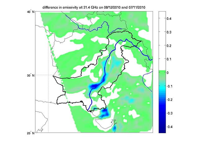
This image from NASA Aqua spacecraft shows how surface emissivity -- how efficiently Earth surface radiates heat -- changed in several regions of Pakistan over a 32-day period between July 11 pre-flood and August 12 post-flood.